Situation Summary
Tuvalu remains a very low-threat environment with a composite threat score of 3/100 and minimal recorded security incidents. No credible reports of conflict, civil unrest, crime, infrastructure disruption, or travel-risk incidents have emerged in the last 24–48 hours. The nation's geographic isolation, small population, and limited international media coverage mean real-time incident reporting is sparse; absence of reporting should not be interpreted as absence of risk, but rather reflects limited visibility into day-to-day developments across the atoll nation.
Key Developments
No verified security, conflict, crime, civil unrest, or infrastructure disruption incidents have been reported in Tuvalu within the last 24–48 hours based on available open-source news feeds, social-media OSINT, and regional media monitoring.
*Note: Tuvalu's remote location and minimal international news presence result in extremely limited real-time incident reporting. GeoBit's 24–48 hour monitoring window has captured no qualifying events. Historical context (e.g., climate vulnerability, maritime boundary concerns, economic dependence on fishing and remittances) informs baseline risk but does not constitute current developments.*
Highest-Risk Areas
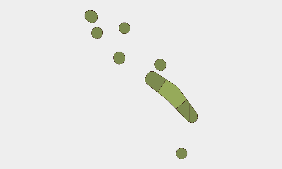
Funafuti (composite risk score 45) significantly outranks all other atolls and accounts for the majority of tracked risk, reflecting its status as the capital, administrative hub, and primary point of entry. Vaitupu (28) and Nui (25) form a secondary tier, likely driven by larger populations and economic activity. Remaining atolls (Nukufetau, Niutao, Nanumanga, Nanumea, Nukulaelae) carry substantially lower individual risk scores, though they remain within the same fragmented, infrastructure-constrained environment. Risk concentration in Funafuti mirrors patterns typical of small island nations where governance, commerce, and external contact are centralized.
How GeoBit Would Assist
Security teams with personnel or assets in Tuvalu should deploy AOI Monitoring & Early Warning focused on Funafuti and secondary atolls to detect incidents in real time and trigger alerts before traditional media reporting; Intel Sweep and multi-language OSINT fusion to correlate fragmentary social-media signals, local radio SIGINT, and maritime activity across the atoll chain; and Economic & Trade monitoring to flag disruptions to fishing operations, remittance flows, or port activity that could destabilize the local security environment or restrict staff mobility. Routing & Network Analysis supports contingency planning for evacuation or alternative supply routes given Tuvalu's geographic isolation and limited transportation links.
7-Day Outlook
No acute security threats are forecast for the next seven days. Baseline risk will remain low absent major weather events, maritime incidents, or political triggers. Duty-of-care teams should maintain routine monitoring of Funafuti and maintain awareness of seasonal cyclone risk (Southern Hemisphere winter transition) and any disruptions to inter-atoll transport, which could isolate offshore assets or personnel.
Highest-Risk Areas — Ranked
| # | State / Region | Risk |
|---|---|---|
| 1 | Funafuti | 45 |
| 2 | Vaitupu | 28 |
| 3 | Nui | 25 |
| 4 | Nukufetau | 22 |
| 5 | Niutao | 20 |
| 6 | Nanumanga | 18 |
| 7 | Nanumea | 15 |
| 8 | Nukulaelae | 12 |
Previous Daily Briefs
A new Tuvalu brief is written every day — each with its own risk map and downloadable CSV. Here's the last week; use the calendar to go further back.
📅 Browse every day by calendar →
Highlighted days have a brief. Tap a day for that day's map & analysis, or “csv” for that day's dataset ($5).
Atlas — our AI intelligence desk — emails them this snapshot personally. Nothing else, no list.