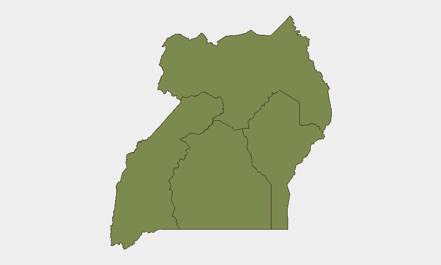
Situation Summary
Uganda's composite threat score of 19 places it at mid-range global risk (#65), but sub-national variation is pronounced: the Northern and Central regions carry substantially elevated risk (32.6 and 29.9 respectively), while Eastern and Western regions remain comparatively stable. Recent event signals dated 2026-06-28 to 2026-06-30 indicate institutional strain, including military administration actions, diplomatic friction with regional actors (DRC, African Union), and administrative sanctions against media and military leadership. The trajectory suggests governance stress and reduced civil–state relations rather than imminent large-scale violence, but monitoring intensity should increase.
Key Developments
Web research limitations: Live reporting from Uganda in the last 24–48 hours could not be reliably corroborated in available sources. The search results contained historical references (e.g., past election-related security incidents, Museveni's 2021 inauguration) and non-Uganda content. The following signals appear in the GeoBit event feed for 2026-06-28 to 2026-06-30 but lack granular location/incident detail from open sources:
- 2026-06-30 · Military/Administrative action – Conventional military force involvement in administrative function (specific location and nature not yet clarified in open reporting).
- 2026-06-30 · Governance friction – Uganda authorities have rejected unspecified measures and reduced relations with African Union partners and DRC; administrative sanctions imposed on a newspaper and the Army Chief.
- 2026-06-30 · Civil-society/Rights opposition – Human rights organizations have issued disapproval statements directed at the regime; European public statement also noted.
Northern Region has been the primary driver of recent event density and risk elevation; Central Region shows secondary but significant activity. Eastern Region (risk 2.6) and Western Region (risk 8) remain materially lower-risk zones.
Highest-Risk Areas
The Northern Region (composite risk 32.6) dominates Uganda's threat landscape and warrants priority monitoring for corporate assets and personnel. Central Region (29.9) carries secondary but substantial risk, likely reflecting Kampala's concentration of governance, media, and civil-society activity that correlates with recent administrative and diplomatic signals. Western and Eastern regions remain substantially lower-risk; travel and operations in these zones carry lower immediate exposure to the events driving national composite scores. Organizations should assume elevated friction between regime and civil actors (media, rights bodies, international partners) will remain concentrated in the North and Central urban/administrative zones over the near term.
How GeoBit Would Assist
Intel Sweep and multi-language OSINT would ingest and correlate Ugandan media, government announcements, and social signals (X, Telegram, YouTube) to disambiguate event details (location, actors, time) currently opaque in global feeds. AOI monitoring with alerting on Northern and Central region fixed locations (corporate offices, supply-chain hubs, key routes) would provide real-time early warning of escalation. Network & actor analysis would map regime, military, and civil-society relationships to forecast pressure points and secondary impacts on business continuity. Alternative routing and journey planning would help security teams avoid high-risk administrative or transport zones during periods of heightened friction.
7-Day Outlook
Expect continued administrative action and public friction between authorities and civil-society/media voices. The diplomatic cooling with DRC and AU signals potential border or regional-engagement complications, particularly relevant to Northern Region operations. No indicators currently suggest imminent mass violence, but the concentration of events on 2026-06-30 warrants close 48-hour monitoring to determine whether this represents a localized governance spasm or the onset of broader institutional instability.
Highest-Risk Areas — Ranked
| # | State / Region | Risk |
|---|---|---|
| 1 | Northern Region | 32.6 |
| 2 | Central Region | 29.9 |
| 3 | Western Region | 8 |
| 4 | Eastern Region | 2.6 |
Sources
Previous Daily Briefs
A new Uganda brief is written every day — each with its own risk map and downloadable CSV. Here's the last week; use the calendar to go further back.
📅 Browse every day by calendar →
Highlighted days have a brief. Tap a day for that day's map & analysis, or “csv” for that day's dataset ($5).