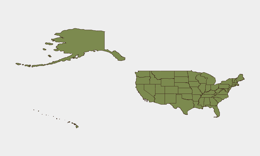
Situation Summary
The United States faces a composite national threat score of 8 (rank #48 globally) with 7,999 tracked events. Recent signals indicate active military mobilization, investigative activity at federal and local levels, and judicial disapproval in at least two cases. California's significantly elevated sub-national risk score (35.6) suggests concentrated threat density in a single state, while Texas, Kansas, New York, and Illinois collectively account for substantial secondary risk.
Key Developments
- 2026-06-03 · Military Mobilization: Chinook helicopter engagement involving National Guard (state unspecified; likely California or contiguous region given state risk distribution).
- 2026-06-03 · Federal Investigation: Authorities initiated investigation against United States entity; scope and jurisdiction not yet clarified.
- 2026-06-03 · Public Statement: U.S. federal body issued statement regarding unidentified male; content and context pending.
- 2026-06-03 · California State Statement: State-level public communication issued; subject and implications require source verification.
- 2026-06-04 · Judicial Action: District Court (Virginia) issued disapproval decision; parties and subject matter not specified in alert summary.
- 2026-06-05 · Attorney Statement: Legal representative issued public statement; matter and jurisdiction unclear.
- Secondary Signal: Police investigation initiated with cross-border element (United Kingdom connection noted); nature of investigation not specified.
*Note: All developments listed reflect event-type flags from the GeoBit platform. Specific incident details, casualty counts, and operational scope require additional source corroboration and are not available from current platform summary.*
Highest-Risk Areas
California's risk score (35.6) is 53% higher than Texas (23.2) and represents the dominant threat concentration in the United States. Military mobilization signals, concurrent federal investigation, and state-level public statements suggest either a single high-impact incident or overlapping operational activity in California. Kansas (19.9) and New York (15.2) represent secondary focal points; Texas, despite its size, ranks second nationally, indicating either a discrete incident or distributed lower-level threats across multiple jurisdictions. Illinois, Florida, New Jersey, and Virginia each maintain double-digit risk scores, suggesting nationwide distribution of concern rather than isolated regional instability.
How GeoBit Would Assist
A corporate security team with assets or personnel in these jurisdictions would employ AOI Monitoring & Early Warning to establish persistent watch on California, Texas, and Kansas, with automated alert thresholds for military activity, law-enforcement operations, and judicial filings. OSINT Fusion & Corroboration across X/Twitter, Telegram, police blotters, and local media—combined with multi-language entity extraction—would enable teams to validate event-type flags, establish causality, and separate operational signals from background noise. Risk & Threat Assessment coupled with GIS & Spatial Analysis would allow mapping of specific facility or personnel locations against evolving threat zones and identification of safe corridors or alternative operational routes.
7-Day Outlook
Current signals suggest active investigation and response phases rather than de-escalation. Federal and state-level communications indicate official engagement with the underlying issue(s), but the absence of formal all-clear or containment statements points to ongoing uncertainty. Expect continued monitoring of California, Texas, and secondary states through mid-June; corporate teams should prepare contingency protocols for workforce movement restrictions or facility access changes.
Highest-Risk Areas — Ranked
| # | State / Region | Risk |
|---|---|---|
| 1 | California | 35.6 |
| 2 | Texas | 23.2 |
| 3 | Kansas | 19.9 |
| 4 | New York | 15.2 |
| 5 | Illinois | 14.9 |
| 6 | Florida | 13.2 |
| 7 | New Jersey | 12 |
| 8 | Virginia | 12 |
| 9 | Ohio | 11.8 |
| 10 | Colorado | 11.1 |
| 11 | Pennsylvania | 10.7 |
| 12 | Minnesota | 10.2 |
Previous Daily Briefs
A new United States brief is written every day — each with its own risk map and downloadable CSV. Here's the last week; use the calendar to go further back.
📅 Browse every day by calendar →
Highlighted days have a brief. Tap a day for that day's map & analysis, or “csv” for that day's dataset ($5).