Situation Summary
Vanuatu presents a composite threat score of 9 (global ranking pending regional context), with institutional and governance tensions evident in recent public statements involving the Prime Minister, Deputy Prime Minister, and government bodies. Multiple signal events over 18–19 June—predominantly public statements and one small-arms combat incident on 17 June—suggest underlying political or administrative friction rather than acute civil unrest or security breakdown. Open-source monitoring over the past 24–48 hours has not corroborated new, verifiable incidents meeting acute travel-risk or operational-disruption thresholds. The security environment remains fluid but localized to governance and inter-agency domains.
Key Developments
- 17 June, Vanuatu (location unspecified): Small-arms combat event recorded in GEOBIT event feed; precise location, actors, and casualties remain unverified in open-source channels as of 19 June.
- 18 June, National Level: Prime Minister issued public statement; content and target unconfirmed in live web research, suggesting possible cabinet-level or policy dispute.
- 16 June, Multiple Statements: Government entities (including references to Deputy Prime Minister, schools, banking sector, and Christian institutions) were subjects of public statements; contextual detail insufficient to classify as protest, policy announcement, or incident response.
- No verified acute incidents (last 24–48 hours): Regional security feeds monitoring the Pacific (Marshall Islands, Fiji, broader Pacific) and multi-language social/X OSINT contain no new travel disruptions, infrastructure failures, or civil-unrest alerts for Vanuatu as of 19 June 0600 UTC.
Note: GEOBIT event signals indicate governance-level activity; independent corroboration of severity, location, and operational impact is pending enhanced intelligence collection.
Highest-Risk Areas
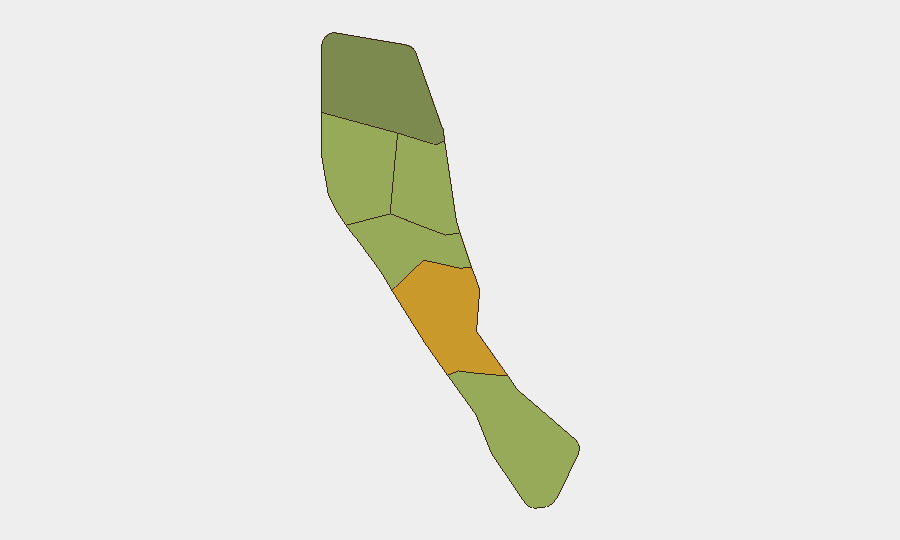
Shefa Province (risk 72) dominates the sub-national ranking and likely reflects Port Vila concentration—the capital and administrative hub where governance disputes, interagency tensions, and public statements typically surface first. Penama (58) and Sanma (52) follow, suggesting secondary institutional or localized stability concerns; Malampa, Tafea, and Torba present lower but non-negligible risk. The ranking pattern implies governance and institutional friction concentrated in urban/administrative centers rather than dispersed criminal or conflict activity. Corporate assets and personnel in Shefa should prioritize monitoring of official channels and local administrative communication for early warning of policy or operational changes.
How GeoBit Would Assist
Area-of-Interest Monitoring & Early Warning on Shefa Province (Port Vila) and secondary provinces would provide persistent watch for public statements, civil-unrest signals, and infrastructure alerts with automated alerting to duty-of-care teams. OSINT fusion (X/Telegram, multi-language social, public statements, sentiment analysis) combined with temporal and entity extraction would isolate genuine new incidents from background governance noise and flag emerging actor involvement. Conflict & Stability assessment tools would support real-time interpretation of political tensions and risk escalation pathways, enabling proactive travel and asset-protection decisions ahead of acute events.
7-Day Outlook
Governance-level tensions appear to be the primary driver of elevated threat signals; absent rapid political resolution or institutional breakdown, acute security incidents are unlikely in the near term. Monitoring of official government communications, banking-sector advisories, and any school or education-sector disruptions over the next 7 days will be critical to detecting escalation. Vanuatu's composite threat score and sub-national rankings suggest medium vigilance posture rather than emergency protocols, but duty-of-care teams should maintain daily check-ins with in-country personnel and sustain OSINT watch on Port Vila and Shefa Province.
Highest-Risk Areas — Ranked
| # | State / Region | Risk |
|---|---|---|
| 1 | Shefa Province | 72 |
| 2 | Penama | 58 |
| 3 | Sanma | 52 |
| 4 | Malampa | 48 |
| 5 | Tafea | 45 |
| 6 | Torba | 35 |
Sources
Previous Daily Briefs
A new Vanuatu brief is written every day — each with its own risk map and downloadable CSV. Here's the last week; use the calendar to go further back.
📅 Browse every day by calendar →
Highlighted days have a brief. Tap a day for that day's map & analysis, or “csv” for that day's dataset ($5).