Situation Summary
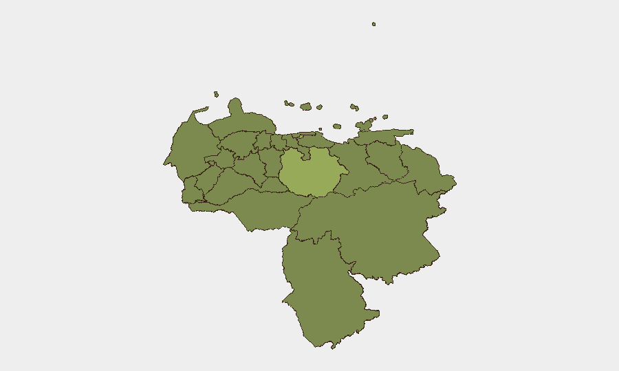
Venezuela remains a moderate composite threat (#43 globally, score 34.3) characterized by political tension, state security operations, and localized civil unrest. Event signals from 9–11 June indicate active friction between government authorities, civil actors, and international stakeholders—including military posturing, arrests, and demonstrations—but no single incident has escalated to critical mass. The Federal District (Caracas) and Guarico State remain the primary threat vectors, with secondary risk concentrated in Zulia, Carabobo, and Monagas States.
Key Developments
- 2026-06-09 · Presidential Military Activity. Government authorities deployed or publicly announced conventional military force operations; no precise location or operational scope confirmed in available reporting.
- 2026-06-09 · Havana–Venezuela Demand. Cuban authorities issued a demand to Venezuelan counterparts; context and specifics unclear from signal alone.
- 2026-06-09 · Arrest (Presidential/Istanbul): Government arrested or detained individual(s) in connection with a person or entity linked to Istanbul; details remain opaque.
- 2026-06-10 · Caracas Anti-US Demonstration. Organized rally or march in Caracas directed at US presence or policy; authorities issued statements in parallel.
- 2026-06-10 · Military Rejection. Venezuelan military publicly rejected a directive, proposal, or external pressure; nature of rejection unconfirmed.
- 2026-06-11 · Community–Student Demand. Community actors issued demand to student group(s); location and substance unspecified.
- 2026-06-11 · Arrest (Venezuela). Detention event recorded without specified actor, location, or victim category.
- 2026-06-09 · US Rejection. United States government rejected Venezuelan position or action; likely diplomatic in nature.
*Note: Precise incident locations, casualty counts, and corroborating detail remain unavailable through current open-source research. Professional incident feeds (GDELT, regional wire services, or live OSINT feeds) are required for granular confirmation.*
Highest-Risk Areas
Federal District (risk 54) and Guarico State (risk 49.4) dominate the risk landscape, driven by state security operations, arrest activity, and demonstration risk centered on the capital and its hinterland. Zulia, Carabobo, and Monagas States (scores 28.4–27.6) represent secondary but persistent threat zones, likely reflecting ongoing criminal-governance tensions, labor unrest, and border-zone vulnerabilities. The concentration of risk in the Federal District reflects Caracas's role as the seat of government, intelligence, and military command, and thus the locus of political friction and detention activity. Personnel and asset concentration in or around Caracas and state capitals should be treated as elevated-exposure conditions.
How GeoBit Would Assist
AOI Monitoring & Early Warning with persistent watch on Federal District, Guarico, and secondary states would alert security teams to demonstration escalation, military movement, or arrest patterns in near-real time. Intel Sweep combined with OSINT fusion & corroboration across X/Telegram, local media, and civil-protection channels would resolve signal ambiguity and confirm incident location, severity, and actor. Network & Actor Analysis would map government, military, and opposition nodes to predict friction points and inform duty-of-care decisions for at-risk personnel.
7-Day Outlook
Expect continued low-to-moderate friction between state security and civil actors, with demonstration risk remaining highest in Caracas and surrounding areas. Military posturing and arrest activity suggest government consolidation or response to perceived domestic challenge; escalation to widespread violence or infrastructure disruption is not currently indicated, but localized confrontation remains probable in high-risk states.
Highest-Risk Areas — Ranked
| # | State / Region | Risk |
|---|---|---|
| 1 | Federal District | 54 |
| 2 | Guarico State | 49.4 |
| 3 | Zulia State | 28.4 |
| 4 | Carabobo State | 27.8 |
| 5 | Monagas State | 27.6 |
| 6 | Tachira State | 24.8 |
| 7 | Barinas State | 24.4 |
| 8 | Vargas State | 24.4 |
| 9 | Sucre State | 24.4 |
| 10 | Falcon State | 24 |
| 11 | Federal Dependencies | 24 |
| 12 | Nueva Esparta State | 24 |
Sources
Previous Daily Briefs
A new Venezuela brief is written every day — each with its own risk map and downloadable CSV. Here's the last week; use the calendar to go further back.
📅 Browse every day by calendar →
Highlighted days have a brief. Tap a day for that day's map & analysis, or “csv” for that day's dataset ($5).