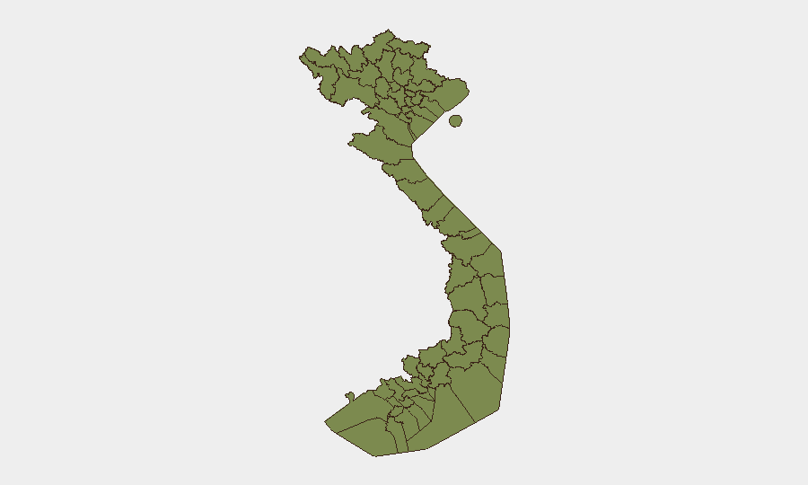
Situation Summary
Vietnam remains a low-threat environment globally (rank #116), with a composite threat score of 5 across 151 tracked events. However, sub-national risk is heavily concentrated in Huế (score 33.4), which significantly outweighs risk in the capital and provincial north. Recent diplomatic tensions with China and US concerns over governance have been publicly aired but have not yet translated into acute security incidents affecting foreign nationals or critical infrastructure in the last 24–48 hours.
Key Developments
- 2026-06-13 · Diplomatic Signal — China–Vietnam. Unnamed investigation flagged by GEOBIT intelligence feeds; specific incident or grievance not yet publicly detailed in corroborated sources. Monitoring ongoing.
- 2026-06-13 · Public Statement — Vietnam. Government communication issued; content and scope not yet specified in available open reporting.
- 2026-06-13 · US Disapproval Signal — Vietnam. United States issued formal disapproval statement; specific policy or conduct cited remains unclear from headline sources.
- 2026-06-13 · Virginia State Disapproval — Vietnam. Sub-national US entity recorded disapproval on Vietnam matter; context and implications for US corporate/diplomatic presence under review.
- 2026-06-12 · Public Statement — Vietnam. Second government statement in 24 hours; suggests elevated communication cadence but motive and audience not yet confirmed.
- Ongoing · Flood Event (ID 1103896). Water-related infrastructure or humanitarian incident flagged in system; no casualty or operational impact to foreign nationals reported to date.
Note: Open-source corroboration of these signals remains incomplete. GEOBIT's event detection has flagged diplomatic and governance signals on 13 June, but independent confirmation of specific triggers or escalation pathways is pending.
Highest-Risk Areas
Huế's risk score (33.4) is an order of magnitude above all other tracked regions, indicating either concentrated historical event density, persistent political sensitivities, or unresolved local governance factors. The northern border provinces (Lai Châu, Lào Cai, Hà Giang, Cao Bằng, Điện Biên, and others along the China frontier) all score 3.4 and warrant routine monitoring for cross-border activity, resource disputes, or ethnic minority unrest. Hà Nội (6.8) remains the capital and primary diplomatic/business hub; its moderate sub-national score reflects both the concentration of foreign nationals and historical protest or labor-action activity. For duty-of-care teams with personnel in central or northern Vietnam, Huế should receive elevated surveillance, and northern border zones should be monitored for seasonal migration, trafficking, or illicit cross-border flows.
How GeoBit Would Assist
Security teams should deploy AOI Monitoring & Early Warning on Huế and key northern provinces to detect real-time unrest, protest formation, or infrastructure disruption. Multi-language OSINT (local news, Vietnamese social platforms, and government agency feeds) will clarify the substance of the 13 June diplomatic signals and establish whether escalation is underway. Routing & Network Analysis allows security coordinators to pre-plan alternative travel and supply routes in the event northern border zones or Huế become restricted, and Conflict & Military monitoring will track any unusual military repositioning or training activity signaling heightened tensions.
7-Day Outlook
Near-term risk trajectory is stable pending clarification of the US and China signals on 13 June. If diplomatic tensions deepen or local unrest in Huế emerges, risk scores will likely spike. Corporate teams should maintain standard duty-of-care protocols and request 24–48 hour notice of any planned travel to Huế or border regions until diplomatic posture clarifies.
Highest-Risk Areas — Ranked
| # | State / Region | Risk |
|---|---|---|
| 1 | Huế | 33.4 |
| 2 | Hà Nội | 6.8 |
| 3 | Lai Châu Province | 3.4 |
| 4 | Lào Cai Province | 3.4 |
| 5 | Hà Giang Province | 3.4 |
| 6 | Tuyên Quang Province | 3.4 |
| 7 | Cao Bằng Province | 3.4 |
| 8 | Bắc Kạn Province | 3.4 |
| 9 | Điện Biên Province | 3.4 |
| 10 | Yên Bái Province | 3.4 |
| 11 | Sơn La Province | 3.4 |
| 12 | Thái Nguyên Province | 3.4 |
Sources
Previous Daily Briefs
A new Vietnam brief is written every day — each with its own risk map and downloadable CSV. Here's the last week; use the calendar to go further back.
📅 Browse every day by calendar →
Highlighted days have a brief. Tap a day for that day's map & analysis, or “csv” for that day's dataset ($5).