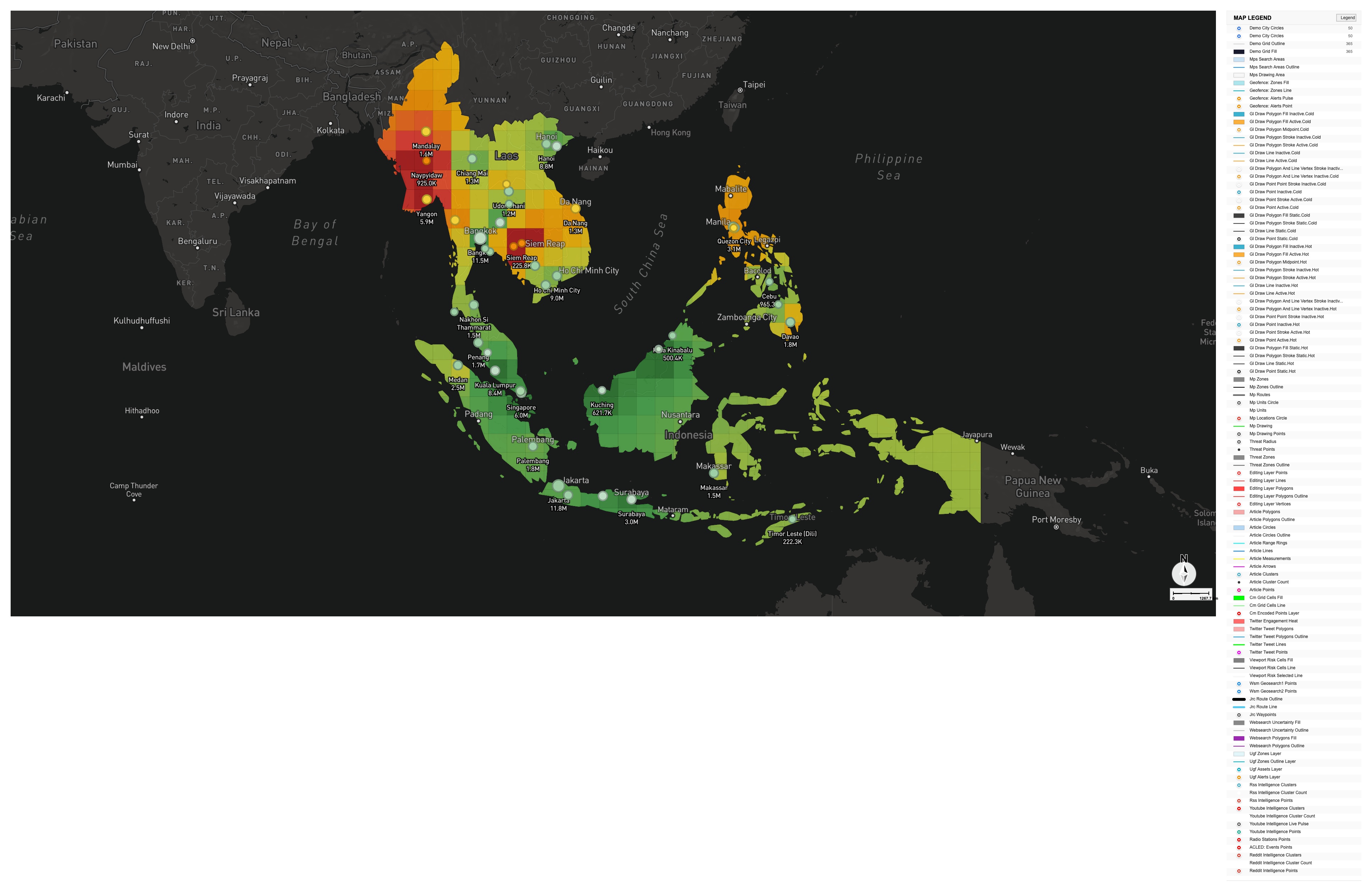
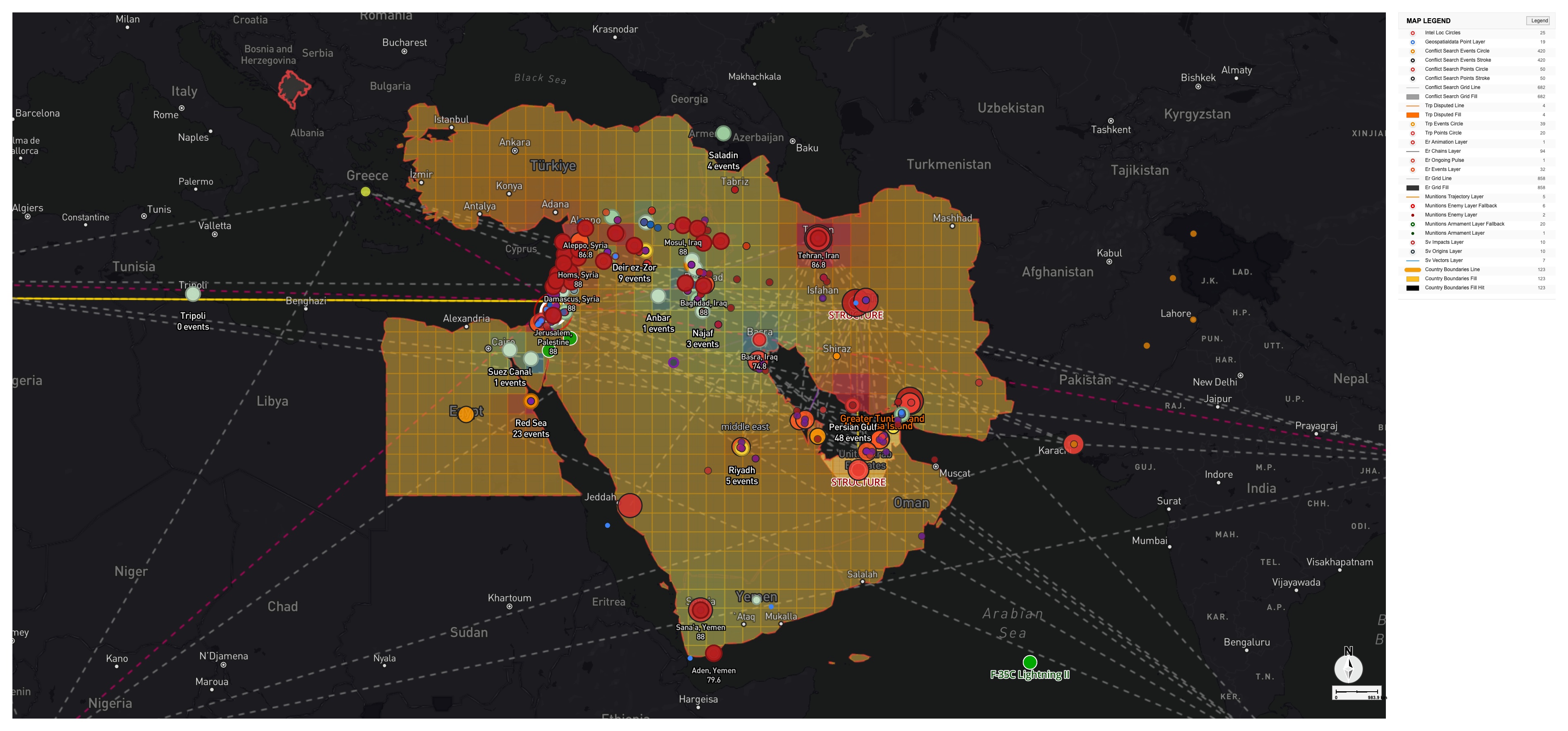
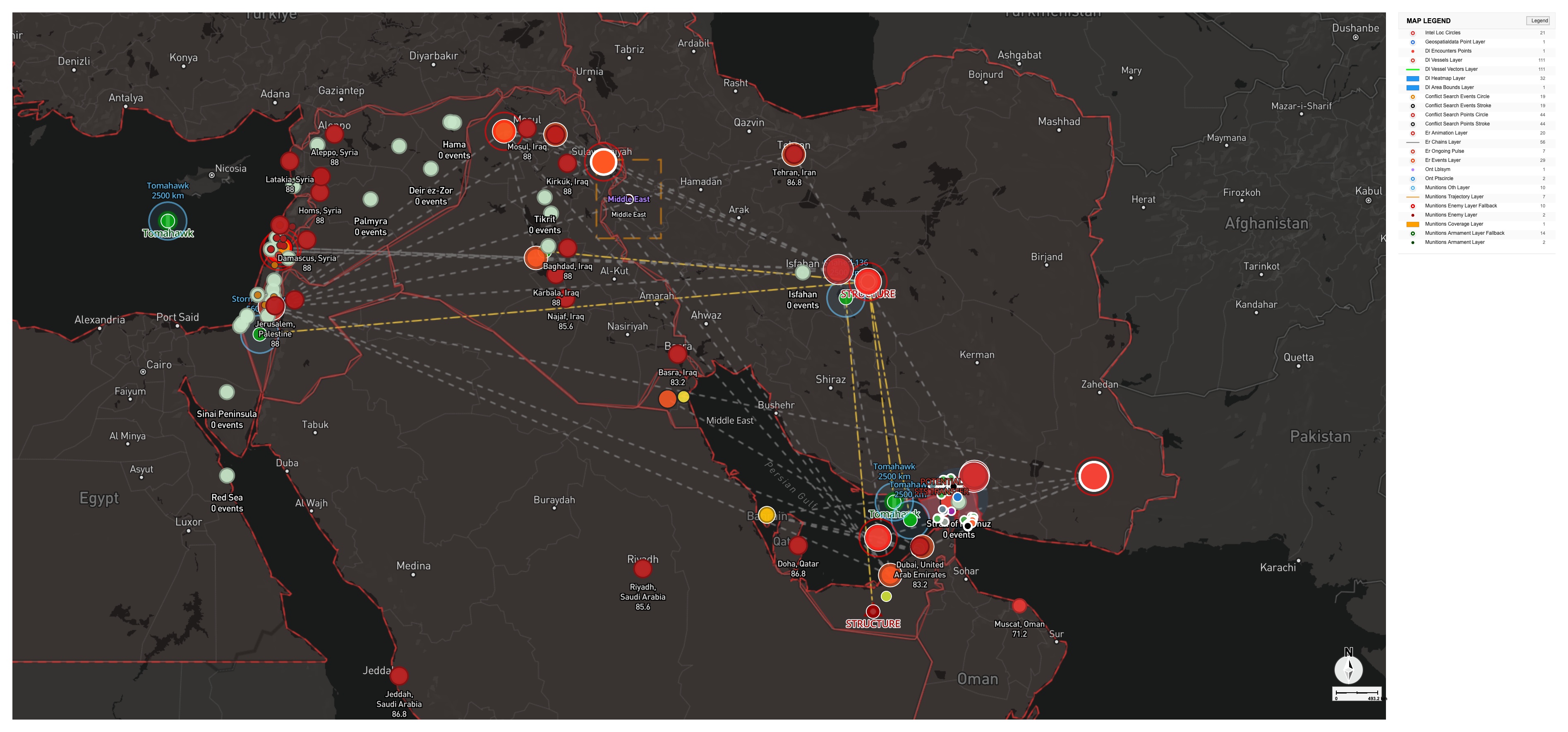
Gallery · Real System Outputs

Intelligence maps,
made in minutes

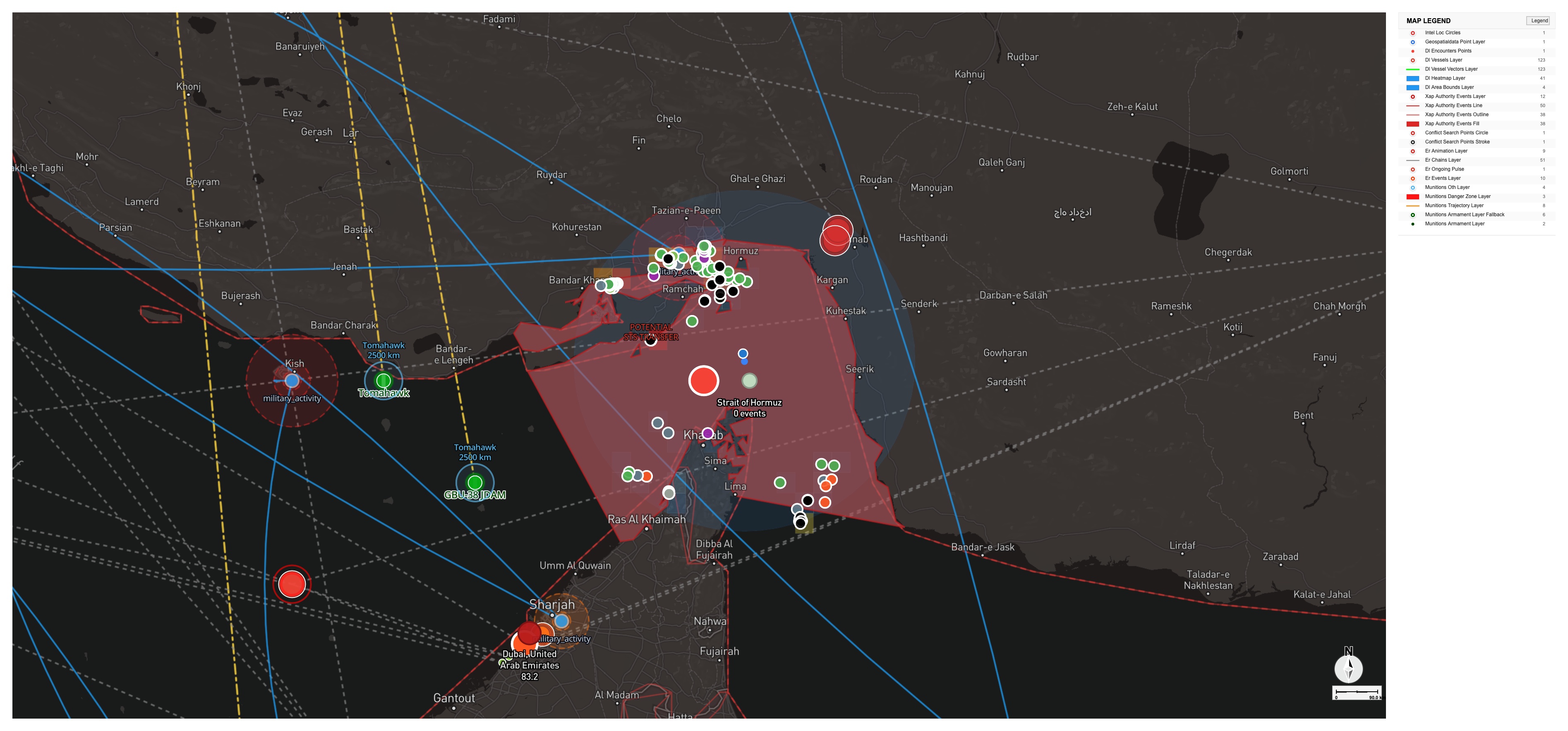
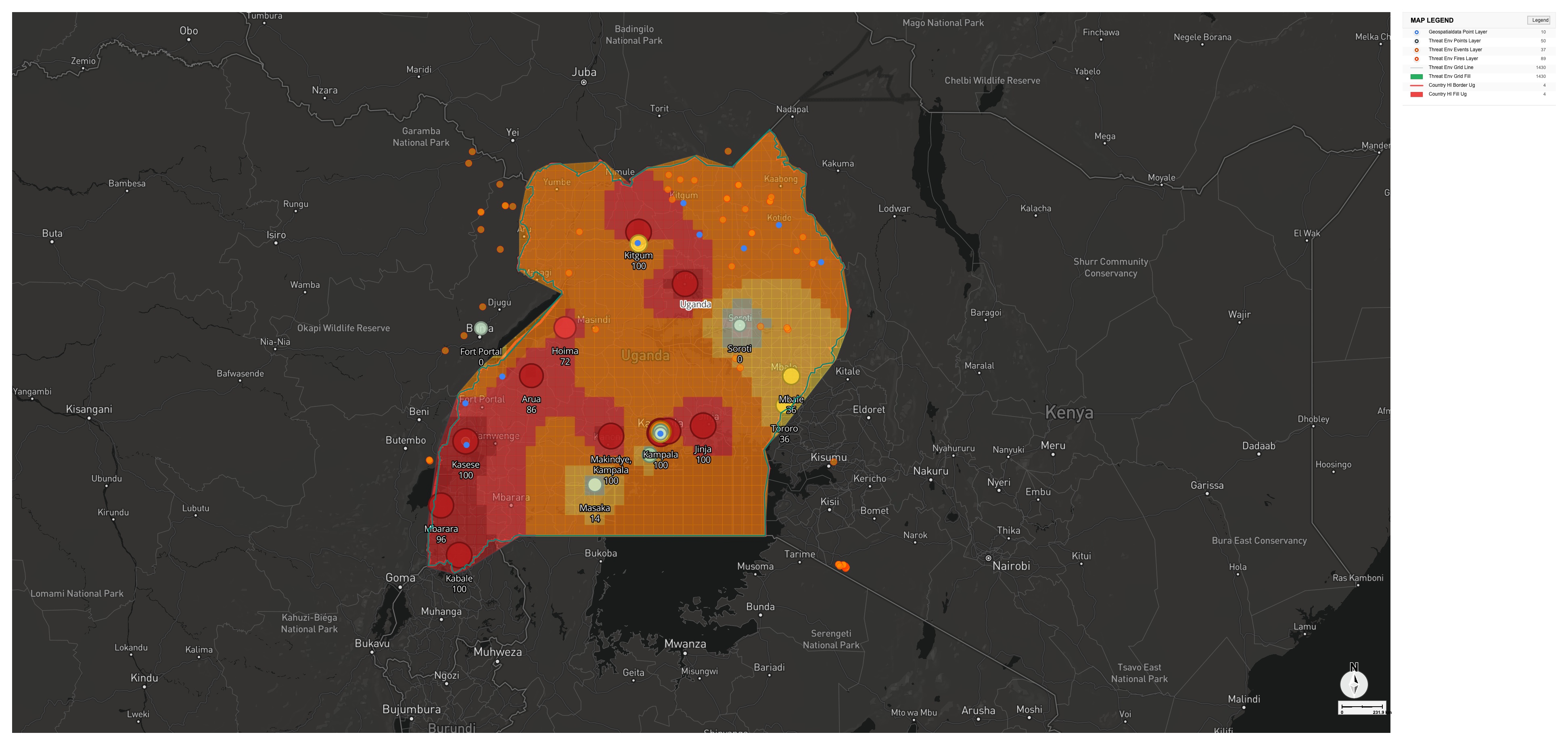
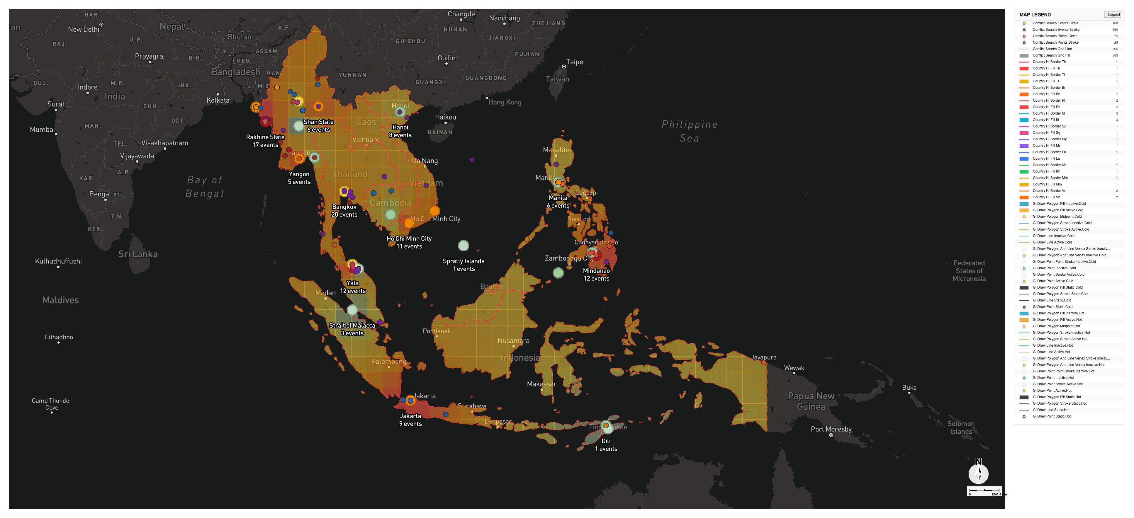
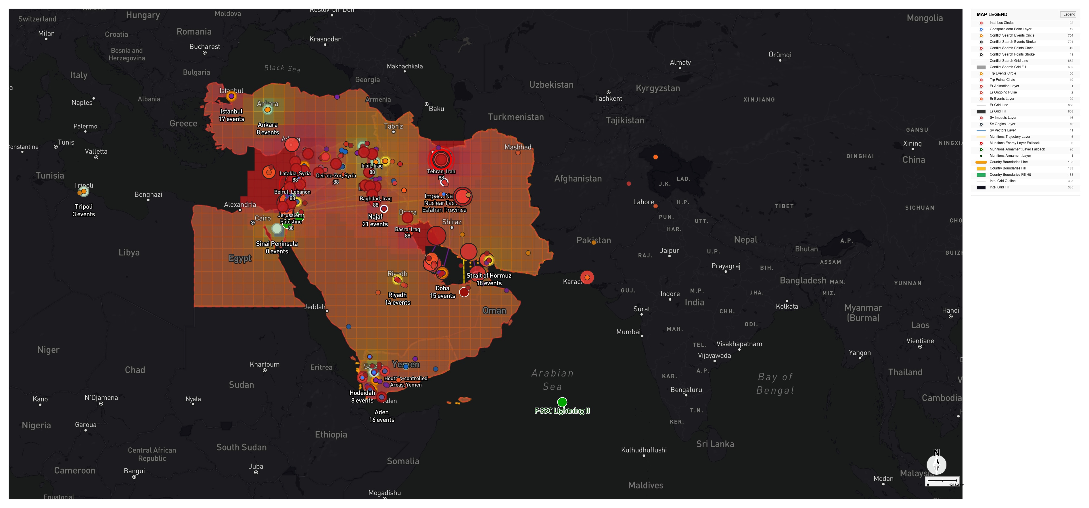
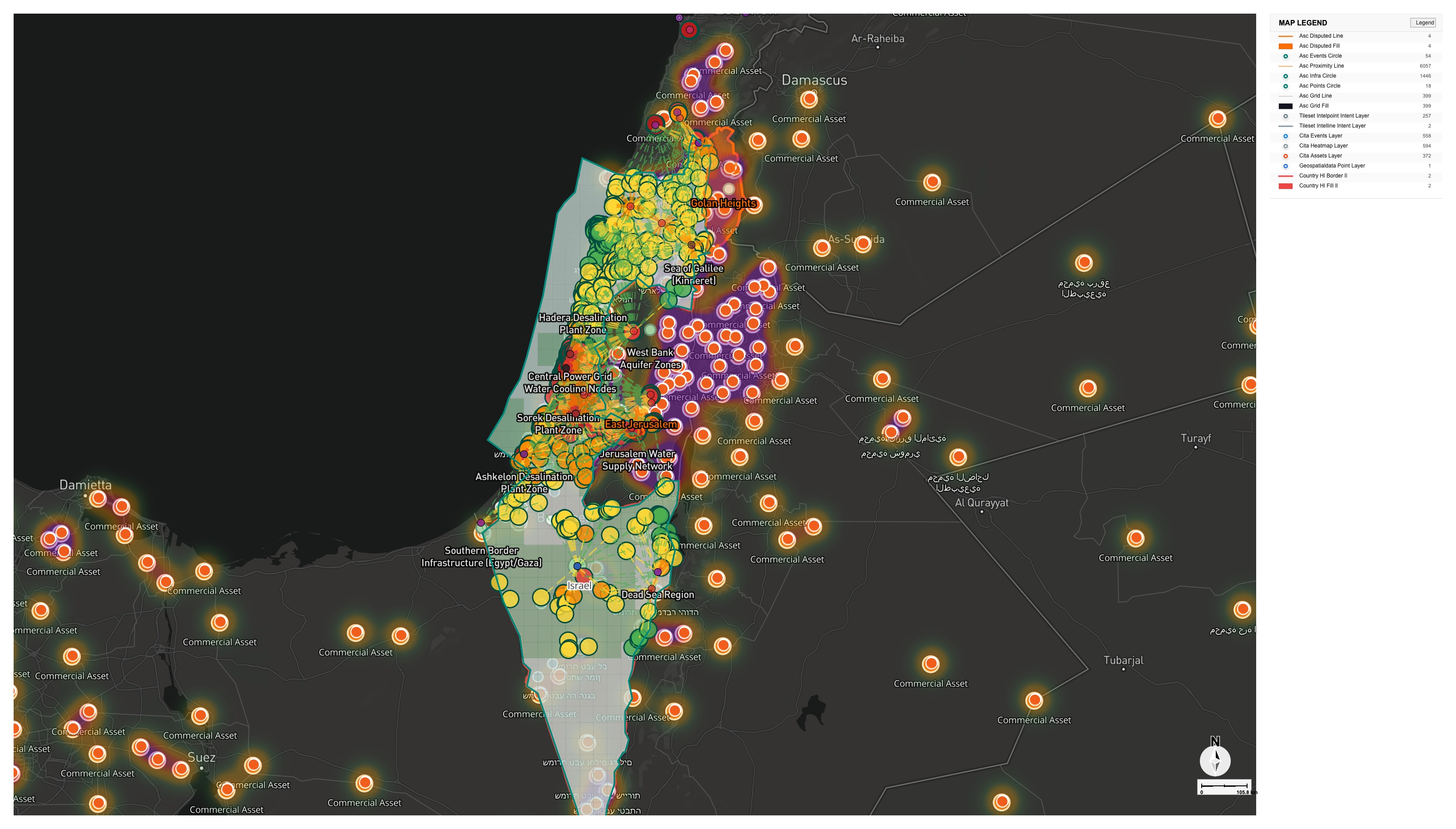
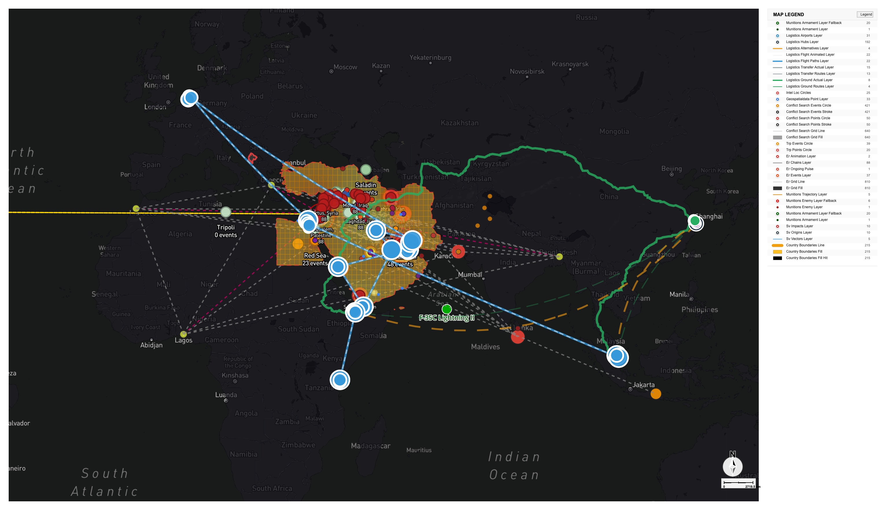
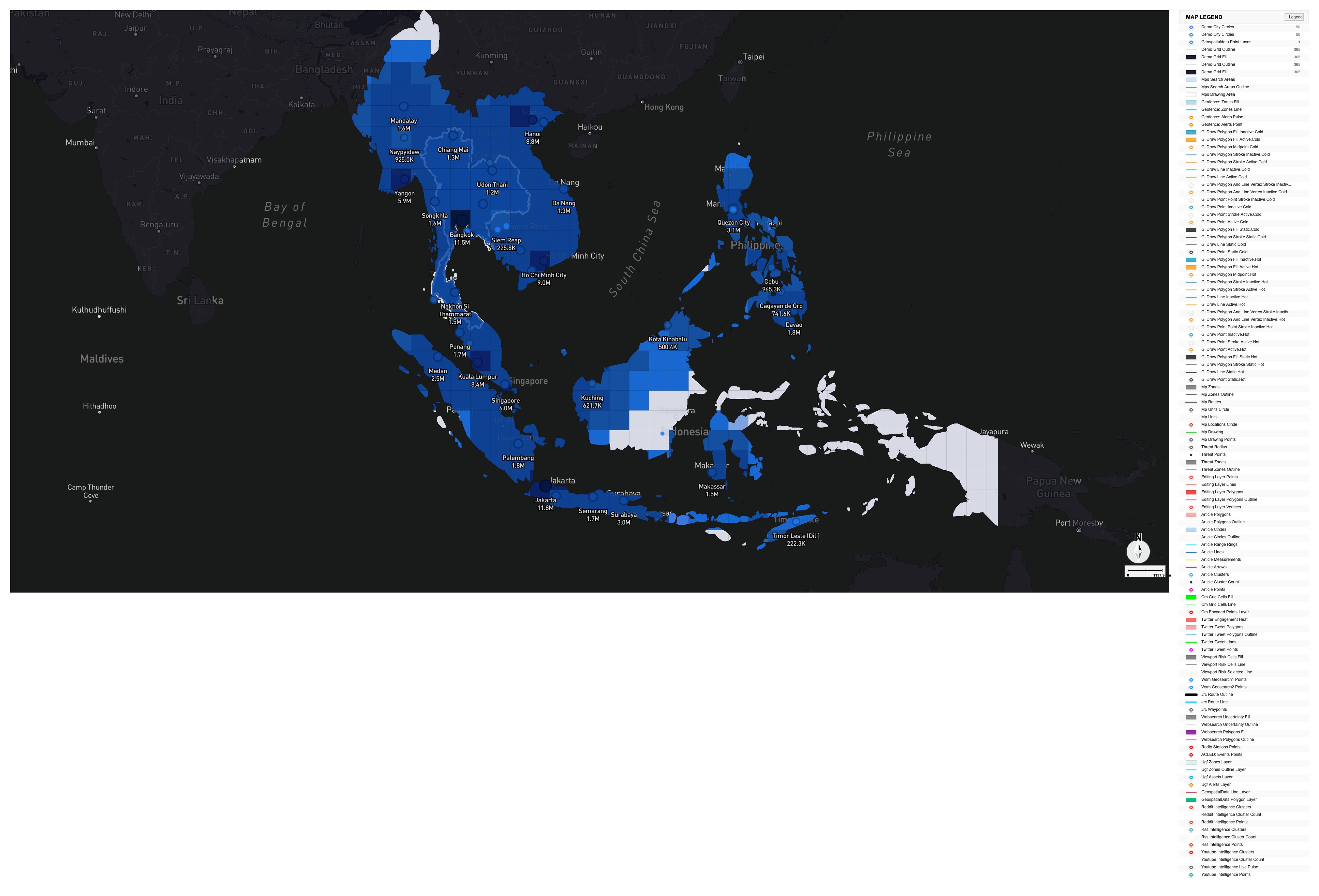
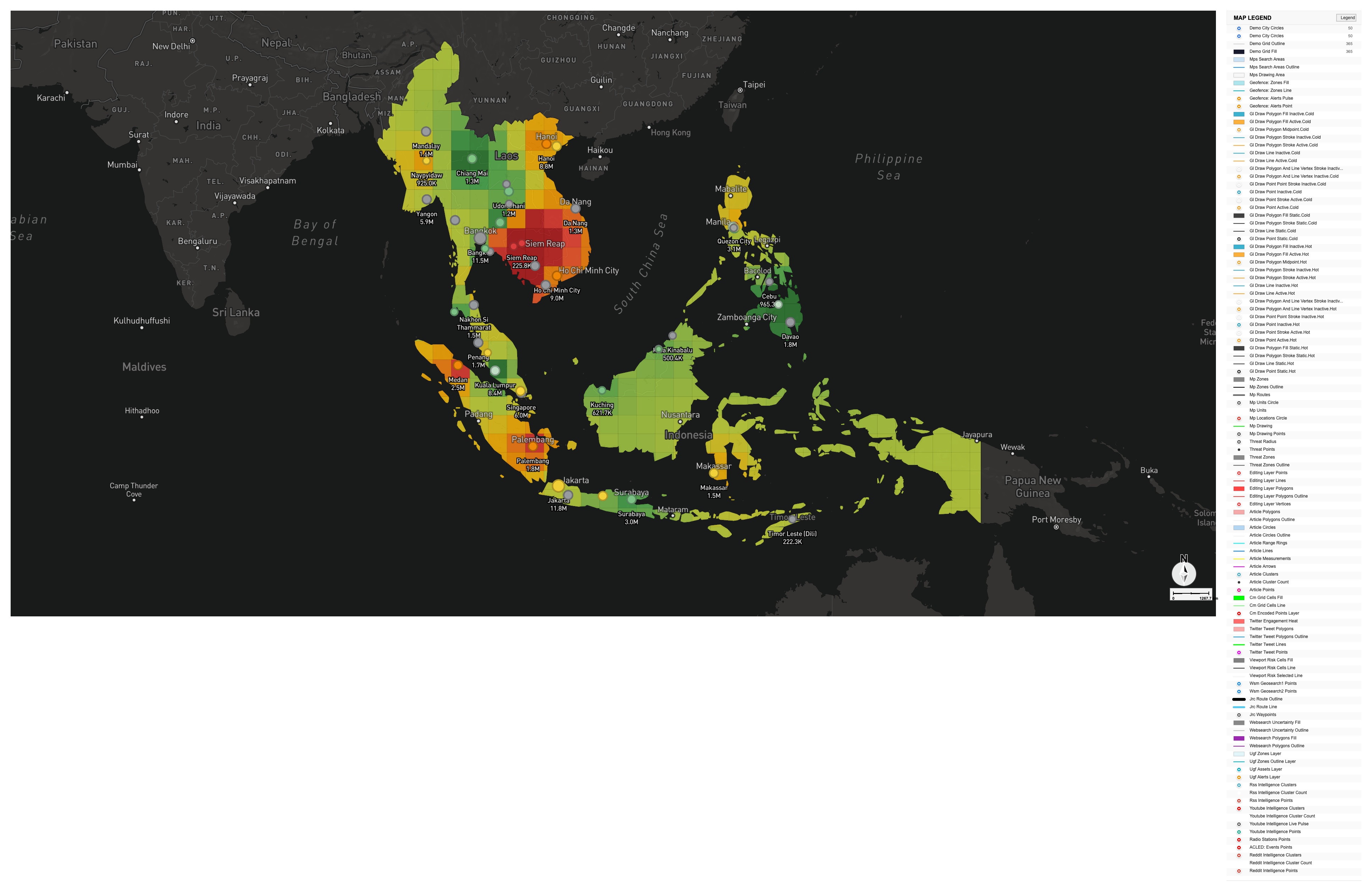
Every map below was produced with GeoBit — fusing 100+ live data sources into operational intelligence on demand. Conflict tracking, chokepoint monitoring, threat-risk analysis, satellite review, and population intelligence. Ask a question; get a map.

Recognized by Deloitte·NVIDIA Inception
Strait of Hormuz chokepoint monitoring map
Chokepoint · Maritime

Strait of Hormuz Monitoring

Southeast Asia threat risk analysis choropleth
Threat Risk · Choropleth

SE Asia Threat-Risk Analysis

Middle East conflict tracking map
Conflict · OSINT

Middle East Conflict Tracking

Uganda protests threat map
Unrest · Africa

Uganda Protest Threat Map

US Israel Iran regional situation map
Geopolitical

US · Israel · Iran Situation

Israel water infrastructure threats map
Critical Infrastructure

Israel Water Infrastructure

Satellite true color analysis
Imagery · Satellite

True-Color Satellite Analysis

Middle East alternative trade routes map
Logistics · Routing

Alternative Trade Routes

Southeast Asia population density map
Population Intelligence

SE Asia Population Density

Youth bulge demographic map
Demographic Risk

Youth-Bulge Indicator

Civil unrest risk map
Unrest · Risk Model

Civil Unrest Risk

Middle East regional overview map
Regional Overview

Middle East Overview

Middle East OSINT event fusion map
OSINT · Fusion

Middle East OSINT Fusion

This is what you'll make

Maps like these are produced on demand from plain-language questions. Bring your area of operations — we'll show you live.

Request a Demo →
EnglishEspañolPortuguêsFrançaisالعربيةעברית日本語