Situation Summary
Australia's composite threat score remains low globally (rank #125, score 6), but sub-national variance is significant, with New South Wales and Northern Territory substantially elevated. Recent 48-hour events include a shark injury in Tasmania, a fugitive-linked arrest in NSW, and a major telecommunications outage affecting emergency services and transport in Sydney. The threat environment is predominantly characterized by localized crime, infrastructure disruption, and diplomatic statements rather than systemic violence or organized threat campaigns.
Key Developments
- Adventure Bay, Tasmania (2026-07-18): A 31-year-old man sustained non-life-threatening injuries from a shark bite at Coal Point. Emergency response was effective; no systemic maritime security implications identified.
- Sydney, NSW (2026-07-17): A 58-year-old woman was apprehended during investigations into fugitive Desmond "Dezi" Freeman, linked to the Porepunkah police killings case. Victoria Police conducted interviews; investigation remains active.
- Sydney, NSW (2026-07-17): Telstra executives faced parliamentary scrutiny following a nationwide mobile network outage that disrupted emergency call routing, payment systems, and train services across NSW and Victoria. Root cause investigation ongoing; service restoration confirmed.
- Diplomatic tension signals (2026-07-16 to 2026-07-18): Public statements and disapproval signals involving Foreign Minister Penny Wong, US–Australia relations, and Laos–Australia interactions indicate minor diplomatic friction. No escalation indicators present.
- Parliamentary oversight activity (2026-07-18): Parliament recorded disapproval signals against a state premier; context suggests routine executive–legislative tension rather than institutional crisis.
Highest-Risk Areas
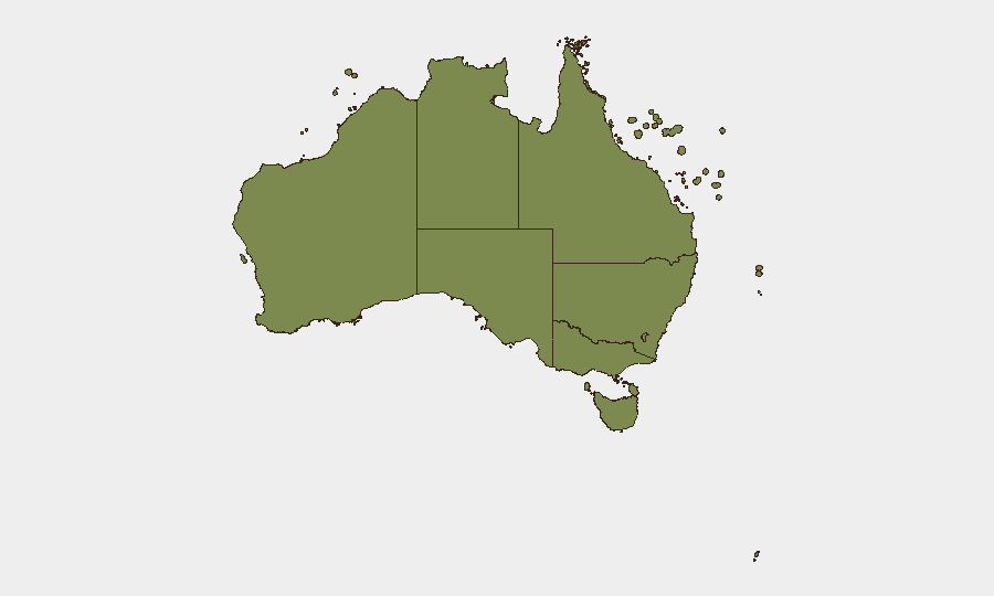
New South Wales (32.5) and Northern Territory (30.9) dominate the risk profile, jointly accounting for over 60% of tracked threat events. NSW risk is driven by urban crime concentration (Sydney metro area), telecommunications infrastructure vulnerabilities, and active criminal investigations. Northern Territory elevation reflects lower absolute event volume but higher per-capita incident density and remoteness factors that complicate emergency response. Victoria (26.3) ranks third but remains moderately elevated, likely reflecting metropolitan concentration in Melbourne. Queensland, Western Australia, and ACT fall substantially below this tier, suggesting risk is geographically concentrated in Australia's eastern seaboard and far north.
How GeoBit Would Assist
Corporate security teams operating in Australia would prioritize Intel Sweep and real-time event-feed monitoring to detect emerging crime, infrastructure disruption, and diplomatic friction in highest-risk zones (NSW, NT). AOI Monitoring & Early Warning with persistent watch on Sydney metro, Darwin, and Melbourne would provide alert-based notification of protests, civil unrest, or transport disruption affecting personnel or supply chains. Routing & Network Analysis would enable rapid alternative-route planning in response to infrastructure outages (as demonstrated by the Telstra incident) and cyber-incident impact modeling for critical assets.
7-Day Outlook
No major escalation is forecast for the next seven days. Ongoing criminal investigations and parliamentary reviews will likely generate continued public statements and diplomatic signals, but without systemic destabilization indicators. Infrastructure resilience and cyber-incident response capability will remain key vulnerabilities; organizations should review telecommunications redundancy and incident communication protocols, particularly in NSW and Victoria.
Highest-Risk Areas — Ranked
| # | State / Region | Risk |
|---|---|---|
| 1 | New South Wales | 32.5 |
| 2 | Northern Territory | 30.9 |
| 3 | Victoria | 26.3 |
| 4 | Queensland | 11.6 |
| 5 | Western Australia | 10.6 |
| 6 | Australian Capital Territory | 10.3 |
| 7 | South Australia | 6.4 |
| 8 | Tasmania | 5.8 |
| 9 | Ashmore and Cartier Islands | 2.5 |
| 10 | Jervis Bay Territory | 2.5 |
| 11 | Coral Sea Islands | 2.5 |
Sources
Previous Daily Briefs
A new Australia brief is written every day — each with its own risk map and downloadable CSV. Here's the last week; use the calendar to go further back.
📅 Browse every day by calendar →
Highlighted days have a brief. Tap a day for that day's map & analysis, or “csv” for that day's dataset ($5).
Atlas — our AI intelligence desk — emails them this snapshot personally. Nothing else, no list.