Situation Summary
Bahrain faces acute elevated threat from Iranian retaliatory drone and missile strikes targeting U.S. Fifth Fleet assets, with simultaneous attacks on civilian residential areas conducted late June 30–early July 1, 2026. U.S. and regional officials report successful interception of all hostile projectiles with no confirmed casualties or structural damage to U.S. installations, though air-raid sirens and civil alerts triggered nationwide response. The incident follows U.S. airstrikes over the preceding weekend and has prompted strong regional diplomatic condemnation; underlying security pressures include recent court verdicts in terrorism-linked cases and indirect maritime risk from Strait of Hormuz activity.
Key Developments
- Manama/U.S. Fifth Fleet base area, June 30–July 1 (late night): IRGC conducted drone and missile strikes against U.S. Navy Fifth Fleet installations at Port Salman; U.S. officials confirm interception of all projectiles with no reported injuries or facility damage.
- Civilian residential neighbourhoods, Bahrain-wide, June 30–July 1 (night): Iranian forces targeted seven attack drones at civilian areas; CENTCOM confirmed hostile action with interception; no confirmed casualties reported as of latest updates.
- Bahrain-wide, June 30–July 1: Air-raid sirens activated and civil-alert systems deployed across multiple zones following drone and missile launches, indicating short-notice threat perception and emergency response protocols.
- Strait of Hormuz, June 30–July 1 (post-strike window): Commercial vessel struck by unidentified projectile with bridge damage but no injuries; incident occurred near concurrent timing with Iran strikes on Bahrain, elevating indirect maritime supply-chain and transit risk.
- Manama/Regional diplomatic sphere, July 1–2: UAE and Kuwait issued public condemnations characterizing Iranian drone attacks as "aggressive" and "reprehensible aggression," signalling heightened regional political tension and potential for advisory changes.
- Bahrain court system, late June–July 1: Court verdicts imposed 10-year sentences on 12 individuals for security-related charges including support for attacks and spreading false information; recent adjudications contribute to internal civil-liberties and activism environment.
Highest-Risk Areas
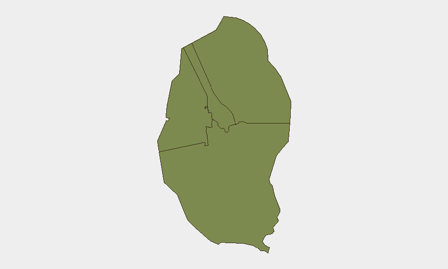
All four governorates—Northern, Capital, Southern, and Muharraq—carry equal composite risk (1.5), reflecting Bahrain's small geography and interconnected infrastructure. The Capital Governorate (Manama) remains operationally most sensitive due to proximity to U.S. Fifth Fleet installations and government ministries; Northern and Muharraq governorates host critical civilian and port facilities vulnerable to indirect effects (air-defence activity, maritime disruption, emergency responses). Risk elevation is primarily externally driven (Iranian strike activity and regional escalation) rather than internal instability, though recent security-related court cases indicate simmering civil tensions that could compound if external pressure persists.
How GeoBit Would Assist
Real-time AOI Monitoring & Early Warning with persistent watch on Fifth Fleet perimeter, port zones, and civilian population centres would provide short-notice alerts on subsequent hostile activity, air-defence activation, or infrastructure disruption. Maritime & Aviation tracking coupled with Strait of Hormuz and regional economic/trade routing analysis would enable supply-chain continuity and personnel-movement planning around hostile activity windows. Conflict & Military intelligence feeds (battle mapping, force posture) and multi-language OSINT (X/Telegram, regional media sentiment) would track IRGC statements, U.S. CENTCOM updates, and Gulf state diplomatic positioning to forecast further escalation or de-escalation signals.
7-Day Outlook
Iranian and U.S. military posturing will likely remain elevated; further retaliatory cycles are possible if either party perceives asymmetric advantage or domestic political pressure. Bahrain's civil and commercial sectors should expect continued short-notice air-defence alerts and possible temporary route/facility access restrictions around military installations. Regional diplomatic activity and any U.S./Gulf Cooperation Council coordinated responses will be primary indicators of de-escalation risk over the next 7 days.
Highest-Risk Areas — Ranked
| # | State / Region | Risk |
|---|---|---|
| 1 | Northern Governorate | 1.5 |
| 2 | Capital Governorate | 1.5 |
| 3 | Southern Governorate | 1.5 |
| 4 | Muharraq Governorate | 1.5 |
Sources
Previous Daily Briefs
A new Bahrain brief is written every day — each with its own risk map and downloadable CSV. Here's the last week; use the calendar to go further back.
📅 Browse every day by calendar →
Highlighted days have a brief. Tap a day for that day's map & analysis, or “csv” for that day's dataset ($5).