Situation Summary
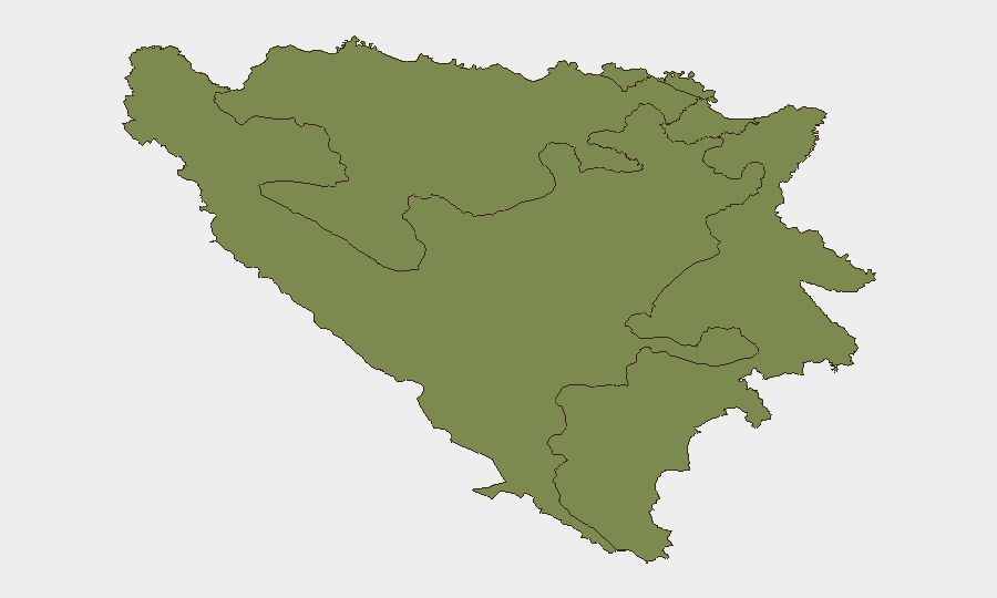
Bosnia and Herzegovina remains a stable, low-threat operating environment at the national level (composite risk score 5/100, ranked #154 globally). No security incidents, civil unrest, crime spikes, or infrastructure disruptions were detected within the country's borders during the last 24–48 hours. Both the Federation of Bosnia and Herzegovina and Republika Srpska maintain equivalent composite risk profiles (31.9 each), reflecting endemic but contained tensions around governance, inter-entity relations, and historical grievances; near-term escalation risk remains low.
Key Developments
No verifiable security, civil-unrest, crime, political-instability, or travel-risk events occurred inside Bosnia and Herzegovina in the last 24–48 hours. Open-source signals monitored by GeoBit show only peripheral references to the country (World Cup fan events involving Bosnia and Herzegovina held in external locations such as North America). Absence of incident reporting does not indicate heightened risk; it reflects continued baseline stability.
Highest-Risk Areas
The Federation of Bosnia and Herzegovina and Republika Srpska are jointly responsible for the country's composite risk profile (both 31.9), driven by underlying institutional fragility, inter-entity administrative disputes, and historical tensions that periodically surface in political rhetoric and public statements. Brčko District (risk 1.9) carries negligible sub-national risk and functions as a neutral administrative zone. Risk in the two primary entities is structural rather than acute: weak central governance, delayed judicial reform, and periodic nationalist discourse create persistent friction, but organized violence, mass protest, or state collapse remain unlikely near-term scenarios. Travelers and resident teams should monitor political-administrative disputes and public statements between entity governments and international supervisory bodies (Office of the High Representative), but should not expect imminent emergency-level events.
How GeoBit Would Assist
A security team with personnel or assets in Bosnia and Herzegovina would use AOI Monitoring & Early Warning (persistent watch on Sarajevo, Banja Luka, and other key cities with alerting on unrest, arrests, or infrastructure incidents) and multi-language OSINT & sentiment analysis (tracking local media, official statements, and social feeds for shifts in political or security rhetoric) to detect early warning of entity-level tensions or localized incidents. Routing & Network Analysis and conflict mapping would support contingency planning and alternative-route identification if travel disruption occurred. Quarterly risk assessment updates against the national and sub-national ranking would inform duty-of-care posture and insurance/security-spending allocation.
7-Day Outlook
No acute security events are anticipated over the next seven days. Baseline political and administrative friction between the Federation and Republika Srpska will likely persist, but organized violence, mass civil unrest, or border incidents remain improbable. Monitoring should remain routine; escalation to emergency protocols would require a significant shift in open-source reporting or political messaging.
Highest-Risk Areas — Ranked
| # | State / Region | Risk |
|---|---|---|
| 1 | Federation of Bosnia and Herzegovina | 31.9 |
| 2 | Republika Srpska | 31.9 |
| 3 | Brčko District | 1.9 |
Previous Daily Briefs
A new Bosnia and Herzegovina brief is written every day — each with its own risk map and downloadable CSV. Here's the last week; use the calendar to go further back.
📅 Browse every day by calendar →
Highlighted days have a brief. Tap a day for that day's map & analysis, or “csv” for that day's dataset ($5).