Situation Summary
Botswana maintains a stable security environment with a composite threat score of 3 and no tracked security incidents as of 7 July 2026. The country ranks #186 globally and presents low risk of conflict, terrorism, or civil unrest. Current attention remains focused on active wildfire events across multiple regions rather than human-driven security threats.
Key Developments
No verifiable security, conflict, civil unrest, crime spike, or infrastructure disruption incidents have been identified in Botswana within the last 24–48 hours from open-source intelligence feeds or social-media monitoring.
Wildfire activity continues to be the primary operational concern, with four separate wildfire events tracked in recent reporting (Events 1029243, 1029230, 1028958, 1028971). These incidents carry potential consequences for transportation, air quality, and supply-chain continuity but do not constitute security threats in the conventional sense.
Organizations with personnel or assets in Botswana should maintain routine situational awareness but face no acute security event requiring immediate escalation at this time.
Highest-Risk Areas
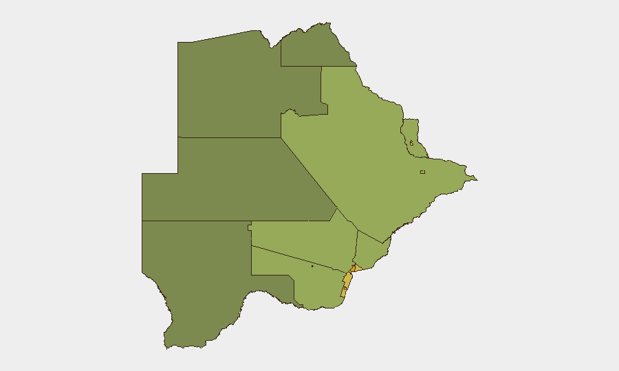
Gaborone (risk 72) and South-East District (risk 68) present the highest composite risk scores, followed by Lobatse (65) and Francistown (62). These urban and peri-urban centers typically concentrate crime, commercial activity, and critical infrastructure, elevating baseline exposure. Mining towns including Jwaneng (61) and Selebi Phikwe (58) carry elevated risk tied to labor dynamics, transient populations, and resource-extraction activity. Northern and central districts (North-West 38, Central 42) register lower scores, reflecting lower population density and reduced operational footprint.
How GeoBit Would Assist
Security teams should deploy AOI Monitoring & Early Warning on Gaborone and South-East District to detect emerging unrest, civil disruption, or crime patterns at earliest stage. Intel Sweep and multi-language OSINT fusion across local news, social platforms, and Telegram channels would enable continuous low-cost monitoring of labor disputes, political tension, or criminal activity in high-risk urban zones. GIS & Spatial Analysis combined with satellite imagery can track wildfire spread, infrastructure exposure, and alternative routing for personnel and supply movements, particularly critical in fire-affected regions.
7-Day Outlook
No escalation in security conditions is anticipated over the next seven days. Wildfire activity may persist and should be monitored for impact on transport corridors and air quality, but these are environmental rather than security concerns. Routine due diligence and standard travel/operations protocols remain appropriate; no elevation of security posture is warranted based on current intelligence.
Highest-Risk Areas — Ranked
| # | State / Region | Risk |
|---|---|---|
| 1 | Gaborone | 72 |
| 2 | South-East District | 68 |
| 3 | Lobatse | 65 |
| 4 | Francistown | 62 |
| 5 | Jwaneng | 61 |
| 6 | Selebi Phikwe | 58 |
| 7 | Southern District | 55 |
| 8 | Kgatleng District | 50 |
| 9 | Kweneng District | 48 |
| 10 | North-East District | 45 |
| 11 | Central District | 42 |
| 12 | North-West District | 38 |
Sources
Previous Daily Briefs
A new Botswana brief is written every day — each with its own risk map and downloadable CSV. Here's the last week; use the calendar to go further back.
📅 Browse every day by calendar →
Highlighted days have a brief. Tap a day for that day's map & analysis, or “csv” for that day's dataset ($5).
Atlas — our AI intelligence desk — emails them this snapshot personally. Nothing else, no list.