Situation Summary
Brunei's internal security environment remains stable with no confirmed incidents of civil unrest, terrorism, major crime, or infrastructure disruption reported in the last 24–48 hours. However, the nation faces elevated diplomatic and geopolitical attention following recent international tribunal activity and military-adjacent developments in the region. The composite threat score of 14 reflects ongoing regional tensions rather than imminent domestic security degradation, though risk concentration in Brunei-Muara District warrants continued monitoring.
Key Developments
- 2026-07-21 · International Tribunal Activity (Jurisdiction: South China Sea): Tribunal issued public statements and demands directed at China and Brunei, signaling renewed focus on maritime and territorial claims; no domestic security impact confirmed as of 22 July.
- 2026-07-20 · Regional Military Activity (Myanmar–Brunei axis): Signals of conventional military force activity involving Myanmar and Brunei noted in event feeds; specifics and proximity to Brunei territory remain unconfirmed pending corroboration.
- 2026-07-20–21 · Multilateral Diplomatic Statements: UK, US, Italy, Germany, Canada, and Australia issued public statements directed at Brunei; China issued disapproval statements. No emergency advisories or travel warnings upgraded by any issuing government.
- No confirmed domestic incidents (last 48h): Royal Brunei Police Force and Prime Minister's Office channels show no incident alerts, civil unrest notices, or infrastructure disruption advisories. Recent foreign travel advisories (e.g., German MFA) continue to characterize Brunei as stable with low crime.
Highest-Risk Areas
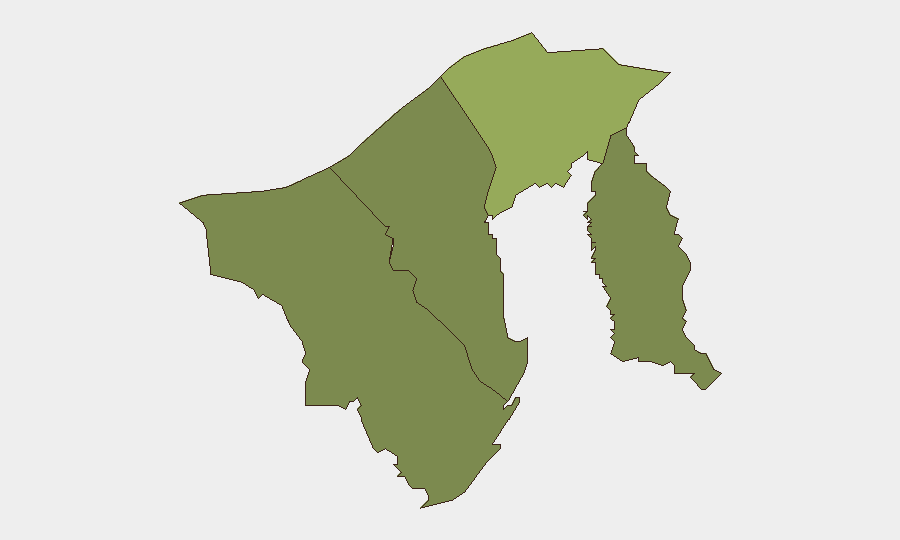
Brunei-Muara District (composite risk 45) represents the dominant risk driver, likely reflecting the capital's concentration of government assets, diplomatic presence, and population density—typical of capital-region risk profiles in Southeast Asia. Tutong District (risk 20) shows secondary elevation, suggesting either cross-border or resource-related risk vectors warranting investigation. Belait and Temburong districts remain at lower baselines (15 and 10 respectively), indicating geographic risk stratification rather than uniformly distributed threat. The overall composite score of 14 places Brunei outside the highest-risk tier globally, consistent with open-source assessments of political stability and low violent-crime prevalence.
How GeoBit Would Assist
Security teams should deploy AOI Monitoring & Early Warning on Brunei-Muara District (especially the capital and port facilities) and maritime zones around Belait and Tutong to detect early indicators of unrest, smuggling activity, or border-adjacent incidents. OSINT fusion across Royal Brunei Police Force social channels, local news outlets, and regional X/Telegram feeds will surface sub-24-hour incident reporting and allow rapid distinction between noise and material threats. Network & Actor Analysis combined with Conflict & Military tracking will clarify the nature and proximity of the Myanmar military signals cited in event feeds, informing duty-of-care risk posture for personnel in border-adjacent areas.
7-Day Outlook
Diplomatic friction over tribunal and maritime claims will likely persist but shows no immediate correlation with domestic security degradation or travel restrictions. Regional military activity warrants continued watch-and-assess posture; any escalation or clarification of Myanmar–Brunei military engagement should trigger rapid escalation review. Absent new incident corroboration, the threat picture over the next week is expected to remain within current parameters: low domestic incident risk, elevated geopolitical activity, no material change to personnel or asset security posture.
Highest-Risk Areas — Ranked
| # | State / Region | Risk |
|---|---|---|
| 1 | Brunei-Muara District | 45 |
| 2 | Tutong District | 20 |
| 3 | Belait District | 15 |
| 4 | Temburong District | 10 |
Sources
Previous Daily Briefs
A new Brunei brief is written every day — each with its own risk map and downloadable CSV. Here's the last week; use the calendar to go further back.
📅 Browse every day by calendar →
Highlighted days have a brief. Tap a day for that day's map & analysis, or “csv” for that day's dataset ($5).
Atlas — our AI intelligence desk — emails them this snapshot personally. Nothing else, no list.