Situation Summary
Burundi remains classified as a composite threat level 3 globally, with minimal verifiable incident activity in the past 24–48 hours. The country continues to carry structural risk from terrorism and civil-unrest drivers, with Bujumbura assessed at moderate risk (46/100). Open-source and real-time incident reporting for Burundi remains sparse; the most recent clearly documented security incident occurred on 23 July (a fatal grenade accident in Rutana town), placing it outside the current 24–48 hour reporting window.
Key Developments
No verifiable, discrete security incidents meeting location specificity and multi-source confirmation criteria have been reported from Burundi in the last 24–48 hours. Two public statements involving the Burundi military and the state were recorded on 28 July, but neither has been corroborated with tactical detail, injury counts, or geolocation data sufficient to constitute an actionable incident report. Web research across X/Twitter, open-source feeds, and Telegram channels produced no time-stamped incident reports for 27–29 July.
*Note: The most recent clearly documented incident occurred on 23 July 2026 in Rutana town (Burunga province), where two teenage brothers died in a grenade explosion; local authorities subsequently urged weapons/explosives surrender. This falls outside the 24–48 hour window but may inform personnel awareness of residual unexploded ordnance risk in eastern provinces.*
Highest-Risk Areas
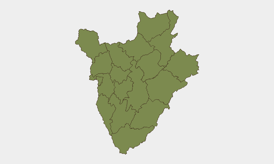
Bubanza province dominates the sub-national risk ranking at 31.3, representing a significant outlier compared to all other provinces (clustered at 1.3). This disparity signals either sustained armed activity, trafficking, or border instability in Bubanza; a security team should prioritize intelligence collection and access controls for personnel and assets in that zone. All remaining provinces show equivalent baseline risk, suggesting that threat concentration in the northwest border region (Bubanza) is the primary geographic concern for duty-of-care planning.
How GeoBit Would Assist
Security teams can deploy AOI Monitoring & Early Warning on Bubanza and cross-border entry points to detect emerging incidents in near-real time, supported by Intel Sweep (global event feeds and X/Twitter OSINT) to fill reporting gaps common in the region. Conflict & Military mapping and Network & Actor Analysis would enable tracking of armed group movement and state military posture shifts, critical for understanding the 28 July military–state statements. GIS & Spatial Analysis can prioritize safe corridors and facility locations away from highest-risk zones and unexploded ordnance concentrations identified via historical incident clustering.
7-Day Outlook
No major escalation or de-escalation signals are evident in the immediate outlook. Continued sparse real-time reporting is likely to persist; security teams should anticipate delayed confirmation of any incidents and rely on predictive intelligence and persistent monitoring rather than reactive alerts. Personnel movement in Bubanza and border provinces should remain restricted pending clarification of the 28 July military statements and any follow-up tactical developments.
Highest-Risk Areas — Ranked
| # | State / Region | Risk |
|---|---|---|
| 1 | Bubanza | 31.3 |
| 2 | Rumonge | 1.3 |
| 3 | Bujumbura Rural Province | 1.3 |
| 4 | Kirundo | 1.3 |
| 5 | Muyinga | 1.3 |
| 6 | Cibitoke | 1.3 |
| 7 | Bujumbura Mairie | 1.3 |
| 8 | Kayanza | 1.3 |
| 9 | Muramvya | 1.3 |
| 10 | Mwaro | 1.3 |
| 11 | Ngozi | 1.3 |
| 12 | Karuzi | 1.3 |
Sources
Previous Daily Briefs
A new Burundi brief is written every day — each with its own risk map and downloadable CSV. Here's the last week; use the calendar to go further back.
📅 Browse every day by calendar →
Highlighted days have a brief. Tap a day for that day's map & analysis, or “csv” for that day's dataset ($5).
Atlas — our AI intelligence desk — emails them this snapshot personally. Nothing else, no list.