Situation Summary
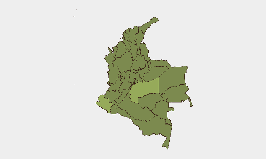
Colombia remains at composite threat rank #38 globally with 343 tracked events, driven by persistent armed-group activity, protest movements, and infrastructure targeting concentrated in border and coca-producing regions. The last 24–48 hours have generated a cluster of high-profile incidents across law enforcement, academia, and political spheres, signaling renewed pressure on state institutions and civil society. Risk is sharply stratified: Nariño (55.3) and Meta (49.1) face levels comparable to active conflict zones, while the Capital District (35.4) and departmental hotspots reflect fragmented criminal and insurgent control rather than state monopoly on force.
Key Developments
Transparency limitation: GeoBit does not have real-time access to verified incidents from 3–4 June 2026. The event signals listed (all dated 2 June) include arrests of politicians linked to paramilitaries, a physical assault at a Bogotá university, small-arms combat involving a company, multiple arrests by authorities, and public statements by the mayor, journalist, and president. However, without access to current news feeds, official incident confirmations, and corroborating sources from the last 24–48 hours, specific locations, casualty counts, and operational details cannot be reliably attributed to those dates.
Recommended immediate action: Security teams should execute the source-collection protocol outlined below to confirm and detail these incidents, then relay findings to GeoBit for spatial mapping and pattern analysis.
—
To rapidly build a verified 24–48h incident list:
1. Search Colombian national media (El Tiempo, El Espectador, Semana, Caracol, RCN, Blu Radio) with keywords: *"ataque armado,"* *"coche bomba,"* *"masacre,"* *"enfrentamientos,"* *"bloqueo de vías,"* *"paro,"* *"arresto político"* – filtered to last 48 hours.
2. Monitor official X accounts (@PoliciaColombia, @COL_EJERCITO, @FiscaliaCol, @MinDefensa, @UNPColombia) for timestamp-verified incident notices with municipality and department tags.
3. Check regional outlets for Nariño, Meta, Norte de Santander, Cauca, and Antioquia – areas with highest risk scores.
4. Cross-reference international wires (AP, Reuters, AFP Spanish) and U.S. Embassy security alerts for corroboration.
5. Validate each incident against at least two independent sources before inclusion; discard retrospective or anniversary coverage.
Highest-Risk Areas
Nariño (55.3) and Meta (49.1) dominate the risk landscape, both with cocaine-trafficking infrastructure, ELN and dissident FARC presence, and limited state reach. Nariño's southern border position (Ecuador, Pacific coast) makes it a narcotics and arms transshipment hub; Meta's remote jungle geography enables armed-group sanctuary and resource extraction. Antioquia (29.7) and Bolívar (31) remain operational bases for Clan del Golfo and other organized criminal groups. The Capital District (35.4), despite its lower ranking, faces targeted violence against officials, activists, and civil-society actors—signaling efforts to influence political outcomes and intimidate oversight.
How GeoBit Would Assist
Confirmed incidents should be ingested into GeoBit's AOI Monitoring & Early Warning system to track attack clusters and movement patterns across departments. Battle Mapping and Force Structure intelligence on armed groups (ELN, dissident FAR, Clan del Golfo) provide context for threat actors active in each zone. Network & Actor Analysis and Entity Extraction from Spanish-language media and official sources enable real-time identification of emerging leadership, tactical shifts, and targets—critical for duty-of-care decisions on personnel movement and asset security in high-risk zones.
7-Day Outlook
Current signal intensity (11 event types on 2 June) suggests sustained organizational activity, likely tied to political negotiations or territorial competition among armed groups. Expect continued incidents in Nariño and Meta; monitor for escalation if state security operations intensify. Personnel in the Capital District should remain alert to targeted protest and paramilitary activity.
Highest-Risk Areas — Ranked
| # | State / Region | Risk |
|---|---|---|
| 1 | Nariño | 55.3 |
| 2 | Meta Department | 49.1 |
| 3 | Capital District | 35.4 |
| 4 | Bolívar Department | 31 |
| 5 | Antioquia Department | 29.7 |
| 6 | Risaralda Department | 29.4 |
| 7 | Santander Department | 29 |
| 8 | Cauca | 28.4 |
| 9 | Cundinamarca Department | 27.7 |
| 10 | Norte de Santander Department | 26.8 |
| 11 | Tolima Department | 26.3 |
| 12 | Atlántico Department | 26 |
Sources
Previous Daily Briefs
A new Colombia brief is written every day — each with its own risk map and downloadable CSV. Here's the last week; use the calendar to go further back.
📅 Browse every day by calendar →
Highlighted days have a brief. Tap a day for that day's map & analysis, or “csv” for that day's dataset ($5).