Situation Summary
Croatia remains a low-threat environment globally (rank #155) with a composite threat score of 4.0 across 30 tracked events. Regional volatility in the northwest (Međimurje and Karlovac counties) is the primary domestic concern, driven by historical border tensions and cross-border criminal activity. Recent signals indicate police action, NATO coordination, and military posturing by Greece and Croatia, suggesting heightened regional diplomatic and security activity rather than direct internal instability.
Key Developments
- 2026-06-21 · Arrest/Detain (PRISON, Croatia) – Prison-related detention activity flagged; specific location and detainee status not yet clarified in available reporting.
- 2026-06-21 · Conventional Military Force (CROATIA) – Croatian military activity reported; details on deployment, scale, or objective pending corroboration.
- 2026-06-21 · Public Statement (CROATIAN) – Official Croatian government communication issued; content and audience not yet specified in current brief.
- 2026-06-21 · Conventional Military Force (GREEK) – Greek military movement detected; potential regional significance given Croatia's NATO membership and Balkans proximity.
- 2026-06-20 · Public Statement (NATO) – NATO issued public communication; likely related to regional military posturing or alliance coordination.
- 2026-06-20 · Demand (EUROPEAN) – Unspecified European demand or directive affecting Croatia; tone and compliance status unclear.
- 2026-06-20 · Disapprove (SERBIA vs PRESIDENT) – Serbian disapproval of Croatian president noted; indicates ongoing bilateral diplomatic friction.
Highest-Risk Areas
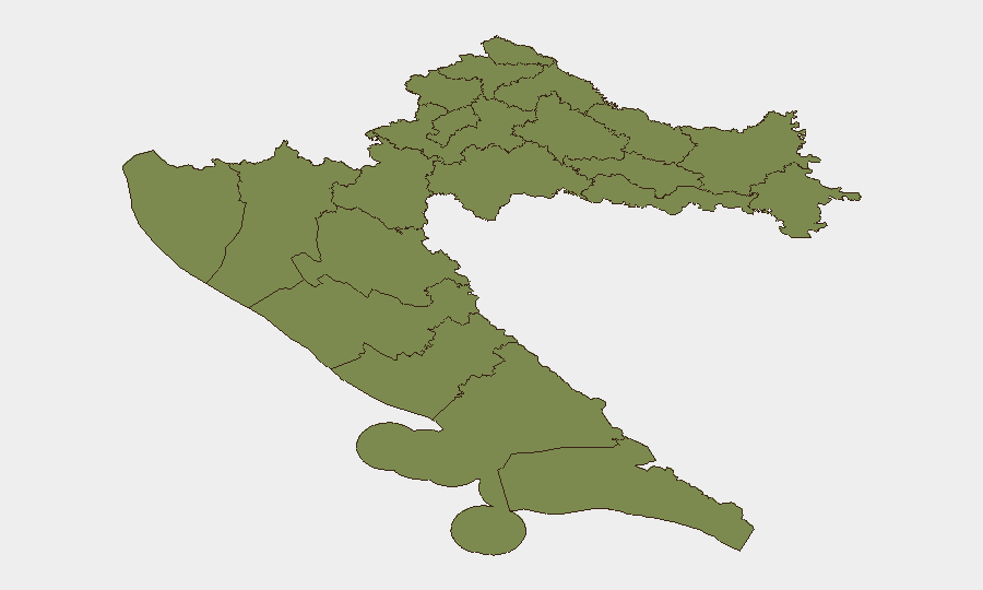
Međimurje County (31.4) and Karlovac County (29.7) significantly exceed national average risk and warrant priority monitoring. Both counties border Serbia and sit along historically contested or sensitive border zones; criminal networks, smuggling routes, and cross-border incidents historically cluster in these areas. Dubrovnik-Neretva County (3.1) shows elevated but secondary concern. All other regions (Zagreb, Istria, Primorje-Gorski Kotar, Sisak-Moslavina, Lika-Senj) score at or near baseline (1.4), indicating concentrated rather than nationwide risk.
How GeoBit Would Assist
Security teams should deploy Area-of-Interest (AOI) Monitoring & Early Warning on Međimurje and Karlovac counties with persistent alerting thresholds set for border-crossing activity, military movement, and law-enforcement incidents. Intel Sweep and multi-language OSINT (targeting Serbian and EU diplomatic channels, Telegram criminal networks, and local Croatian media) will provide real-time corroboration of military posturing, bilateral tensions, and cross-border crime flows. Network & Actor Analysis linked to known smuggling and organized-crime groups operating in the northwest will accelerate threat identification before escalation.
7-Day Outlook
The coincidence of Greek military activity, Croatian military response, NATO statement, and Serbian presidential disapproval suggests a period of elevated regional diplomatic and military coordination rather than acute kinetic threat to Croatia itself. Monitoring should remain elevated on northwest border counties; further escalation is unlikely unless Serbian or Greek state actions materially change. Duty-of-care teams in Međimurje and Karlovac should maintain awareness of possible border restrictions or temporary movement disruptions, though current indicators do not yet warrant personnel relocation or asset withdrawal.
Highest-Risk Areas — Ranked
| # | State / Region | Risk |
|---|---|---|
| 1 | Međimurje County | 31.4 |
| 2 | Karlovac County | 29.7 |
| 3 | Dubrovnik-Neretva County | 3.1 |
| 4 | Krapina-Zagorje County | 1.4 |
| 5 | Varaždin County | 1.4 |
| 6 | Koprivnica-Križevci County | 1.4 |
| 7 | City of Zagreb | 1.4 |
| 8 | Zagreb County | 1.4 |
| 9 | Sisak-Moslavina County | 1.4 |
| 10 | Istria | 1.4 |
| 11 | Primorje-Gorski Kotar County | 1.4 |
| 12 | Lika-Senj County | 1.4 |
Sources
Previous Daily Briefs
A new Croatia brief is written every day — each with its own risk map and downloadable CSV. Here's the last week; use the calendar to go further back.
📅 Browse every day by calendar →
Highlighted days have a brief. Tap a day for that day's map & analysis, or “csv” for that day's dataset ($5).