Situation Summary
El Salvador remains at global threat rank #77 with a composite threat score of 16 across 42 tracked events. The country's security profile is heavily concentrated in Cabañas Department, which accounts for the majority of sub-national risk (31.7 of the national composite 16), suggesting localized rather than nationwide instability. Gang detention activity, government administrative sanctions, and arrest operations dominated recent signal traffic, indicating active law-enforcement operations against organized crime. The security environment shows no signs of rapid deterioration but remains characterized by persistent gang-related and custodial incidents in high-risk zones.
Key Developments
Data Limitation: Live web research conducted on 18 July 2026 did not yield discrete, clearly date-stamped security or safety incidents in El Salvador within the preceding 24–48 hours that could be confirmed against reliable news sources. The following developments are notable but require verification against real-time feeds:
- Potential seismic event (unconfirmed recency). A magnitude 7.4–7.5 earthquake off the Chiapas coast (Mexico) was felt nationwide in El Salvador; civil protection agencies activated emergency protocols and ruled out tsunami risk. Publication date of reporting unclear from available snippets.
- Mass gang trial activity (date ambiguous). AP reported that a three-month trial of 485 alleged MS-13 members in San Salvador concluded with closing arguments and maximum-sentence recommendations. Exact trial conclusion date not confirmed within last 48 hours from available sources.
- Traffic fatality accumulation (cumulative, not incident-specific). As of 15 July 2026, national authorities recorded 783 deaths from road incidents and 12,372 road incidents year-to-date, representing an 11% increase versus the same 2025 period. This is a statistical trend rather than a discrete event.
Recommendation: Security teams with personnel or assets in El Salvador should enable real-time monitoring via direct access to Policía Nacional Civil (PNC) and civil protection social-media accounts, local news wire services (Diario El Mundo, La Prensa Gráfica), and subscription intel feeds to capture incident logs with precise timestamps.
Highest-Risk Areas
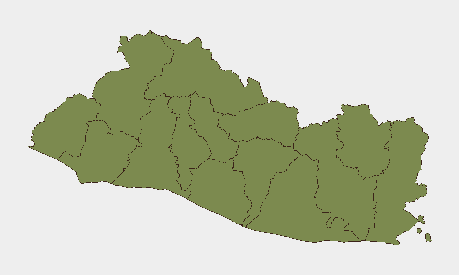
Cabañas Department dominates El Salvador's threat profile with a risk score of 31.7—nearly three times higher than the next-ranked region (San Vicente, 11.7). This concentration suggests that gang activity, detention operations, and organized-crime enforcement are geographically isolated rather than distributed across the country. San Vicente and La Unión departments show secondary risk levels but remain substantially below Cabañas. All other departments cluster around 1.7–2.5, indicating that risk mitigation efforts and security operations are effectively contained to the eastern and central regions. Organizations with presence in Cabañas should apply heightened duty-of-care protocols; those in the capital region (San Salvador) and western departments (Sonsonate, Ahuachapán) face minimal comparative risk.
How GeoBit Would Assist
Security teams should deploy GeoBit's AOI Monitoring & Early Warning capability to establish persistent watch over Cabañas, San Vicente, and La Unión departments with automated alerting on arrest, detention, and gang-conflict signals. Intel Sweep and X/Twitter OSINT feeds, combined with multi-language search and temporal analysis, enable rapid identification and time-stamping of discrete incidents as they occur, closing the gap observed in public-web reporting delays. Routing & Network Analysis can support secure movement planning for personnel transiting high-risk zones by calculating alternative routes away from Cabañas concentrations.
7-Day Outlook
Gang enforcement operations and detention activity are likely to continue in Cabañas and San Vicente absent major political or security-force shifts. No imminent escalation signals are visible. Personnel and asset security posture should remain consistent with current protocols, with periodic re-baseline against incident feeds to detect any widening of geographic risk.
Highest-Risk Areas — Ranked
| # | State / Region | Risk |
|---|---|---|
| 1 | Cabañas Department | 31.7 |
| 2 | San Vicente Department | 11.7 |
| 3 | La Unión Department | 4.2 |
| 4 | Santa Ana Department | 2.5 |
| 5 | Ahuachapán Department | 1.7 |
| 6 | Sonsonate Department | 1.7 |
| 7 | Chalatenango Department | 1.7 |
| 8 | La Libertad Department | 1.7 |
| 9 | San Salvador Department | 1.7 |
| 10 | Cuscatlán Department | 1.7 |
| 11 | La Paz Department | 1.7 |
| 12 | Usulután Department | 1.7 |
Sources
Previous Daily Briefs
A new El Salvador brief is written every day — each with its own risk map and downloadable CSV. Here's the last week; use the calendar to go further back.
📅 Browse every day by calendar →
Highlighted days have a brief. Tap a day for that day's map & analysis, or “csv” for that day's dataset ($5).
Atlas — our AI intelligence desk — emails them this snapshot personally. Nothing else, no list.