Situation Summary
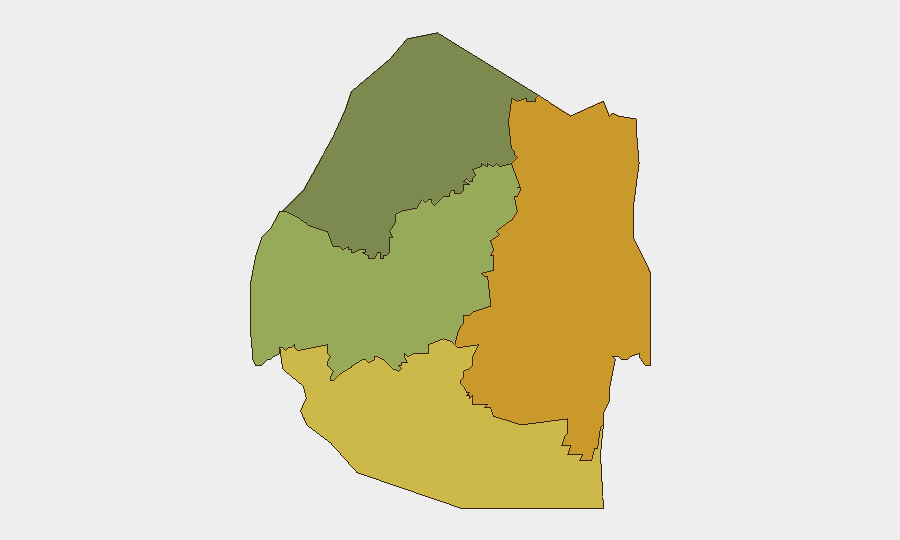
Eswatini remains stable with no confirmed acute security incidents reported in the last 24–48 hours. The national composite threat score stands at 10 (globally unranked), reflecting low acute risk but persistent baseline vulnerabilities in crime, emergency-response capacity, and political tensions. Sub-national disparities are significant, with Lubombo and Shiselweni regions elevated above the national baseline, while Hhohho remains relatively lower-risk. The security environment is characterized by structural fragility rather than active crisis.
Key Developments
No credible, location-specific security incidents in Eswatini have been confirmed within the last 24–48 hours across open-source news, social media, or civil-society reporting. Monitoring of live risk dashboards, local media, and regional feeds has identified no new protests, roadblocks, violence, or infrastructure disruptions dated 22–23 June 2026. Regional events involving Lebanon, Iran, Switzerland, and the United States are trending in global event signals but have no direct bearing on Eswatini's domestic security posture at this time.
Highest-Risk Areas
Lubombo Region (risk score 72) and Shiselweni Region (risk score 68) drive the country's highest localized vulnerabilities—a 37–33 point spread above the national average. Both regions experience elevated crime, limited law-enforcement capacity, and economic stress; Lubombo's border position and cross-border trafficking networks further elevate exposure. Manzini Region (score 55) represents a mid-tier concern, likely reflecting urban density and economic activity, while Hhohho (score 35) remains the lowest-risk area. Corporate and NGO personnel in Lubombo and Shiselweni should maintain heightened situational awareness and community-network intelligence.
How GeoBit Would Assist
A security team operating in or monitoring Eswatini would deploy AOI Monitoring & Early Warning on Lubombo and Shiselweni to detect emerging protest calls, roadblocks, or security-force operations in real time. Intel Sweep and X/Twitter & Telegram OSINT (including multi-language monitoring of local activist and journalist accounts) would provide daily texture on political mood and civil-society activity. Routing & Network Analysis enables duty-of-care teams to pre-plan alternative routes for personnel in high-risk regions, while Risk & Threat Assessment dashboards keep baseline crime and stability scores current as conditions shift.
7-Day Outlook
No acute incident trajectory is evident. The baseline risk profile—elevated in Lubombo and Shiselweni, stable elsewhere—is likely to persist absent new political agitation, economic shock, or security-force actions. Continued monitoring of regional media, local government statements, and civil-society social-media channels is warranted to detect any shift in political temperature or grassroots mobilization. Personnel and asset-protection protocols should remain calibrated to sub-regional risk levels rather than national averages.
Highest-Risk Areas — Ranked
| # | State / Region | Risk |
|---|---|---|
| 1 | Lubombo | 72 |
| 2 | Shiselweni | 68 |
| 3 | Manzini Region | 55 |
| 4 | Hhohho Region | 35 |
Sources
Previous Daily Briefs
A new Eswatini brief is written every day — each with its own risk map and downloadable CSV. Here's the last week; use the calendar to go further back.
📅 Browse every day by calendar →
Highlighted days have a brief. Tap a day for that day's map & analysis, or “csv” for that day's dataset ($5).