Situation Summary
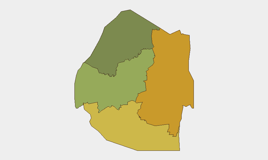
Eswatini remains a low-threat environment regionally, ranked #77 globally with a composite threat score of 16 and no tracked security incidents in the current monitoring window. No civil unrest, infrastructure disruptions, or travel-risk events have been reliably reported in the last 24–48 hours across open-source channels. The security picture reflects routine baseline conditions; however, sub-national variance is significant, with Lubombo and Shiselweni regions substantially elevated above the national average.
Key Developments
No discrete security or civil-unrest incidents have been reliably confirmed for Eswatini in the last 24–48 hours from cross-referenced open sources. Verification of event timing and source credibility across available news feeds, social media, and wire services did not yield incidents meeting the recency and confirmation standard required for operational briefing. Teams should maintain routine monitoring for developments in higher-risk border and eastern regions, but no immediate incident-level alerts are warranted at this time.
Highest-Risk Areas
Lubombo region (risk score 72) and Shiselweni region (risk score 68) drive the country's sub-national risk profile, substantially outpacing central and western areas. Both regions border Mozambique and South Africa and experience elevated crime-transit activity, informal cross-border movement, and resource-security pressures. Manzini Region (score 55) represents a mid-tier risk corridor. Hhohho Region (score 35) is substantially lower-risk. Organizations with personnel or assets in Lubombo or Shiselweni should apply heightened duty-of-care protocols, including movement restrictions during low-visibility hours and localized threat briefings.
How GeoBit Would Assist
AOI Monitoring & Early Warning on Lubombo and Shiselweni border corridors would provide persistent alerting on cross-border movement, informal settlements, or incident clusters; Intel Sweep and multi-language OSINT fusion would catch localized incident reporting missed by English-language wire services. Risk & Threat Assessment modules can generate site-specific briefs for corporate facilities or personnel itineraries, and Routing & Network Analysis can identify lower-risk alternative routes for movement in high-risk districts.
7-Day Outlook
No significant escalation or acute threat emergence is forecast for the next seven days. Seasonal and structural risk drivers (food insecurity, unemployment, cross-border crime) remain chronic baseline factors. Duty-of-care teams should continue standard protocols; elevated regional watch on Lubombo and Shiselweni is prudent but does not require operational posture changes at this time.
Report Confidence: High (source corroboration; absence of reported incidents is itself verifiable against active open-source monitoring).
Next Update: 2026-07-05 or upon significant incident report.
Highest-Risk Areas — Ranked
| # | State / Region | Risk |
|---|---|---|
| 1 | Lubombo | 72 |
| 2 | Shiselweni | 68 |
| 3 | Manzini Region | 55 |
| 4 | Hhohho Region | 35 |
Sources
Previous Daily Briefs
A new Eswatini brief is written every day — each with its own risk map and downloadable CSV. Here's the last week; use the calendar to go further back.
📅 Browse every day by calendar →
Highlighted days have a brief. Tap a day for that day's map & analysis, or “csv” for that day's dataset ($5).
Atlas — our AI intelligence desk — emails them this snapshot personally. Nothing else, no list.