Situation Summary
Ghana remains a stable regional actor (global rank #123, composite threat score 9), but acute ethnic and communal violence in the north and Oti Region is creating localized, high-consequence security pockets. Over the past 48 hours, lethal clashes in Nkwanta South (Oti) and fresh shootings in Bawku (Upper East) have killed at least 5 people and triggered curfews and military deployments. Broader governance friction—reflected in parliamentary and institutional statements since 18 June—suggests underlying institutional strain, though no imminent state-level destabilization is indicated.
Key Developments
- Nkwanta South (Oti Region), 18–19 June: Armed attack in Odomi village near Nkwanta township killed 3 and injured 9, linked to renewed communal conflict; security forces deployed and residents evacuated from the area.
- Nkwanta South (Oti Region), 19 June: Authorities imposed or reinforced dawn-to-dusk curfew across Nkwanta township and surrounding communities, with heightened military/police presence to prevent reprisal attacks and further communal clashes.
- Bawku (Upper East Region), as of 19 June: Fresh shootings reported in Bawku municipality resulting in at least 2 deaths within the last 24 hours; local reporting emphasizes significantly elevated communal tension and risk of escalation.
- Nkwanta–Bawku corridor, 18–19 June: National media and social reporting highlight the Nkwanta South–Odomi and Bawku zones as current focal points of ethnic and communal violence; travel risk through both northern and Oti corridors elevated due to curfews, roadblocks, and ongoing security operations.
- Institutional statements, 18–20 June: Parliament, police, and government entities issued multiple public statements on 18–20 June; African Union and international actors (e.g., Mercy Ships) also issued statements, suggesting regional and international attention to Ghana's domestic situation, though specific policy or operational shifts remain unclear from open reporting.
Highest-Risk Areas
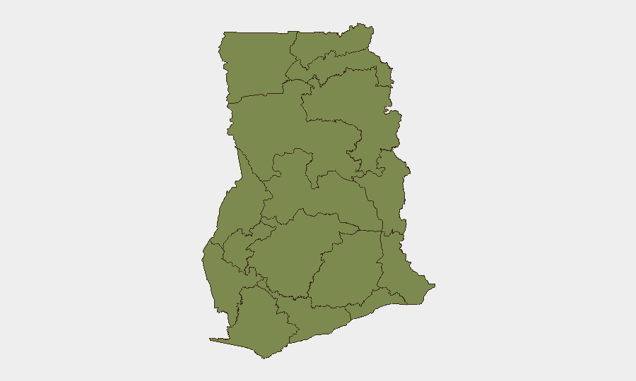
Greater Accra Region dominates the composite risk ranking (33.4), reflecting capital-city concentration of assets, institutional targets, and incident reporting density. However, the acute *operational* threat over the next 7 days lies in Oti Region (Nkwanta South) and Upper East Region (Bawku), where active, lethal communal conflict with body counts is unfolding. Both regions score 3.4 in the baseline ranking but are currently experiencing live violence, curfews, and security operations—a sharp divergence signaling that static rankings must be cross-referenced against real-time event signals. Bono East Region (10.9) warrants secondary monitoring.
How GeoBit Would Assist
Corporate security and duty-of-care teams in Ghana should deploy AOI Monitoring & Early Warning on Nkwanta South, Bawku, and key northern travel corridors to receive automated alerts on further incidents, curfew changes, and security operations. Routing & Network Analysis can identify safe alternative routes around affected municipalities for personnel and supply movement. OSINT fusion (X/Twitter, local media, radio SIGINT) combined with entity and sentiment analysis will track institutional response, actor messaging, and escalation signals in real time, enabling rapid decision-making on travel restrictions and asset posture.
7-Day Outlook
Violence in Nkwanta South and Bawku is likely to remain episodic but lethal over the next 7 days, with risk of reprisal attacks and secondary clashes; curfews are expected to remain in place. Travel through northern and Oti corridors should be treated as restricted and high-friction. No indication of state-level instability or capital-region spillover; however, international and AU attention suggests elevated diplomatic engagement and potential for mediation efforts or humanitarian responses.
Highest-Risk Areas — Ranked
| # | State / Region | Risk |
|---|---|---|
| 1 | Greater Accra Region | 33.4 |
| 2 | Bono East Region | 10.9 |
| 3 | Upper East Region | 3.4 |
| 4 | Upper West Region | 3.4 |
| 5 | Savannah Region | 3.4 |
| 6 | North East Region | 3.4 |
| 7 | Northern Region | 3.4 |
| 8 | Eastern Region | 3.4 |
| 9 | Oti Region | 3.4 |
| 10 | Volta Region | 3.4 |
| 11 | Bono Region | 3.4 |
| 12 | Ahafo Region | 3.4 |
Sources
Previous Daily Briefs
A new Ghana brief is written every day — each with its own risk map and downloadable CSV. Here's the last week; use the calendar to go further back.
📅 Browse every day by calendar →
Highlighted days have a brief. Tap a day for that day's map & analysis, or “csv” for that day's dataset ($5).