Situation Summary
Grenada's overall security environment remains stable, with a composite threat score of 14 and no confirmed new incidents reported in the last 24–48 hours. Open-source monitoring across news, social media, and regional security briefs detect no active armed conflict, civil unrest, major crime spikes, infrastructure disruption, or acute travel risks during the assessment window (29–31 July 2026). The Royal Grenada Police Force's recent public communications do not indicate any new acute security events requiring immediate escalation.
Key Developments
No high-confidence security incidents meeting the 24–48 hour window have been identified in Grenada during this reporting period. Current open-source signals and regional security monitoring indicate stable conditions across the country.
Background context (outside current reporting window):
- Grand Anse Beach, St. George's (since 22 July): Search operations continue for missing U.S. visitor Elizabeth Waddell, last seen swimming off Grand Anse Beach on 22 July. This incident predates the current 24–48 hour assessment window but remains operationally active.
Highest-Risk Areas
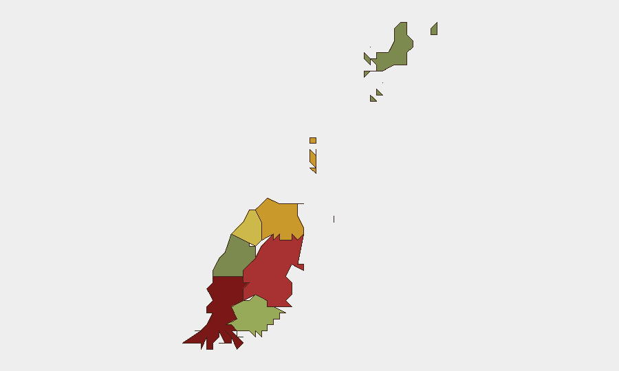
Saint George parish carries the highest composite risk score (92), driven by population density, tourism concentration, and historical crime clustering in St. George's capital district. Saint Andrew (78) and Saint Patrick (71) follow as secondary risk zones. By contrast, Carriacou and Petite Martinique (12) present minimal assessed risk. The concentration of risk in the three northernmost parishes reflects traditional crime patterns and urban density rather than current acute instability; no new incident spike in these areas has been detected in the last 24–48 hours.
How GeoBit Would Assist
Security and duty-of-care teams managing personnel or assets in Grenada can deploy AOI (Area-of-Interest) Monitoring & Early Warning to track Saint George, Saint Andrew, and Saint Patrick parishes with persistent alerting on crime, civil unrest, or infrastructure events. OSINT fusion and multi-platform intelligence sweeps (X/Twitter, Telegram, YouTube, news feeds, and local radio SIGINT) provide real-time detection of emerging threats or public incidents in advance of mainstream reporting. GIS & Spatial Analysis enables risk-stratified site planning and personnel routing away from highest-risk zones during operational movements.
7-Day Outlook
Near-term conditions in Grenada are expected to remain stable, with no indicators of impending unrest, conflict escalation, or major security disruption. Ongoing search operations for the missing visitor may generate periodic local media activity and police resource deployment, but this is unlikely to affect broader security posture. Routine vigilance in Saint George and Saint Andrew parishes is warranted for corporate personnel and asset protection teams.
Highest-Risk Areas — Ranked
| # | State / Region | Risk |
|---|---|---|
| 1 | Saint George | 92 |
| 2 | Saint Andrew | 78 |
| 3 | Saint Patrick | 71 |
| 4 | Saint Mark | 64 |
| 5 | Saint David | 52 |
| 6 | Saint John | 38 |
| 7 | Carriacou and Petite Martinique | 12 |
Sources
Previous Daily Briefs
A new Grenada brief is written every day — each with its own risk map and downloadable CSV. Here's the last week; use the calendar to go further back.
📅 Browse every day by calendar →
Highlighted days have a brief. Tap a day for that day's map & analysis, or “csv” for that day's dataset ($5).
Atlas — our AI intelligence desk — emails them this snapshot personally. Nothing else, no list.