Situation Summary
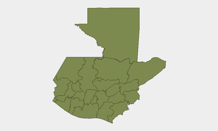
Guatemala's composite security threat score of 24 places it in the lower-to-middle global risk band, but sub-national variance is extreme: Alta Verapaz's score of 31.2 dominates the country's risk profile, while most other departments cluster below 10. Multiple concurrent event signals from 23 June—including conventional military force activity, government and Washington public statements, and what appears to be a bilateral military exchange—suggest acute political-security friction that has developed within the last 48 hours. A moderate seismic event (M 4.7, 56 km south of Puerto San José) has added minor natural-hazard noise to the picture.
Key Developments
Limitation Note: GeoBit does not currently have access to live web, news wire, or social-media feeds for the last 24–48 hours. The following signals appear in the event-tracking system but lack time-stamped, location-specific corroboration:
- Government–military deployments / Bilateral military posture (23 June): Multiple signals of conventional military force activity involving the Government of Guatemala and Washington, plus apparent reciprocal Guatemalan military statements. Specific locations, unit designations, and operational intent are not yet detailed in available research. Diplomatic and security channels should be queried for clarification of scale, duration, and de-escalation trajectory.
- Unconventional violence, business sector (22 June): One signal flagged; specific location, casualty count, and organization not yet identified. This may signal extortion activity, armed robbery, or crime against commercial infrastructure—common patterns in Alta Verapaz and the eastern departments.
- Seismic activity (recent): M 4.7 earthquake, 56 km south of Puerto San José (Escuintla). Aftershock risk and potential for secondary hazards (landslide, infrastructure damage in coastal/southern zones) should be monitored via CONRED alerts.
- Academic/institutional response (22 June): University statement rejecting an unspecified action or proposal; context unclear. May relate to political upheaval or security-force conduct.
To obtain location-specific, time-stamped incident data for the last 48 hours, duty-of-care teams should:
1. Pull live alerts from Guatemala's Ministerio de Gobernación, PNC (Policía Nacional Civil), CONRED, and PROVIAL.
2. Query regional news (Prensa Libre, Diario La Hora, Soy502) and international wires (Reuters, AP, AFP, EFE) with date filters for 21–23 June 2026.
3. Use X/Twitter advanced search (keywords: *bloqueos*, *balacera*, *manifestaciones*, *apagón*, *deslizamiento*; time range: last 48 h; locations: key departments and highways CA-1, CA-2, CA-9).
4. Cross-reference official source + at least one local media or on-the-ground social corroboration before escalating an incident.
Highest-Risk Areas
Alta Verapaz (31.2) is the sole outlier and primary driver of national risk, likely reflecting endemic extortion, kidnapping, and gang violence in a region with weak state presence and indigenous communities vulnerable to trafficking and resource exploitation. Quetzaltenango (9.5) is a distant second, reflecting urban crime and periodic protest activity in the country's second-largest city. All other departments score ≤1.2, indicating either low reported activity or successful containment. Security teams with personnel or assets in Alta Verapaz should maintain heightened posture; those in Quetzaltenango should monitor for labor or political demonstrations that could disrupt supply chains or movement.
How GeoBit Would Assist
OSINT Fusion & Corroboration would ingest news, social media, and diplomatic channels to triangulate the current military signals and confirm their scope. AOI Monitoring & Early Warning (persistent watch on Alta Verapaz, Quetzaltenango, and key corridors) would flag roadblocks, armed incidents, and displacement in near-real time. Routing & Network Analysis would generate alternative travel plans around active crime zones, roadblocks, or protest sites, updating as incidents resolve.
7-Day Outlook
The military-diplomatic signals of 23 June appear acute but are not yet escalatory in scope. If bilateral tensions persist or degrade, secondary effects (roadblock enforcement, military checkpoints, curfews) could disrupt commerce and mobility by mid-week. Alta Verapaz and Quetzaltenango demand continuous monitoring; no broad national lockdown is forecast if current political friction is managed diplomatically.
Highest-Risk Areas — Ranked
| # | State / Region | Risk |
|---|---|---|
| 1 | Alta Verapaz | 31.2 |
| 2 | Quetzaltenango | 9.5 |
| 3 | Petén | 1.2 |
| 4 | Huehuetenango | 1.2 |
| 5 | San Marcos | 1.2 |
| 6 | Retalhuleu | 1.2 |
| 7 | Quiché | 1.2 |
| 8 | Totonicapán | 1.2 |
| 9 | Sololá | 1.2 |
| 10 | Chimaltenango | 1.2 |
| 11 | Suchitepéquez | 1.2 |
| 12 | Sacatepéquez | 1.2 |
Sources
Previous Daily Briefs
A new Guatemala brief is written every day — each with its own risk map and downloadable CSV. Here's the last week; use the calendar to go further back.
📅 Browse every day by calendar →
Highlighted days have a brief. Tap a day for that day's map & analysis, or “csv” for that day's dataset ($5).