Situation Summary
Guyana is experiencing a major national crisis following the 22 July capsizing of the MV Barima ferry off the North Atlantic coast, which has claimed at least 53 confirmed dead with approximately 50 persons still missing and a revised passenger manifest indicating 179 aboard—far exceeding earlier reports. Concurrent with the maritime disaster, criminal and administrative investigations have been opened into potential wrongdoing by police, defence force, and maritime administration officials regarding vessel overloading and safety failures. The overall security environment remains stable at rank #67 globally (threat score 16), but the Barima incident and associated official accountability probes are driving elevated national attention and short-term institutional strain.
Key Developments
- MV Barima search and recovery (off Pomeroon River / Waini Point, 18–22 July, ongoing): Search-and-recovery operations continue with 16 vessels deployed across a ~1,070 sq km zone. Authorities have recovered 53 bodies, confirmed 76 survivors, and estimate approximately 50 persons remain missing. Regional and French support teams are actively engaged; the search zone has been expanded multiple times toward Waini Point as casualty figures have been revised upward.
- Independent Commission of Inquiry announced (national level, 22 July): Prime Minister Mark Phillips confirmed establishment of an independent investigative body into the MV Barima disaster and announced that investigations now place the total number of persons aboard at 179—substantially higher than earlier manifest figures—triggering questions about vessel safety protocols and loading oversight.
- Criminal and administrative investigations into official responsibility (Georgetown / maritime authorities, 19–22 July): Prime Minister Phillips stated that criminal and administrative investigations have been launched targeting potential wrongdoing by members of the police force, defence force, and maritime administration in connection with the MV Barima's overloading and safety failures, indicating forthcoming disciplinary or legal proceedings.
- Presidential declaration of national mourning (national level, 22 July): President Irfaan Ali declared three days of national mourning beginning 22 July for MV Barima victims, with the Government coordinating a multi-agency and international response. The EU delegation and France have publicly confirmed participation in the mourning period.
- Ongoing high-profile criminal investigations (Georgetown, 22 July): Mechanic Satrohan "Depo" Rajkumar from Friendship Housing Scheme surrendered to police less than 24 hours after being declared wanted in connection with the long-running 2021 "Paper Shorts" murder probe, indicating sustained law-enforcement pressure on high-profile cases.
- Immigration enforcement action (location unspecified, ~21–22 July): Guyanese police charged five Chinese nationals with immigration offences following discovery of visa overstays, reflecting ongoing routine immigration compliance operations.
Highest-Risk Areas
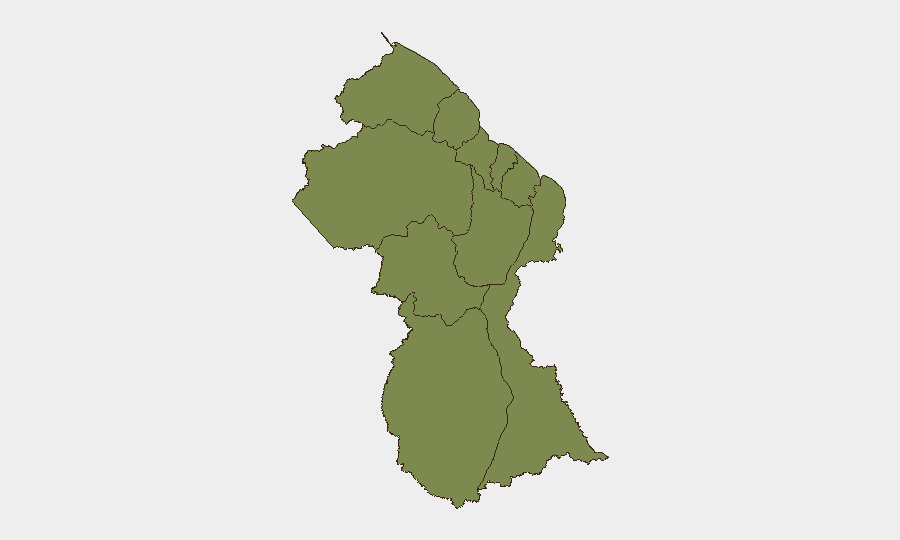
Barima-Waini (risk 31.4) dominates the sub-national ranking by a factor of four, driven almost entirely by the maritime disaster's geographic proximity to the Pomeroon River and Waini Point region. Demerara-Mahaica (risk 7.2) registers the second-highest score, reflecting Georgetown's role as the administrative centre where criminal investigations, police operations, and government accountability processes are concentrated. All other regions score at or below 1.4, indicating that current threat concentration is tightly geographic and incident-specific rather than broadly distributed.
How GeoBit Would Assist
Security teams should deploy AOI Monitoring & Early Warning on the active search zone and coastal administrative centres (Georgetown, Port Kaituma) to track investigative developments and potential follow-on institutional or political volatility. OSINT fusion and network analysis will track emerging accountability narratives and official statements via X, Telegram, and government channels to identify reputational or operational impact on maritime and defence institutions. Maritime tracking capabilities would enable real-time monitoring of vessel movements and safety compliance patterns post-incident to support duty-of-care protocols for personnel or assets dependent on coastal transport.
7-Day Outlook
The search-and-recovery operation is expected to continue through the national mourning period (through 24 July minimum), with casualty figures likely to stabilize as the search zone is progressively narrowed. Investigative statements by officials and preliminary findings from the Independent Commission will emerge during weeks ahead, but immediate near-term risk remains centred on the maritime disaster response and potential administrative or reputational consequences for government agencies rather than systemic security deterioration.
Highest-Risk Areas — Ranked
| # | State / Region | Risk |
|---|---|---|
| 1 | Barima-Waini | 31.4 |
| 2 | Demerara-Mahaica | 7.2 |
| 3 | Upper Demerara-Berbice | 5.3 |
| 4 | Cuyuni-Mazaruni | 1.4 |
| 5 | Pomeroon-Supenaam | 1.4 |
| 6 | Essequibo Islands | 1.4 |
| 7 | Mahaica-Berbice | 1.4 |
| 8 | Potaro-Siparuni | 1.4 |
| 9 | East Berbice-Corentyne | 1.4 |
| 10 | Upper Takutu-Upper Essequibo | 1.4 |
Sources
Previous Daily Briefs
A new Guyana brief is written every day — each with its own risk map and downloadable CSV. Here's the last week; use the calendar to go further back.
📅 Browse every day by calendar →
Highlighted days have a brief. Tap a day for that day's map & analysis, or “csv” for that day's dataset ($5).
Atlas — our AI intelligence desk — emails them this snapshot personally. Nothing else, no list.