Situation Summary
Honduras remains a low-to-moderate security environment globally (rank #64, composite threat score 16/100) with no discrete security incidents confirmed in the last 24–48 hours. The country's threat profile is heavily concentrated in the eastern Olancho department, which carries a composite risk score of 31.4—more than 20 times higher than all other tracked departments. Broader organized crime, trafficking networks, and localized gang activity persist as chronic stressors, but no acute escalations or new incident clusters have been detected in the current reporting window.
Key Developments
- No confirmed new security incidents in Honduras in the last 24–48 hours. Available open-source reporting does not surface any current attacks, unrest, infrastructure disruptions, or travel-related incidents within the current window.
- Tegucigalpa — June 9, 2026 (outside 48h window; background reference) — U.S. and Honduran military and intelligence personnel conducted a bilateral partnership exchange at the Dirección de Información Estratégica. This reflects ongoing intelligence-sharing cooperation and does not constitute a security incident.
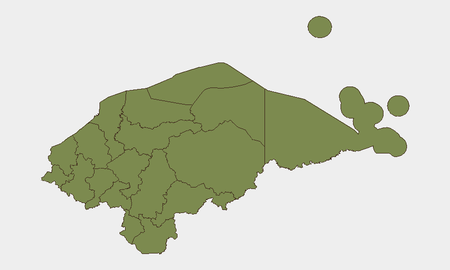
- Olancho department remains the dominant risk driver. With a composite risk score of 31.4, Olancho significantly outpaces all other departments (next highest: 1.4 across a broad regional band). The concentration of risk in this eastern region warrants sustained monitoring but does not indicate an acute new event.
- No imminent threat signals detected. Across 88 tracked events in the Honduras portfolio and current web research, no credible indicators of impending violence, criminal escalation, or humanitarian emergencies have surfaced.
Highest-Risk Areas
Olancho department dominates Honduras's subnational risk profile, with a composite score of 31.4 compared to 1.4 across all other departments. This 22-fold differential reflects chronic exposure to trafficking routes, gang-controlled territory, and limited state presence in rural and border-adjacent zones. All other tracked departments—El Paraíso, Copán, Cortés, Yoro, and the central and western highlands—carry uniform risk scores of 1.4, suggesting either stabilized conditions or less granular differentiation in those areas. For corporate security and duty-of-care purposes, Olancho should remain the primary focus for enhanced protocols; operations outside Olancho and the capital region (Francisco Morazán) carry lower statistical risk but should still observe standard Central American travel and asset-protection practices.
How GeoBit Would Assist
Teams with personnel or assets in Honduras should employ AOI Monitoring & Early Warning on Olancho and key transport corridors to detect emerging gang, trafficking, or security-force activity before it affects operations. OSINT Fusion & Corroboration (including X/Telegram monitoring, radio SIGINT, and multi-language web search) will capture localized criminal activity, roadblocks, or curfews that may not appear in mainstream reporting. Routing & Network Analysis can identify real-time alternative transit routes around known gang-controlled zones, particularly in Olancho and along major highways linking Honduras to Guatemala and El Salvador.
7-Day Outlook
No acute deterioration is forecast for the next seven days. Olancho will remain the primary risk concentration, with chronic but stable organized-crime activity. Duty-of-care teams should maintain standard monitoring cadence and ensure personnel adhere to localized travel advisories and curfew compliance in higher-risk departments; no emergency protocols or standdown measures are warranted at this time based on current intelligence.
Highest-Risk Areas — Ranked
| # | State / Region | Risk |
|---|---|---|
| 1 | Olancho | 31.4 |
| 2 | El Paraíso | 1.4 |
| 3 | Copán | 1.4 |
| 4 | Ocotepeque | 1.4 |
| 5 | Cortés | 1.4 |
| 6 | Yoro | 1.4 |
| 7 | Santa Bárbara | 1.4 |
| 8 | Lempira | 1.4 |
| 9 | Intibucá | 1.4 |
| 10 | Comayagua | 1.4 |
| 11 | La Paz | 1.4 |
| 12 | Valle | 1.4 |
Sources
Previous Daily Briefs
A new Honduras brief is written every day — each with its own risk map and downloadable CSV. Here's the last week; use the calendar to go further back.
📅 Browse every day by calendar →
Highlighted days have a brief. Tap a day for that day's map & analysis, or “csv” for that day's dataset ($5).