Situation Summary
Ireland remains a low-threat environment globally (rank #116, composite score 6), with 39 tracked security events. However, a significant airline-related incident cluster has emerged over the past 48 hours, generating multiple investigative, diplomatic, and abduction/hijacking signals involving U.S. and Pacific territorial entities. This escalation, centered on airline operations, warrants close monitoring by organizations with aviation exposure or personnel in transit hubs, particularly Dublin.
Key Developments
- 2026-06-22 · Airline sector – Public statements issued by both U.S. government and Memphis-based entity in response to unfolding incident; signals suggest diplomatic or official communications to media or stakeholders.
- 2026-06-21 · Abduction/hijacking signals – Multiple incidents reported involving an airline and Guam and American Samoa; exact aircraft identity, crew/passenger numbers, and current location/status not yet confirmed in available summary data.
- 2026-06-21 · Airline regulatory/diplomatic downgrades – Two separate "Disapprove" and "Reduce Relations" signals flagged against an airline operator; likely reflects official government or authority response to incident.
- 2026-06-20 · Two concurrent investigations opened against airline(s); suggests law enforcement or transport-authority fact-finding underway.
- Operational detail gap: GeoBit event signals do not specify which airline, which aircraft, whether Dublin or another Irish airport is a departure/arrival/diversion point, or current passenger/crew status; this opacity limits immediate threat specificity for corporate duty-of-care teams.
Highest-Risk Areas
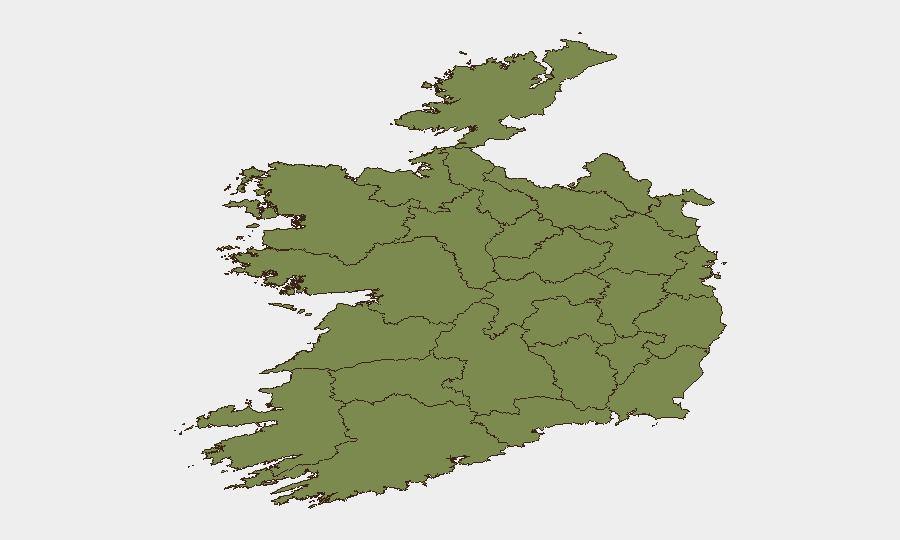
County Dublin dominates the sub-national risk profile (31.4), driven by aviation, financial, and diplomatic concentrations at the capital and its environs. County Tipperary (19.4) and County Laois (13.4) show elevated composite scores; context on those drivers (criminal activity, infrastructure, or second-order airline-related impacts) is not detailed in current signals. All other tracked counties fall below 10. For organizations with Dublin-based or Dublin-transiting staff and supply chains, the airline cluster presents the primary near-term concern; Tipperary and Laois risk drivers should be clarified via sector-specific queries.
How GeoBit Would Assist
Intel Sweep & OSINT Fusion would establish real-time identity, status, and location of the implicated airline(s), aircraft, and any Dublin-involved flight operations or diversions. AOI Monitoring & Early Warning on Dublin Airport, regional airfields, and major transport nodes would detect secondary disruptions (closures, congestion, security lockdowns) and flag them for duty-of-care teams within hours. Entity & Network Analysis would map the airline operator, regulatory bodies, and any external actors (state or non-state) linked to the abduction/hijacking signals, clarifying threat attribution and trajectory.
7-Day Outlook
If the airline incident involves an Irish-registered or Dublin-transiting flight, expect heightened Garda Síochána and transport-security activity, possible flight disruptions, and media-driven reputational/operational pressure on the carrier through mid-week. Absent escalation of hostage demands or additional aircraft incidents, baseline Irish security should stabilize; however, diplomatic tensions between the U.S. and the airline's home nation may persist and indirectly affect aviation or business confidence. Recommendation: confirm aircraft identity and current status within 4–6 hours; brief relevant personnel on potential travel delays and contingent routing.
Highest-Risk Areas — Ranked
| # | State / Region | Risk |
|---|---|---|
| 1 | County Dublin | 31.4 |
| 2 | County Tipperary | 19.4 |
| 3 | County Laois | 13.4 |
| 4 | County Galway | 8.2 |
| 5 | County Kildare | 5.9 |
| 6 | County Meath | 3.6 |
| 7 | County Mayo | 1.4 |
| 8 | County Sligo | 1.4 |
| 9 | County Clare | 1.4 |
| 10 | County Limerick | 1.4 |
| 11 | County Donegal | 1.4 |
| 12 | County Leitrim | 1.4 |
Sources
Previous Daily Briefs
A new Ireland brief is written every day — each with its own risk map and downloadable CSV. Here's the last week; use the calendar to go further back.
📅 Browse every day by calendar →
Highlighted days have a brief. Tap a day for that day's map & analysis, or “csv” for that day's dataset ($5).