Situation Summary
Jamaica's security environment remains moderate and geographically fragmented as of 29 July 2026, with violent crime concentrated in Kingston and select parishes rather than evidence of national destabilization. Open-source monitoring over the last 24–48 hours has detected no new, time-stamped incidents of acute conflict, civil unrest, or infrastructure disruption at the national level. A policing-division curfew remains in effect in St Andrew South (Kingston) through 29 July, but this reflects pre-existing localized gang and shooting activity rather than an emerging crisis. The overall trajectory is one of sustained, endemic crime volatility in high-risk zones rather than escalation.
Key Developments
- St Andrew South (Kingston) – Curfew in effect through 29 July 2026: A policing-division curfew restricts movement between 6 p.m. and 6 a.m. across a defined zone (Chisholm & Maxfield Ave, Marcus Garvey Dr, Duhaney River, Kingston Harbour, Happy Grove), requiring official permission for transit. This measure reflects ongoing gang and shooting incidents in the parish.
- No new, verifiable incidents recorded in the last 24–48 hours: Open-source intelligence feeds, news aggregators, and specialist monitoring show no freshly time-stamped security events, arrests, unrest, or crime spikes in Jamaica between 27–29 July (as of morning UTC 29 July 2026).
- Recent context (preceding 24–48 hours, for situational awareness): Between 21–27 July, Jamaica recorded multiple fatal shootings across Manchester, Clarendon, and Kingston, police raids in St Ann yielding 18 arrests on narcotics and serious-crime charges, and a fire of unknown origin at Jamaica Defence Force Up Park Camp (25 July). These incidents underpin the current curfew and elevated divisional vigilance but do not constitute new developments within your reporting window.
Highest-Risk Areas
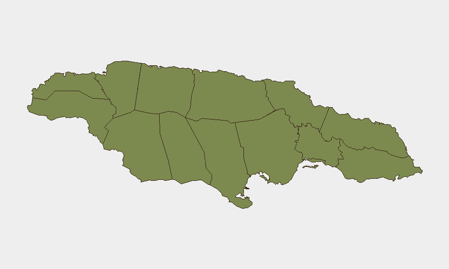
Saint Andrew (composite risk 31.3) dominates Jamaica's sub-national threat profile, driven by gang violence, drug trafficking, and shootings concentrated in western Kingston's urban corridors (Chisholm, Marcus Garvey, Maxfield). Trelawny (7.3) ranks second, reflecting localized gang activity and inter-gang disputes, though significantly below Saint Andrew's risk level. The remaining ten parishes cluster at risk scores of 1.3, indicating that violent crime and organized gang activity are highly concentrated in Kingston and Trelawny rather than distributed across the island. Corporate and duty-of-care teams should treat Saint Andrew—particularly west Kingston—as the primary zone of vigilance; travel, logistics, and staff movements in other parishes carry substantially lower threat profiles.
How GeoBit Would Assist
A security team protecting people or assets in Jamaica would deploy AOI Monitoring & Early Warning on high-risk Kingston and Trelawny neighborhoods to receive real-time alerting when fresh incidents (shootings, arrests, unrest) are detected in designated areas. Multi-language OSINT sweep and social-media intelligence (X/Twitter, Telegram, local news feeds) would provide continuous, low-latency detection of emerging threats, curfew extensions, or police operations that could disrupt business continuity or staff movement. Routing & Network Analysis would enable security teams to plan alternative journeys and safe corridors around active curfew zones and high-crime corridors, reducing exposure to localized violence.
7-Day Outlook
Jamaica's security trajectory over the next 7 days is expected to remain stable at the national level, with persistent gang violence and police enforcement localized to Kingston and Trelawny. The St Andrew South curfew may be extended or lifted depending on police assessment; monitoring official Jamaica Constabulary Force statements and divisional announcements is critical for duty-of-care planning. No indicators of island-wide unrest, political instability, or infrastructure collapse are evident in current open-source intelligence.
Highest-Risk Areas — Ranked
| # | State / Region | Risk |
|---|---|---|
| 1 | Saint Andrew | 31.3 |
| 2 | Trelawny | 7.3 |
| 3 | Hanover | 1.3 |
| 4 | Westmoreland | 1.3 |
| 5 | Saint James | 1.3 |
| 6 | Saint Elizabeth | 1.3 |
| 7 | Manchester | 1.3 |
| 8 | Saint Ann | 1.3 |
| 9 | Clarendon | 1.3 |
| 10 | Saint Catherine | 1.3 |
| 11 | Saint Mary | 1.3 |
| 12 | Portland | 1.3 |
Sources
Previous Daily Briefs
A new Jamaica brief is written every day — each with its own risk map and downloadable CSV. Here's the last week; use the calendar to go further back.
📅 Browse every day by calendar →
Highlighted days have a brief. Tap a day for that day's map & analysis, or “csv” for that day's dataset ($5).
Atlas — our AI intelligence desk — emails them this snapshot personally. Nothing else, no list.