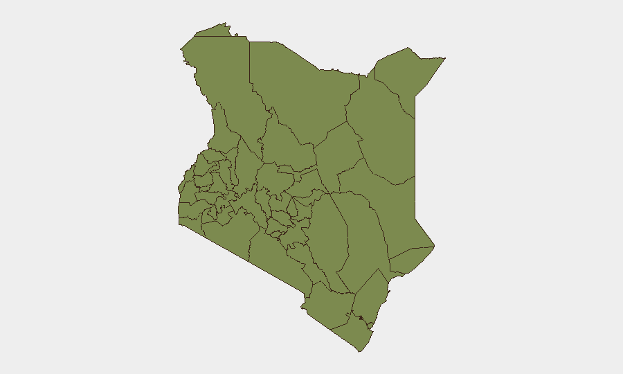
Situation Summary
Kenya remains a moderate-threat environment (rank #116 globally, composite score 14) with 347 tracked events, but sub-national risk is sharply concentrated in pastoral and peri-urban zones. The past 48 hours have been marked by a high-profile executive-judicial clash over a U.S.-backed biosecurity facility, renewed youth-mobilization planning in the capital region, and a significant escalation in official rhetoric framing civil protest as a security threat. Current trajectory indicates sustained tension between civil-society activism and security-sector assertiveness, with particular flashpoints in Nairobi County, Laikipia, and Kajiado.
Key Developments
- Nanyuki / Laikipia Air Base (Laikipia County) – 24 June (Tuesday): Health Minister Aden Duale announced in High Court that construction on the U.S.-backed Ebola quarantine facility has been halted per court order, following a contempt finding issued 23 June. Prior violent clashes between protesters and security forces near the base have resulted in reported fatalities.
- Nairobi County – 23 June (Monday–Tuesday): Security meeting held in Kitengela (Kajiado County boundary area) involving local authorities and security organs ahead of a planned "Gen Z commemoration" event, signaling official concern over youth-led gatherings and pre-emptive crowd-management coordination.
- National (Parliamentary) – recent session (date circulated 23 June): Parliament approved establishment of a National Cybersecurity Agency (NCSA) under presidential order, indicating heightened institutional concern over digital-infrastructure vulnerability and cyber-threat penetration of government and financial networks.
- National (Government Statement) – recent circulation (23 June): Deputy President Rigathi Gachagua publicly warned against public demonstrations, characterizing them as infiltration vectors for criminal elements, while citing a doubling of security-sector budget allocation (KSh 318 bn → KSh 567 bn).
- Laikipia County (High Court ruling) – 23 June (Monday): Health Minister found in contempt for prior failure to suspend construction at Laikipia Air Base, reflecting institutional friction between executive and judiciary and signaling continued legal and political contestation over the facility.
Highest-Risk Areas
Samburu (31.5), Nakuru (29.3), and Nairobi County (25.0) account for the largest composite risk scores. Samburu and Nakuru reflect ongoing pastoral-zone insecurity (livestock raids, inter-communal conflict, and Al-Shabaab activity). Nairobi County's elevation is driven by civil-unrest risk, criminal activity in informal settlements, and now active youth-mobilization planning. Laikipia, while not independently ranked in the top tier, has emerged as a localized flashpoint due to the Ebola facility dispute, with documented violent protest-police clashes and fatality reports in the past week.
How GeoBit Would Assist
Security teams should deploy Area-of-Interest Monitoring & Early Warning on Nanyuki/Laikipia Air Base, Kitengela, and central Nairobi to detect renewed protest mobilization or security-force movement. Network & Actor Analysis and X/Twitter & Telegram OSINT will track Gen Z coordination channels, youth-group messaging, and civil-society planning around the commemorative event. Risk & Threat Assessment and Sentiment Analysis of parliamentary and government rhetoric will provide early signals of escalating executive security posture and potential policy shifts affecting corporate assets or personnel.
7-Day Outlook
Immediate risk elevation is likely if construction resumes at Laikipia Air Base or if the Gen Z commemoration event in Kitengela/Nairobi materializes with significant turnout. Official messaging framing protest as a security threat, combined with near-doubled security budgets, suggests potential for more assertive crowd management. Watch for parliamentary or executive moves to restrict assembly or expand security-sector authority.
Highest-Risk Areas — Ranked
| # | State / Region | Risk |
|---|---|---|
| 1 | Samburu | 31.5 |
| 2 | Nakuru | 29.3 |
| 3 | Nairobi County | 25 |
| 4 | Migori County | 22.9 |
| 5 | Uasin Gishu County | 10 |
| 6 | Homa Bay County | 5.8 |
| 7 | Busia County | 3.6 |
| 8 | Machakos County | 3.6 |
| 9 | Kajiado County | 3.6 |
| 10 | Kakamega County | 1.5 |
| 11 | Vihiga County | 1.5 |
| 12 | Nandi County | 1.5 |
Sources
Previous Daily Briefs
A new Kenya brief is written every day — each with its own risk map and downloadable CSV. Here's the last week; use the calendar to go further back.
📅 Browse every day by calendar →
Highlighted days have a brief. Tap a day for that day's map & analysis, or “csv” for that day's dataset ($5).