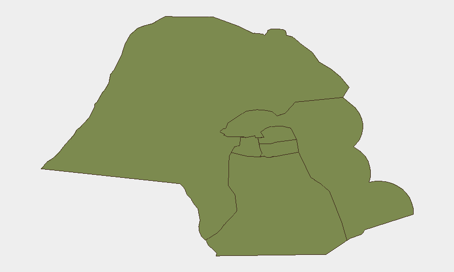
Situation Summary
Kuwait is experiencing an active military escalation with Iran, marked by repeated drone and ballistic missile strikes since 21 July. Air-defense systems have successfully intercepted the majority of incoming threats, but critical infrastructure—including a major power and desalination plant—has sustained damage, triggering localized power outages and civilian conservation advisories. The threat trajectory remains elevated with no ceasefire indicators; diplomatic support from Saudi Arabia has been publicly reinforced as of 23 July.
Key Developments
- Kuwait City & nationwide airspace, 23 July 2026: Kuwaiti Armed Forces intercepted hostile Iranian drones and ballistic missiles entering airspace from dawn; explosions reported across multiple districts attributed to air-defense fire rather than impacts. No civilian casualties confirmed, though material damage documented.[5][6]
- Kuwaiti Army camps (unspecified locations), 23 July 2026: Ministry of Defense confirmed Iranian drones targeted multiple Army facilities, wounding several Land Forces personnel on duty. All injured personnel treated and reported in stable condition.[6][2]
- Power generation and desalination facility, 23 July 2026: A vital electricity and water-production plant was struck by Iranian missiles/drones, igniting fires and disabling generation units. Ministry of Electricity, Water and Renewable Energy shut units as precaution and issued public conservation directives.[5][6]
- Multiple civilian districts, 23 July 2026: Power outages reported across several areas following infrastructure strike; repair and damage-assessment operations ongoing.[1][6]
- Kuwait International Airport, 23 July 2026: Takeoff and landing operations temporarily suspended due to active missile/drone activity and air-defense activation. Flight rescheduling implemented; gradual normalization expected as interception activity subsides.[5]
- Civil-defense sirens, nationwide, 23 July 2026: Country-wide warning system activated for the fourth time in current escalation. Social-media reports documented repeated overnight and morning siren activations.[5][6]
- Saudi–Kuwaiti diplomatic engagement, 23 July 2026: Saudi Crown Prince Mohammed bin Salman called Kuwait's Emir to condemn Iranian attacks and reaffirm full Saudi support. Statement widely circulated by regional media as signal of allied solidarity.[9][6]
Highest-Risk Areas
Jahra Governorate (composite risk 31.4) significantly outranks all other regions and represents the primary threat concentration in Kuwait; Capital Governorate (25.4) is secondary but remains substantially elevated. Both areas' heightened risk likely reflects proximity to military installations, critical infrastructure, and air-defense activity zones. Remaining governorates (Ahmadi, Farwaniya, Hawalli, Mubarak al-Kabir) show uniform low risk (1.4 each), suggesting threat concentration in the northern and central zones.
How GeoBit Would Assist
Corporate security teams should leverage Area-of-Interest (AOI) Monitoring & Early Warning to establish persistent watch on Jahra and Capital Governorates and critical-infrastructure sites, with automated alerting on hostile air activity and weapons deployment. Conflict & Military capabilities—including battle-mapping, force-structure tracking, and weapons-capability analysis—enable real-time assessment of Iranian capabilities and Kuwaiti air-defense effectiveness to inform risk-mitigation decisions. Alternative Route & Journey Planning and Maritime & Aviation Tracking support duty-of-care compliance by identifying safe transit corridors and providing live operational-status updates for airports and border crossings.
7-Day Outlook
Iran's pattern of multi-day strike sequences suggests additional barrages within the next 48–72 hours are plausible absent diplomatic intervention. Critical-infrastructure vulnerability (power, desalination, airports) remains the highest civilian-impact risk; full restoration may require 5–10 days depending on strike severity. Escalation or de-escalation signals should emerge by 26–27 July from regional diplomatic channels or changes in strike tempo.
Highest-Risk Areas — Ranked
| # | State / Region | Risk |
|---|---|---|
| 1 | Jahra Governorate | 31.4 |
| 2 | Capital Governorate | 25.4 |
| 3 | Ahmadi Governorate | 1.4 |
| 4 | Farwaniya Governorate | 1.4 |
| 5 | Hawalli Governorate | 1.4 |
| 6 | Mubarak al-Kabir Governorate | 1.4 |
Sources
Previous Daily Briefs
A new Kuwait brief is written every day — each with its own risk map and downloadable CSV. Here's the last week; use the calendar to go further back.
📅 Browse every day by calendar →
Highlighted days have a brief. Tap a day for that day's map & analysis, or “csv” for that day's dataset ($5).
Atlas — our AI intelligence desk — emails them this snapshot personally. Nothing else, no list.