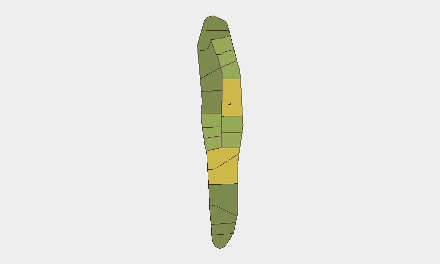
Situation Summary
Maldives remains a low-threat environment at the national level (composite threat score 3; no tracked conflict or terrorism events), but localized crime and public-safety incidents continue in the capital and population centers. The past 48 hours saw three separate incidents—an inter-group assault, a hit-and-run speedboat collision, and an immigration enforcement operation—each confined to Malé or its immediate periphery and consistent with baseline urban crime patterns. The security trajectory is stable; no signals of organized instability, political unrest, or emerging conflict actors have been detected.
Key Developments
- Vilimale' (Kandholhumaa Goalhi), 2026-07-17, ~15:12 – Four men sustained injuries in a clash between two groups; police responded but no arrests or escalation reported.
- Izzuddin Jetty, Malé, 2026-07-17 – A speedboat collision injured five people; two hospitalized as of 2026-07-18. A second vessel fled the scene; investigation ongoing. No political or trafficking nexus identified in initial reporting.
- Thilafushi, 2026-07-12 – Immigration authorities conducted a large-scale raid on undocumented foreign workers, questioning 836 expatriates and detaining 32 individuals (primarily nationals of India, Bangladesh, and Nepal) on visa, work-permit, and suspected illegal business violations. This reflects routine enforcement rather than crisis response.
- Malé (Maafannu district), 2026-07-18 – Prosecutors charged five suspects in connection with a March 2026 residential theft valued at approximately MVR 4 million; case update underway in the courts.
Highest-Risk Areas
Malé and Malé Atoll dominate the risk profile (scores 85 and 68 respectively), driven by high population density, transient labor populations, petty and organized crime, and law-enforcement activity. The broader northern atoll chain (Hadhdhunmathi, Kolhumadulu, Felidhu) also registers elevated composite risk scores (65–58), reflecting similar urban-crime and migration pressures. Southern and outer atolls show progressively lower risk (40–42). Risk concentration in Malé reflects both genuine crime incidence and the visibility of policing and reporting infrastructure in the capital; outer islands experience less documented but potentially under-reported crime.
How GeoBit Would Assist
Corporate security teams with personnel or assets in Maldives would employ AOI Monitoring & Early Warning with persistent watch on Malé and the northern atolls to detect emerging crime clusters or labor-unrest signals; OSINT Fusion (X, Telegram, local news feeds) to corroborate incident reports and assess community sentiment in real time; and Routing & Network Analysis to identify safe transit corridors and alternative journey planning around known crime hotspots or incidents. Combined with Risk & Threat Assessment dashboards, these capabilities enable rapid duty-of-care decision-making when staff movements are planned.
7-Day Outlook
No indicators suggest a shift toward organized violence, political instability, or terrorism in the near term. Petty and organized crime will likely persist at current baseline levels in Malé and surrounding atolls; immigration enforcement operations may continue sporadically. The July monsoon season may increase maritime-incident frequency (collisions, capsizing) but does not typically drive security escalation. Recommended posture: maintain standard urban-crime awareness in Malé; no heightened alert warranted across the archipelago.
Highest-Risk Areas — Ranked
| # | State / Region | Risk |
|---|---|---|
| 1 | Malé | 85 |
| 2 | Malé Atoll | 68 |
| 3 | Hadhdhunmathi | 65 |
| 4 | Kolhumadulu | 60 |
| 5 | Felidhu Atoll | 58 |
| 6 | Mulaku Atoll | 55 |
| 7 | Faadhippolhu | 52 |
| 8 | South Miladhunmadulu | 48 |
| 9 | North Miladhunmadulu | 45 |
| 10 | South Nilandhe Atoll | 44 |
| 11 | North Nilandhe Atoll | 42 |
| 12 | South Ari Atoll | 40 |
Sources
Previous Daily Briefs
A new Maldives brief is written every day — each with its own risk map and downloadable CSV. Here's the last week; use the calendar to go further back.
📅 Browse every day by calendar →
Highlighted days have a brief. Tap a day for that day's map & analysis, or “csv” for that day's dataset ($5).
Atlas — our AI intelligence desk — emails them this snapshot personally. Nothing else, no list.