Situation Summary
Mali's security environment has deteriorated sharply into a multi-front conflict involving Al-Qaeda-linked JNIM, Islamic State affiliates, and Tuareg separatists, with the capital Bamako now under declared siege. Military ruler Assimi Goïta's junta has responded with intensified operations and checkpoint reinforcement, backed by Russian Africa Corps units, but state control is fragmenting across northern and central regions. The strategic vulnerabilities exposed in late-April coordinated attacks—which killed the Defence Minister—remain unresolved, and foreign governments are now advising evacuation. Mali's trajectory points toward sustained high-intensity conflict with expanding geographic fragmentation.
Key Developments
- Bamako siege declaration (2026-06-04): JNIM has declared all access routes to the capital "blocked" and threatened lethal force against anyone attempting entry, forcing the junta to announce search-and-clear operations and tighten checkpoint controls across the Bamako perimeter and Koulikoro corridor.
- Kidal region collapse (recent): The Front for the Liberation of Azawad (MNLA/FLA) now controls Kidal city, Tessalit, and Amchach after expelling Malian and Russian forces; remaining government units are withdrawing, leaving significant military hardware in separatist hands.
- ISGS entrenchment in Ménaka (northeast): Islamic State in the Greater Sahara has moved into Ménaka region, established checkpoints, and is attempting to seize the regional capital, forcing Mali's armed forces into a two-front posture and elevating threat levels on eastern routes toward Niger.
- Supply-route disruption (ongoing): JNIM raids on fuel convoys and logistics across central and northern Mali have created sustained shortages and economic strain, raising risk for commercial and humanitarian movements on inter-regional corridors.
- Foreign evacuation orders (current): France's Foreign Ministry has directed nationals to leave Mali immediately, citing "extremely volatile" conditions and heightened terrorist, armed-clash, and road-safety risks; similar advisories expected from other states.
- April attack aftermath (strategic impact): The 25–26 April coordinated assaults across the Kidal–Kati axis killed Defence Minister Sadio Camara and gravely wounded the intelligence chief, exposing command-and-control vulnerabilities that remain unresolved.
Highest-Risk Areas
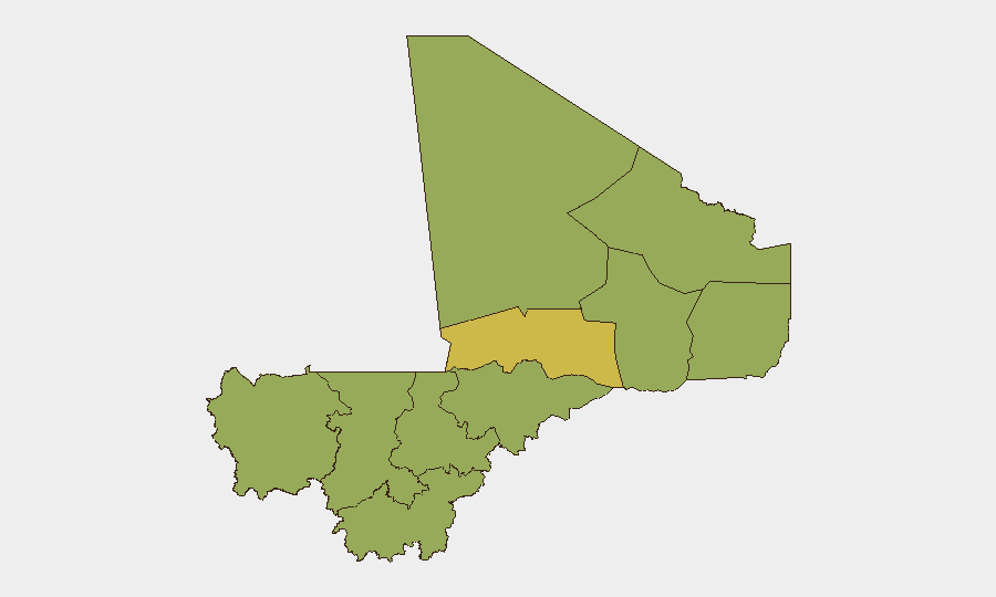
Bamako's composite score of 83.6 reflects its status as the conflict epicenter—the seat of state power, target of the JNIM siege, and focus of junta security operations. Timbuktu (68.6) sits at the western edge of JNIM-controlled territory and remains exposed to supply-line attacks and militant incursions. The nine regions ranked 53.6 (Ménaka, Kayes, Taoudénit, Kidal, Gao, Koulikoro, Ségou, Sikasso, Mopti) collectively indicate nationwide fragmentation: ISGS and separatists control or contest the north and east; JNIM operates across the center; and the Koulikoro–Bamako corridor faces sustained pressure. Risk is no longer concentrated—it is distributed across the country's administrative geography, with no region exempt.
How GeoBit Would Assist
Security teams should deploy AOI Monitoring & Early Warning on Bamako, Koulikoro, Ménaka, and Kidal to track militant movements, checkpoint activity, and siege indicators in near-real time. Routing & Network Analysis and conflict mapping capabilities enable alternative journey planning and situational awareness on road conditions, blockades, and safe corridors for personnel and supply movements. Multi-language OSINT, entity extraction, and network analysis on JNIM, ISGS, and FLA communications and propaganda feeds provide 24–48-hour early warning of attacks and route disruptions before they affect operations on the ground.
7-Day Outlook
JNIM's siege posture around Bamako will likely persist, with sporadic attacks on checkpoints and patrols designed to pressure the junta and disrupt logistics. ISGS consolidation in Ménaka and FLA control of Kidal suggest further territorial fragmentation and reduced state capacity to project power into contested zones. All inter-city travel and commercial operations should be reassessed against heightened ambush, IED, and checkpoint-interdiction risk across central and northern corridors through at least mid-June.
Highest-Risk Areas — Ranked
| # | State / Region | Risk |
|---|---|---|
| 1 | Bamako | 83.6 |
| 2 | Timbuktu | 68.6 |
| 3 | Ménaka | 53.6 |
| 4 | Kayes | 53.6 |
| 5 | Taoudénit Region | 53.6 |
| 6 | Kidal | 53.6 |
| 7 | Gao | 53.6 |
| 8 | Koulikoro | 53.6 |
| 9 | Ségou Region | 53.6 |
| 10 | Sikasso Region | 53.6 |
| 11 | Mopti | 53.6 |
Previous Daily Briefs
A new Mali brief is written every day — each with its own risk map and downloadable CSV. Here's the last week; use the calendar to go further back.
📅 Browse every day by calendar →
Highlighted days have a brief. Tap a day for that day's map & analysis, or “csv” for that day's dataset ($5).