Situation Summary
Mauritius maintains a stable security environment with no credible reports of acute incidents, civil unrest, terrorism, or major crime affecting residents or visitors in the last 24–48 hours. The composite threat score of 14 places the country in the lower-risk band globally, and UK Foreign Office travel guidance remains current with no new alerts. Structural security upgrades—including digital border controls and a planned National Crime Agency—are underway but represent policy evolution rather than response to emergent crises.
Key Developments
- Port Louis (capital) – 19 June 2026 – UK FCDO travel advisory remained current with no new terrorism, civil unrest, or major-crime alerts reported, confirming stable conditions in the highest-risk district.
- Sir Seewoosagur Ramgoolam International Airport (Grand Port) – 18–19 June 2026 – Government budget documents confirmed normal airport operations and announced planned digital border-control upgrades (biometric e-gates, e-visa system) for 2026–2027; no security incidents or disruptions reported.
- Maritime approaches, nationwide – 18–19 June 2026 – No new piracy, armed robbery at sea, or maritime-security incidents detected in open-source regional maritime or travel-advisory reporting.
- Domestic political environment – 18–19 June 2026 – No verified reports of violent protest, political unrest, or destabilizing political action; governance assessments continue to characterize the country as a stable democracy.
- Urban crime hotspots (Port Louis, Grand Baie, Flic-en-Flac) – 18–19 June 2026 – Routine petty crime persists but no credible multi-source indication of violent-crime spikes, targeted attacks on foreign nationals, or organized criminal incidents during the period.
Highest-Risk Areas
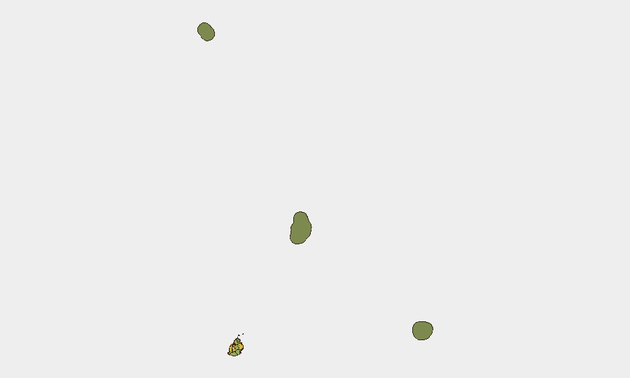
Port Louis (risk 92) dominates the sub-national profile, reflecting the capital's concentration of commercial, administrative, and social activity alongside routine street crime and petty theft targeting urban populations and visitors. Plaines Wilhems (68) and Black River (65) follow, likely driven by economic inequality, informal settlements, and geographic isolation that complicate law-enforcement reach. The remaining districts (Flacq, Grand Port, Moka, Savanne, Pamplemousses) exhibit moderate baseline risk typical of mixed urban–rural jurisdictions. Remote island territories (Rodrigues, Saint Brandon, Agaléga) carry minimal scores consistent with sparse population and limited incident reporting infrastructure.
How GeoBit Would Assist
Security teams operating in Mauritius would benefit from AOI Monitoring & Early Warning on Port Louis, airport, and maritime approaches to detect any sudden escalation in crime, unrest, or cross-border activity; Intel Sweep and OSINT fusion to corroborate rumors of political instability or emerging criminal networks across open-source, social media, and local reporting; and Maritime & Aviation tracking to monitor vessel and flight patterns around the island, particularly for anomalous activity indicating piracy, smuggling, or irregular migration. Routing & Network Analysis supports duty-of-care teams in identifying safer transit corridors within high-risk districts.
7-Day Outlook
No indicators suggest imminent deterioration in Mauritius' security posture over the next seven days. Planned structural security reforms (border modernization, law-enforcement capacity-building) will unfold without urgency, and routine baseline crime is expected to remain stable. Monitor Port Louis and maritime zones for any shift in incident frequency; absent credible alerts, the current low-risk classification is expected to persist.
Highest-Risk Areas — Ranked
| # | State / Region | Risk |
|---|---|---|
| 1 | Port Louis | 92 |
| 2 | Plaines Wilhems | 68 |
| 3 | Black River | 65 |
| 4 | Flacq | 62 |
| 5 | Grand Port | 58 |
| 6 | Moka | 52 |
| 7 | Savanne | 48 |
| 8 | Pamplemousses | 45 |
| 9 | Rivière du Rempart District | 38 |
| 10 | Rodrigues | 22 |
| 11 | Saint Brandon | 8 |
| 12 | Agaléga | 5 |
Sources
Previous Daily Briefs
A new Mauritius brief is written every day — each with its own risk map and downloadable CSV. Here's the last week; use the calendar to go further back.
📅 Browse every day by calendar →
Highlighted days have a brief. Tap a day for that day's map & analysis, or “csv” for that day's dataset ($5).