Situation Summary
Namibia remains a low-threat environment with no major security incidents documented in the last 24–48 hours. The nation's composite threat score of 5 places it outside global rankings and reflects a stable baseline. However, multiple political-institutional events flagged on 2026-07-21—including parliamentary investigations, judicial disapproval of government action, and public statements spanning parliament, judiciary, and civil society—signal emerging institutional tension that warrants monitoring for downstream civil-unrest or governance-capacity risks.
Key Developments
- Nationwide — Political-institutional tension, 2026-07-21: Parliament launched an investigation into government actions; a judge issued formal disapproval of government conduct; and government, judiciary, and public actors issued multiple public statements on the same date. This concentration of institutional discord on a single day indicates a potential governance friction point, though no specific triggering incident or service-disruption has been verified.
- Nationwide — Wildfire event, recent: A wildfire affecting Namibia and Botswana (event ID 1029477) has been recorded; extent, location specificity, and impact to populated areas or infrastructure remain unconfirmed in available reporting.
- Nationwide — No acute crime or civil unrest, last 48 hours: Open-source daily threat briefs confirm Namibia recorded no major security incidents, civil unrest, infrastructure disruption, or conflict activity in the 2026-07-16 to 2026-07-19 window; today's political signals do not yet show mass mobilization or street-level escalation.
Highest-Risk Areas
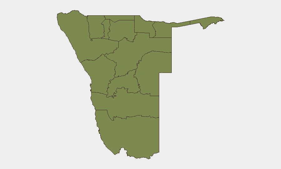
Khomas Region (composite risk 31.3), which includes the capital Windhoek, dominates the national risk profile—a concentration typical of capital-region political, administrative, and economic activity and the location where today's parliamentary and judicial events are centered. Oshikoto Region (risk 13.3) and Erongo Region (risk 7.3) show elevated but significantly lower risk. Remaining regions cluster at risk 1.3, indicating dispersed, low-level baseline threat. The stark contrast between Khomas and all other regions underscores the centrality of Windhoek-based governance developments to national security posture; escalation of current institutional tensions would most immediately affect the capital and surrounding Khomas footprint.
How GeoBit Would Assist
A security team with personnel or assets in Namibia should deploy AOI (Area-of-Interest) Monitoring & Early Warning on Khomas Region, particularly Windhoek, to detect escalation from institutional tension to public mobilization or service disruption. Concurrent Intel Sweep (X/Twitter, Telegram OSINT, multi-language search, sentiment analysis) will track parliamentary, judicial, and civil-society rhetoric to identify trigger points for expanded unrest. Election Monitoring and Regime Stability search modules can contextualize whether current institutional friction reflects normal governance friction or signals deeper state-capacity or legitimacy erosion.
7-Day Outlook
The institutional events of 2026-07-21 do not yet constitute an acute security emergency but represent a flagged tension requiring daily monitoring. Absent major escalation (mass protest, service disruption, or security-force mobilization) in the next 48–72 hours, risk is expected to remain within current baseline. However, duty-of-care teams should prepare contingency communication and routing protocols should Khomas Region instability accelerate; alternative-route planning via Routing & Network Analysis may become operationally relevant if capital-region movement constraints emerge.
Highest-Risk Areas — Ranked
| # | State / Region | Risk |
|---|---|---|
| 1 | Khomas | 31.3 |
| 2 | Oshikoto | 13.3 |
| 3 | Erongo Region | 7.3 |
| 4 | Kunene Region | 1.3 |
| 5 | Omusati | 1.3 |
| 6 | Ohangwena | 1.3 |
| 7 | Oshana | 1.3 |
| 8 | Kavango West | 1.3 |
| 9 | Otjozondjupa | 1.3 |
| 10 | Omaheke | 1.3 |
| 11 | Kavango East | 1.3 |
| 12 | Zambezi | 1.3 |
Sources
Previous Daily Briefs
A new Namibia brief is written every day — each with its own risk map and downloadable CSV. Here's the last week; use the calendar to go further back.
📅 Browse every day by calendar →
Highlighted days have a brief. Tap a day for that day's map & analysis, or “csv” for that day's dataset ($5).
Atlas — our AI intelligence desk — emails them this snapshot personally. Nothing else, no list.