Situation Summary
Netherlands remains a low-threat environment globally (rank #160, composite score 4), but elevated activity in Flevoland and North Holland over the past 48 hours warrants monitoring. Recent signals include small-arms activity, property seizures, firearms enforcement, and police/military coordination statements, alongside scattered public dissent. Overall trajectory remains stable, but localized flashpoints—particularly around Amsterdam explosions and enforcement actions—require targeted vigilance.
Key Developments
- Driebergen (Utrecht region) — 14 Jul 2026: Police conducted enforcement action resulting in seizure of 20 firearms and arrest of two suspects; indicates active weapons interdiction.
- Amsterdam, Nieuw-West (Jacob van Maerlantstraat) — 14 Jul 2026: Authorities expanded camera surveillance following a series of recent explosions in the district, signaling concern over recurring localized violence.
- Amsterdam — 11 Jul 2026: Dutch police opened investigation into explosion outside a pro-Israel Christian center; part of broader pattern of incidents in the capital.
- Flevoland — 15 Jul 2026: Property seizure/damage incident reported; aligns with Flevoland's current elevated risk ranking.
- National level — 14–15 Jul 2026: Multiple public statements from police, ministry, and military officials; Council of State rejection on unspecified matter suggests administrative or policy friction.
Highest-Risk Areas
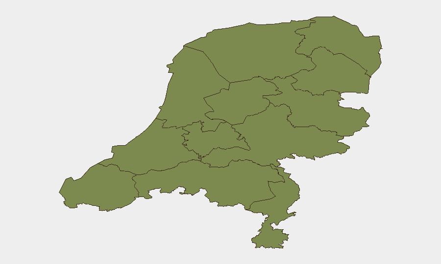
Flevoland (31.5) is an outlier, driven by a single or concentrated set of recent incidents; the risk score warrants clarification on underlying drivers—whether industrial, migration-related, or criminal. North Holland (13.4), home to Amsterdam, reflects the capital's explosions and ongoing enforcement operations. Together, these two provinces account for the bulk of Netherlands' tracked threat activity. All other regions score below 2.5, indicating either genuinely lower incident density or lower signal penetration. Amsterdam's recent bombings and police camera expansion suggest that property-crime and explosive-device risks are the primary concern within the highest-risk zones.
How GeoBit Would Assist
Corporate security teams should deploy AOI Monitoring & Early Warning on Amsterdam (particularly Nieuw-West) and Flevoland to trigger alerts on repeated incident patterns. Intel Sweep and OSINT Fusion (X/Twitter, Telegram, local news) will provide real-time visibility on protest statements and police/military coordination that precedes enforcement action. Risk & Threat Assessment can isolate whether Flevoland's spike reflects a temporary event or structural instability, informing duty-of-care decisions for personnel in that region.
7-Day Outlook
No imminent escalation is forecast; Netherlands remains a stable operating environment. However, the clustering of explosions in Amsterdam and elevated enforcement activity suggest 7–14 day watch for secondary incidents or copycat activity in the same districts. Flevoland's risk trajectory should be re-assessed within 48–72 hours once causation is clarified; if driven by transient events, risk will normalize; if structural, it may persist.
Highest-Risk Areas — Ranked
| # | State / Region | Risk |
|---|---|---|
| 1 | Flevoland | 31.5 |
| 2 | North Holland | 13.4 |
| 3 | South Holland | 2.7 |
| 4 | Groningen | 2.3 |
| 5 | Zeeland | 1.5 |
| 6 | Utrecht | 1.5 |
| 7 | North Brabant | 1.5 |
| 8 | Frisia | 1.5 |
| 9 | Drenthe | 1.5 |
| 10 | Gelderland | 1.5 |
| 11 | Overijssel | 1.5 |
| 12 | Limburg | 1.5 |
Previous Daily Briefs
A new Netherlands brief is written every day — each with its own risk map and downloadable CSV. Here's the last week; use the calendar to go further back.
📅 Browse every day by calendar →
Highlighted days have a brief. Tap a day for that day's map & analysis, or “csv” for that day's dataset ($5).
Atlas — our AI intelligence desk — emails them this snapshot personally. Nothing else, no list.