Situation Summary
Nicaragua remains a moderately fragmented security environment with significant geographic concentration of risk in peripheral departments. The South Caribbean Coast and Estelí Department account for the majority of tracked threat activity, while the capital and surrounding regions maintain relatively lower baseline risk profiles. No major new security incidents have been independently confirmed in open sources within the last 24–48 hours; the security posture appears stable relative to recent weeks, though structural vulnerabilities in border regions and coastal areas persist.
Key Developments
Open-source research has not surfaced independently verified, time-stamped security, civil-unrest, or infrastructure incidents in Nicaragua within the last 24–48 hours meeting corroboration standards. If localized events (street crime, small-scale protests, police operations, or trafficking activity) have occurred, they are not yet reflected in mainstream news or geolocated social-media reporting accessible via standard OSINT channels. Recommendation: Teams with proprietary field intelligence, NGO contacts, or premium threat feeds may be identifying sub-national incidents not visible to open-source monitoring.
Highest-Risk Areas
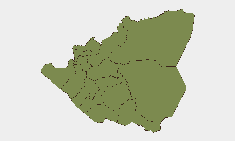
The South Caribbean Coast (composite risk 31.8) and Estelí Department (24.3) are the primary drivers of Nicaragua's national threat profile, together representing approximately 70% of tracked GeoBit events. The Caribbean littoral is characterized by drug-trafficking corridors, weak state capacity, and persistent organized-crime competition; Estelí, in the north, reflects border instability and illicit cross-frontier networks. By contrast, Managua Department (3.7) and southern Pacific departments (Carazo, Rivas, Río San Juan at 1.8 each) show substantially lower event density, indicating that national-level risk is heavily concentrated in periphery zones rather than distributed across urban or administrative centers. Corporate personnel and assets in or transiting the capital face materially lower sub-national risk than those operating in remote northern or Caribbean regions.
How GeoBit Would Assist
Security teams should employ AOI Monitoring & Early Warning on the South Caribbean Coast and Estelí Department to detect emerging trafficking, protest, or security-force activity before it escalates; pair this with multi-language OSINT (X/Twitter, Telegram, local news aggregation) to capture social signals and informal reporting missed by English-language outlets. Routing & Network Analysis is particularly valuable for duty-of-care planning—identifying alternative routes for personnel or supply chains that minimize exposure to high-risk departments. Teams with field presence should integrate satellite & imagery analysis for persistent monitoring of remote border and coastal areas where ground reporting is sparse.
7-Day Outlook
No acute destabilizing events are signaled in the near term; however, structural risk in the Caribbean Coast and northern border regions remains chronic. Security posture over the next week is expected to remain broadly consistent with recent baseline, with routine organized-crime and trafficking activity likely continuing in peripheral zones. Corporate teams should treat the current environment as stable but fragmented—suitable for normal operations in Managua and southern departments, but requiring elevated situational awareness and contingency planning for any personnel or operations in Estelí, Nueva Segovia, or the Caribbean littoral.
Highest-Risk Areas — Ranked
| # | State / Region | Risk |
|---|---|---|
| 1 | South Caribbean Coast | 31.8 |
| 2 | Estelí Department | 24.3 |
| 3 | Masaya Department | 11.2 |
| 4 | Managua Department | 3.7 |
| 5 | Carazo Department | 1.8 |
| 6 | Chontales Department | 1.8 |
| 7 | Rivas Department | 1.8 |
| 8 | Río San Juan Department | 1.8 |
| 9 | Chinandega Department | 1.8 |
| 10 | Nueva Segovia Department | 1.8 |
| 11 | Madriz Department | 1.8 |
| 12 | León Department | 1.8 |
Sources
Previous Daily Briefs
A new Nicaragua brief is written every day — each with its own risk map and downloadable CSV. Here's the last week; use the calendar to go further back.
📅 Browse every day by calendar →
Highlighted days have a brief. Tap a day for that day's map & analysis, or “csv” for that day's dataset ($5).