Situation Summary
Palau remains at very low aggregate threat (composite score 7; no tracked security events in the current window). No confirmed security incidents, civil unrest, infrastructure disruption, or travel-risk developments have been reported in the last 24–48 hours. The security environment is stable across most of the archipelago, though sub-national risk variation is significant, with Peleliu and Angaur substantially elevated relative to other states. Organizations with personnel or assets in-country face minimal imminent risk but should maintain baseline duty-of-care protocols, particularly in higher-risk jurisdictions.
Key Developments
No discrete security, conflict, crime, civil-unrest, or infrastructure incidents have been verified for Palau within the last 24–48 hours. Live web research yielded no confirmed disruptive events; available results reference scheduled multilateral military training exercises with Palauan Security Forces (routine, non-incident) and regional economic meetings (administrative, not security-related). The absence of reported incidents reflects the overall stability of the national security environment.
Highest-Risk Areas
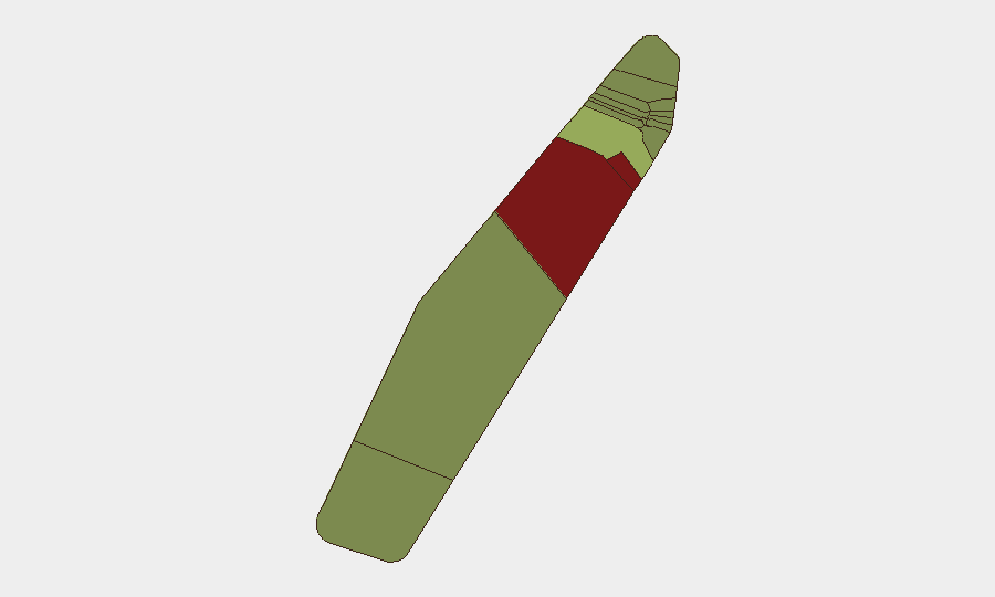
Peleliu (risk 92) and Angaur (risk 88) drive the sub-national risk profile and are substantially more elevated than the remainder of Palau. Both states warrant heightened monitoring and duty-of-care protocols if assets or personnel are present. Koror (risk 45) represents the third-highest risk area and is the commercial and administrative hub; risk drivers there likely reflect population density, port activity, and urban crime baseline rather than acute instability. The remaining nine states all score below 35 and reflect considerably lower operational risk. The specific drivers underlying Peleliu and Angaur's elevated scores should be confirmed through targeted local-authority and AOI monitoring.
How GeoBit Would Assist
Organizations with sustained presence or assets in Palau should deploy AOI Monitoring & Early Warning protocols focused on Peleliu, Angaur, and Koror to capture emerging incidents, civil activity, or infrastructure disruption in real time. OSINT & Intelligence Sweep capabilities—including X/Twitter, Telegram, local government feeds, and multi-language search—should be configured to monitor police advisories, port/airport notices, and verified local sources for travel restrictions, crime upticks, or political developments. Risk & Threat Assessment modules can be layered against specific corporate operations (e.g., tourism, maritime, extractive, or diplomatic activities) to refine exposure and inform contingency planning.
7-Day Outlook
No acute security deterioration is forecast for the next seven days. The stability observed in the current 24–48-hour window is likely to persist absent new triggering events or external shocks. Routine monitoring of higher-risk states and maintenance of standard duty-of-care protocols remain appropriate for organizations with ongoing operations in the archipelago.
Highest-Risk Areas — Ranked
| # | State / Region | Risk |
|---|---|---|
| 1 | Peleliu | 92 |
| 2 | Angaur | 88 |
| 3 | Koror | 45 |
| 4 | Melekeok | 35 |
| 5 | Airai | 32 |
| 6 | Ngatpang | 28 |
| 7 | Ngeremlengui | 26 |
| 8 | Ngaraard | 25 |
| 9 | Ngardmau | 24 |
| 10 | Aimeliik | 23 |
| 11 | Ngiwal | 22 |
| 12 | Ngchesar | 21 |
Previous Daily Briefs
A new Palau brief is written every day — each with its own risk map and downloadable CSV. Here's the last week; use the calendar to go further back.
📅 Browse every day by calendar →
Highlighted days have a brief. Tap a day for that day's map & analysis, or “csv” for that day's dataset ($5).