Situation Summary
Papua New Guinea remains a fragmented, high-risk operating environment dominated by localized criminal and communal violence rather than coordinated national insurgency. The National Capital District (Port Moresby) accounts for the majority of tracked threat incidents, reflecting persistent gang activity, armed robbery, and infrastructure vulnerability. Seismic activity across multiple provinces and a confirmed polio circulation event add non-security hazards to the risk picture. The overall threat trajectory remains elevated but stable within historical norms for the country.
Key Developments
Open-source reporting for the past 24–48 hours is sparse and lacks the specificity required for incident-level attribution. Three parliamentary statements were issued on 2026-06-12, likely relating to domestic governance or resource matters, but detailed public disclosure is unavailable. Multiple seismic events (M 4.2–4.5) were recorded near Goroka, Kokopo, and Lae in the recent period, with no immediate reports of structural damage or casualties; however, these warrant monitoring given PNG's volcanic and tectonic setting. Circulating vaccine-derived poliovirus type 2 (cVDPV2) has been confirmed in-country, presenting a non-security but operational hazard to expat and local workforces. Titan Ridge Volcano remains under observation. At present, no specific, multi-source-confirmed security incidents (criminal, civil unrest, infrastructure disruption) have been identified in the past 48 hours that meet threshold for operational alerting.
Highest-Risk Areas
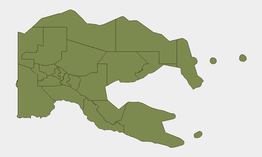
The National Capital District (risk score 31.3) dominates the threat landscape and is the primary driver of national-level risk, reflecting Port Moresby's chronic gang violence, armed robbery targeting expatriates and supply convoys, and limited police capacity in outer suburbs. The Autonomous Region of Bougainville (21.3) presents secondary risk stemming from residual post-conflict instability, community disputes over mining, and loose security control in remote areas. All other provinces score materially lower (1.3 each), indicating either effective local order, lower population density, or reduced reporting—though this should not be interpreted as "safe"; rural areas often experience unreported clan violence and roadside banditry. Security planning should remain NCD-centric while maintaining contingency for Bougainville-specific events (mining unrest, smuggling).
How GeoBit Would Assist
Corporate security teams should deploy AOI Monitoring & Early Warning on Port Moresby and Bougainville key infrastructure (ports, airports, fuel depots, residential compounds) to flag movement anomalies and emerging unrest in near-real time. Multi-language OSINT fusion (X/Twitter, local PNG news outlets, community pages, and radio SIGINT) would capture incident reports and civil tension ahead of wire-service confirmation, enabling faster duty-of-care escalation. Routing & Network Analysis supports dynamic travel-risk assessment and alternative-route planning for personnel and supply movements, particularly in the NCD and outlying provinces.
7-Day Outlook
No significant escalation in national-level security incidents is anticipated over the next seven days. Seismic and volcanic monitoring should continue; any M 5.0+ event or volcanic activity spike could trigger secondary hazards (tsunami risk, ashfall, displacement). Polio vaccination and public-health coordination with PNG authorities remain operationally relevant. Corporate teams should maintain routine situational awareness through local security partners and DFAT/FCDO advisories; no new travel or movement restrictions are expected absent a major incident.
Highest-Risk Areas — Ranked
| # | State / Region | Risk |
|---|---|---|
| 1 | National Capital District | 31.3 |
| 2 | Autonomous Region of Bougainville | 21.3 |
| 3 | Eastern Highlands | 1.3 |
| 4 | Gulf | 1.3 |
| 5 | Madang | 1.3 |
| 6 | Manus | 1.3 |
| 7 | West New Britain | 1.3 |
| 8 | New Ireland | 1.3 |
| 9 | East New Britain | 1.3 |
| 10 | Morobe | 1.3 |
| 11 | Central | 1.3 |
| 12 | Oro | 1.3 |
Sources
Previous Daily Briefs
A new Papua New Guinea brief is written every day — each with its own risk map and downloadable CSV. Here's the last week; use the calendar to go further back.
📅 Browse every day by calendar →
Highlighted days have a brief. Tap a day for that day's map & analysis, or “csv” for that day's dataset ($5).