ملخص الوضع
تظل بابوا غينيا الجديدة بيئة أمنية مجزأة مع تباين إقليمي حاد؛ تهيمن مقاطعة مورobe على الصورة الأمنية الوطنية برصيد مخاطر مركب أعلى بحوالي 10 مرات من أي ولاية أخرى. يواجه البلد ضغوطاً متزامنة من النزاعات الإقليمية المحلية والنشاط الزلزالي (حدثت هزتان تزيد قوتهما عن 4.5 درجات في الأيام الأخيرة)، وتداول فيروس شلل الأطفال المشتق من اللقاح. لم يتم التحقق بشكل موثوق من أي حوادث أمنية رئيسية عبر المصادر المفتوحة في آخر 24-48 ساعة، لكن البيئة التشغيلية تبقى متقلبة في المقاطعات الرئيسية.
التطورات الرئيسية
- 2026-06-18 · احتلال أراضٍ · موقع غير محدد. تم الإبلاغ عن نزاع على الملكية؛ تتطلب التفاصيل الجغرافية والأطراف المعنية التحقق من خلال حكومات المقاطعات والوسائط الإعلامية المحلية في بابوا غينيا الجديدة.
- النشاط الزلزالي · أحداث متعددة (حديثة). زلزال بقوة 4.8 درجة على بُعد 65 كم جنوب كوكوبو (بريطانيا الجديدة الشرقية) وحدث بقوة 4.6 درجة على بُعد 78 كم غرب بانجونا (بوغانفيل). لم يؤدِ أي منهما إلى إصدار تحذيرات من أمواج تسونامي أو إبلاغات مؤكدة عن ضحايا كبار، لكن الضعف في البنية التحتية ومسارات الإمداد في المناطق المتأثرة يستحق استعراضاً لجرد الأصول.
- الصحة العامة · تداول cVDPV2. يستمر تداول فيروس شلل الأطفال المشتق من اللقاح من النوع 2 في بابوا غينيا الجديدة. لم تكن هناك مواقع تفشٍ جديدة أو أعداد حالات متاحة من آخر 48 ساعة؛ يُنصح بمراقبة تنبيهات وزارة الصحة للعاملين في المناطق النائية ومنخفضة التغطية.
- فجوة الاستخبارات من المصادر المفتوحة. لم يتم التحقق من حوادث أمنية إضافية (نزاع، اضطرابات مدنية، جريمة، عدم استقرار سياسي) عبر المصادر المفتوحة الموثوقة التاريخ في آخر 24-48 ساعة. وهذا لا يشير إلى غياب المخاطر؛ بل يعكس تأخر الإبلاغ وقيود التغطية الإعلامية في بابوا غينيا الجديدة، مما يعني أن الحوادث قد لا تظهر إلا بعد 48-72 ساعة من وقوعها.
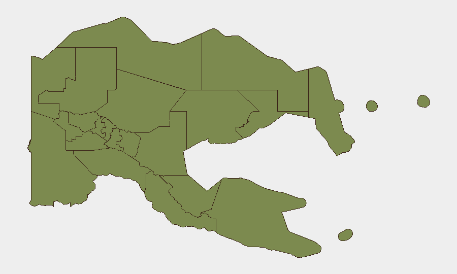
أعلى المناطق خطورة
تستحوذ مقاطعة مورobe (درجة مخاطرة 31.3) على الغالبية العظمى من مؤشرات التهديد المتتبعة وتمثل التركيز الفريد للقلق الأمني الوطني في بابوا غينيا الجديدة. تكمل مقاطعات المرتفعات الشرقية وخليج بابوا وMadang وManus الفئة الثانوية، بدرجات تتراوح بين 1.3 و3.1؛ تستحق مقاطعة Manus (3.1) انتباهاً خاصاً مقارنة بنظيراتها. يشير التفاوت في الخطورة إلى أن مقاطعة مورobe تتعرض لحوادث متكررة من الدرجة الأولى (جرائم عادية، نزاعات عشائرية، فرض ضرائب غير رسمية) بدلاً من الأحداث الكارثية؛ مع ذلك، فإن الاحتكاك التشغيلي التراكمي للعاملين وسلاسل الإمداد في تلك المقاطعة كبير. تسجل جميع المقاطعات الأخرى، بما في ذلك منطقة العاصمة الوطنية (بورت مورسبي)، مستويات أساسية (1.3)، مما يعكس حكماً نسبياً مستقراً لكنه ضعيف مؤسسياً.
كيف يمكن لـ GeoBit أن يساعد
يجب على فريق الأمن نشر مراقبة منطقة الاهتمام والإنذار المبكر على مقاطعات مورobe وManus والمرتفعات الشرقية لتوليد تنبيهات حول تجميع الحوادث والاتجاهات الزمنية. سيؤدي مسح الاستخبارات وذكاء X/Twitter (مع التصفية حسب الموقع والتاريخ والحسابات الحكومية/الإعلامية المتحققة في بابوا غينيا الجديدة) إلى ظهور تقارير الحقيقة الأرضية بسرعة أكبر من الأسلاك الرئيسية بـ 24-48 ساعة. يسمح تحليل نظم المعلومات الجغرافية والتحليل المكاني المرتبط بجرد الأصول بتقييم مخاطر التوجيه والحركة الفعلية في الوقت الفعلي حول مناطق المتاعب المؤكدة؛ يدعم تحليل التوجيه والشبكة تخطيط الرح
المناطق الأعلى خطورة — مرتبة
| # | الولاية / المنطقة | الخطر |
|---|---|---|
| 1 | Morobe | 31.3 |
| 2 | Manus | 3.1 |
| 3 | Eastern Highlands | 1.3 |
| 4 | Gulf | 1.3 |
| 5 | Madang | 1.3 |
| 6 | West New Britain | 1.3 |
| 7 | New Ireland | 1.3 |
| 8 | East New Britain | 1.3 |
| 9 | National Capital District | 1.3 |
| 10 | Central | 1.3 |
| 11 | Oro | 1.3 |
| 12 | Milne Bay | 1.3 |
المصادر
الموجزات اليومية السابقة
يُنشر موجز جديد عن Papua New Guinea كل يوم — لكل منها خريطة مخاطر وملف CSV قابل للتنزيل. هذا هو الأسبوع الأخير؛ استخدم التقويم للرجوع أبعد.
📅 Browse every day by calendar →
Highlighted days have a brief. Tap a day for that day's map & analysis, or “csv” for that day's dataset ($5).