Situation Summary
Peru maintains a composite national threat score of 22 (global rank #69) with 205 tracked security events. The country remains under a state of emergency in Lima and Callao due to ongoing violent crime and gang activity, with travel advisories from multiple governments recommending heightened caution. Recent event signals indicate scattered protest activity, administrative sanctions, and political disapproval across multiple dates (2026-06-20 to 2026-06-22), though open-source verification of specific incidents in the last 24–48 hours remains limited. The security posture reflects chronic instability in specific regions rather than acute national crisis.
Key Developments
Open-source verification of Peru-specific security incidents within the last 24–48 hours is currently insufficient to meet the threshold for inclusion in this brief. Multiple government travel advisories (Australia, U.S., Canada, UK) continue to flag violent crime, demonstrations, and roadblocks as persistent concerns in Lima and Callao, but available web sources do not provide clearly time-stamped, independently corroborated incident reports dating to 2026-06-21 or 2026-06-22. The absence of verifiable recent incident detail does not indicate an absence of threat—rather, it reflects a gap in publicly indexed, real-time event data.
Recommended action: Security and duty-of-care teams should supplement this brief by direct monitoring of official channels (Ministerio del Interior, Policía Nacional, regional governors) and embassy security feeds on X/Twitter and official websites for Lima, Junín, Huánuco, and Ayacucho, where risk scores are highest.
Highest-Risk Areas
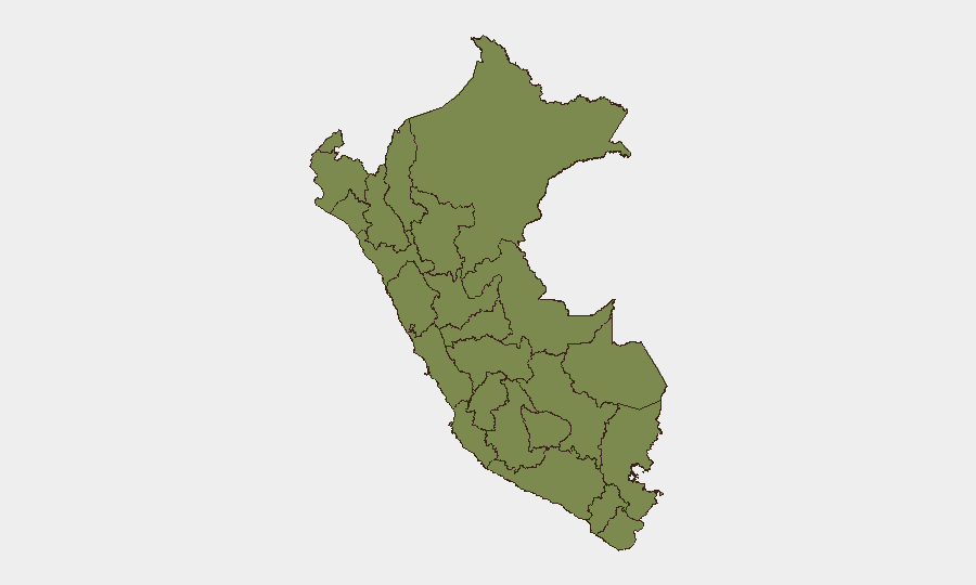
Junín (risk 31.5) is the single highest-risk region, likely reflecting gang presence, drug-trafficking activity, and associated violence in the central highlands and jungle zones. Lima (risk 23.2) remains Peru's second-highest-risk area, driven by violent crime, organized gang activity in peripheral districts, and the ongoing state of emergency in the capital and Callao. Huánuco (risk 19.7) and Ayacucho (risk 16.8) follow as secondary concern zones, historically associated with drug-trafficking corridors and insurgent activity. All remaining tracked regions fall below risk 6, indicating that threat concentration is heavily skewed toward these four departments; teams with operations or personnel outside these zones face materially lower exposure.
How GeoBit Would Assist
Teams operating in Peru should deploy AOI (Area-of-Interest) Monitoring & Early Warning on Junín, Lima, Huánuco, and Ayacucho to receive automated alerts on protest activity, roadblocks, and security incidents before they impact supply chains or personnel movement. Intel Sweep and X/Twitter & Telegram OSINT capabilities enable near-real-time collection and corroboration of unverified events, filling the gap in open-source verification and shortening the lag between incident and situational awareness. Routing & Network Analysis supports duty-of-care teams in pre-positioning alternative routes and safe havens for personnel transiting high-risk corridors, particularly around Lima–Junín and southern mining regions.
7-Day Outlook
No major escalation is indicated by current signals, though protest activity and administrative friction remain volatile in peripheral districts of Lima and in central-highland departments. Political disapproval statements and scattered demonstrations suggest a baseline of civil friction tied to Peru's 2026 election cycle and unresolved gang-violence grievances, without indicating imminent coordinated unrest. Security teams should maintain heightened vigilance on Junín and Lima through the coming week and cross-reference any new event signals against embassy advisories and local media to confirm operational impact before altering movement or operations.
Highest-Risk Areas — Ranked
| # | State / Region | Risk |
|---|---|---|
| 1 | Junín | 31.5 |
| 2 | Lima | 23.2 |
| 3 | Huánuco | 19.7 |
| 4 | Ayacucho | 16.8 |
| 5 | Apurímac | 5 |
| 6 | Cusco | 3.8 |
| 7 | Tumbes | 3.2 |
| 8 | La Libertad | 2.6 |
| 9 | Ica | 2.6 |
| 10 | Loreto | 1.5 |
| 11 | Piura | 1.5 |
| 12 | Lambayeque | 1.5 |
Sources
Previous Daily Briefs
A new Peru brief is written every day — each with its own risk map and downloadable CSV. Here's the last week; use the calendar to go further back.
📅 Browse every day by calendar →
Highlighted days have a brief. Tap a day for that day's map & analysis, or “csv” for that day's dataset ($5).