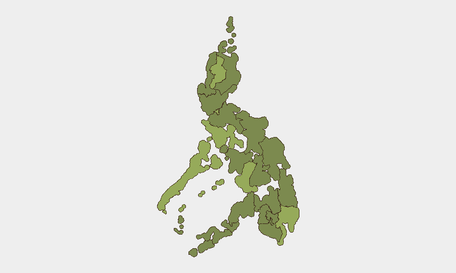
Situation Summary
The Philippines faces a compound security environment shaped by a major natural disaster, emerging political-security concerns, and persistent regional instability. A devastating 7.8-magnitude earthquake struck southern Mindanao on June 9, killing at least 38 and displacing search-and-rescue and security resources across the Davao Region and neighboring provinces. Concurrently, Philippine Senate leadership has elevated security posture following threat reporting from the National Bureau of Investigation, signaling renewed attention to domestic political security risks. The country's composite threat ranking (#39 globally, score 34.8) reflects these layered hazards—seismic vulnerability, terrorism/insurgency drivers in the south, and governance-related tensions.
Key Developments
- Davao Region & Southern Mindanao, June 9–10: A 7.8-magnitude earthquake devastated multiple provinces, killing at least 38 and collapsing structures; ongoing search-and-rescue operations continue, with authorities warning casualty figures may rise as rubble clearance proceeds.
- Southern Mindanao transport corridors, June 9–10: Critical infrastructure damage (roads, buildings) has severely disrupted local movement and commerce; authorities have implemented movement controls and debris-clearance operations in worst-affected towns while aftershocks persist.
- Philippine Senate complex (Pasay City, Metro Manila), June 9–10: Senate leadership implemented stricter access controls, visitor screening, and coordination with national security agencies following NBI threat reporting; security posture remains elevated.
- National law enforcement, June 9: Fugitive ex-police officer Rafael Dumlao III, convicted mastermind in the 2016 killing of South Korean businessman Jee Ick Joo, was arrested in a multi-unit operation, demonstrating continued high-profile fugitive enforcement activity.
- Mindanao urban centers, June 9–10: Police deployments exceeded 2,000 personnel across affected cities to secure damaged areas, prevent looting, and support relief—indicating resource strain and potential security gaps in non-quake-affected regions.
- Event-signal cluster, June 8–10: Multiple "reduce relations" and threatening statements directed at Japan and Malaysia suggest elevated regional diplomatic tension; Philippine public statements across the same period indicate defensive posturing on territorial or resource matters.
Highest-Risk Areas
Cordillera Administrative Region (54.4) and Mimaropa (47.2) remain the two highest-risk sub-national zones, driven by terrain-based isolation, criminal networks, and historical insurgency presence. The Davao Region (45.5), now acutely stressed by earthquake damage and active SAR/security operations, has elevated immediate risk; Metro Manila (43.4) is exposed to political-security and critical-infrastructure threats, evidenced by the Senate security alert. Southern regions—Zamboanga Peninsula (30.7), Bangsamoro (24.8)—retain baseline terrorism and militant activity risk, though Bangsamoro's relatively lower ranking may reflect improved government presence or reduced reporting rather than diminished threat. Earthquake damage and emergency-response demands will likely strain law-enforcement and humanitarian capacity across the south for weeks.
How GeoBit Would Assist
Corporate security and duty-of-care teams should deploy AOI Monitoring & Early Warning focused on the Davao Region, Cordillera, and Mimaropa to track SAR progress, aftershock activity, and security incidents in real time. OSINT fusion (X/Telegram monitoring, media feeds, sentiment analysis) will detect emerging threats—looting reports, supply-chain disruptions, political volatility—faster than official channels. Routing & Network Analysis is operationally critical for teams with personnel in Mindanao, enabling real-time alternative-route planning and movement advice as infrastructure damage evolves.
7-Day Outlook
Search-and-rescue operations will remain the dominant security and resource driver in southern Mindanao through mid-June, likely constraining police availability elsewhere and increasing vulnerability to criminal activity in non-quake zones. Senate security operations and regional diplomatic statements suggest sustained political tension; monitor for escalation in public threats or institutional security measures. Aftershock risk and potential secondary disasters (landslides, dam failures) should be tracked daily; coordinate with local authorities on movement clearances before scheduling critical business travel in the south.
Highest-Risk Areas — Ranked
| # | State / Region | Risk |
|---|---|---|
| 1 | Cordillera Administrative Region | 54.4 |
| 2 | Mimaropa | 47.2 |
| 3 | Davao Region | 45.5 |
| 4 | Negros Island Region | 45.1 |
| 5 | Metro Manila | 43.4 |
| 6 | Zamboanga Peninsula | 30.7 |
| 7 | Central Luzon | 29.4 |
| 8 | Soccsksargen | 26.9 |
| 9 | Bicol Region | 26.1 |
| 10 | Western Visayas | 25.6 |
| 11 | Bangsamoro | 24.8 |
| 12 | Eastern Visayas | 24.8 |
Sources
Previous Daily Briefs
A new Philippines brief is written every day — each with its own risk map and downloadable CSV. Here's the last week; use the calendar to go further back.
📅 Browse every day by calendar →
Highlighted days have a brief. Tap a day for that day's map & analysis, or “csv” for that day's dataset ($5).