Situation Summary
Romania remains positioned at moderate global risk (#93 globally, composite threat score 12) with 41 tracked events. The primary near-term security driver is proximity to the Ukraine conflict, evidenced by active Russian drone activity near the Danube and Black Sea border corridor. Concurrent cyber threats—notably the ongoing healthcare ransomware incident—and isolated civil unrest signals suggest a fragmented threat environment rather than systemic instability. The security posture remains defensive and reactive.
Key Developments
- Tulcea County, Danube border (night of 25–26 June 2026): Romanian National Defence Ministry issued air-raid warning for northern Tulcea County after Russian drone strike on Odesa oblast, Ukraine. IAR-330 Puma helicopter deployed at 03:57 for airspace monitoring near Sulina/Vylkove; all-clear issued at 04:23. No airspace violation or debris impact on Romanian territory reported.
- Black Sea and Danube corridor airspace (night of 25–26 June 2026): Romanian air defence assets tracked Russian strike drones operating near Romanian airspace along the Black Sea–Danube corridor. No engagement or on-ground impacts reported; heightened readiness maintained per Defence Ministry communique.
- National healthcare sector ransomware (late June 2026, update within 48h): Large-scale ransomware attack that disrupted dozens of Romanian hospitals remains under active remediation; systems offline for several days. Incident continues to feature in international cybersecurity reporting as one of the most serious recent global healthcare cyber incidents, with follow-on advisories still being discussed.
- Civil-sector disapproval signals (25–27 June 2026): Multiple signals of disapproval from civic, armed, and human-rights groups; presidential rejection and civic-group rejection noted. Limited detail in open sources; scale and specific grievances remain unclear but suggest underlying dissatisfaction not currently manifesting as organized protest or violence.
- Cross-border diplomatic tension signal (25 June 2026): Public statement from Moldova expressing disapproval toward Romania noted; context and substance not detailed in available reporting. May reflect ongoing bilateral friction but does not appear to constitute immediate security escalation.
Highest-Risk Areas
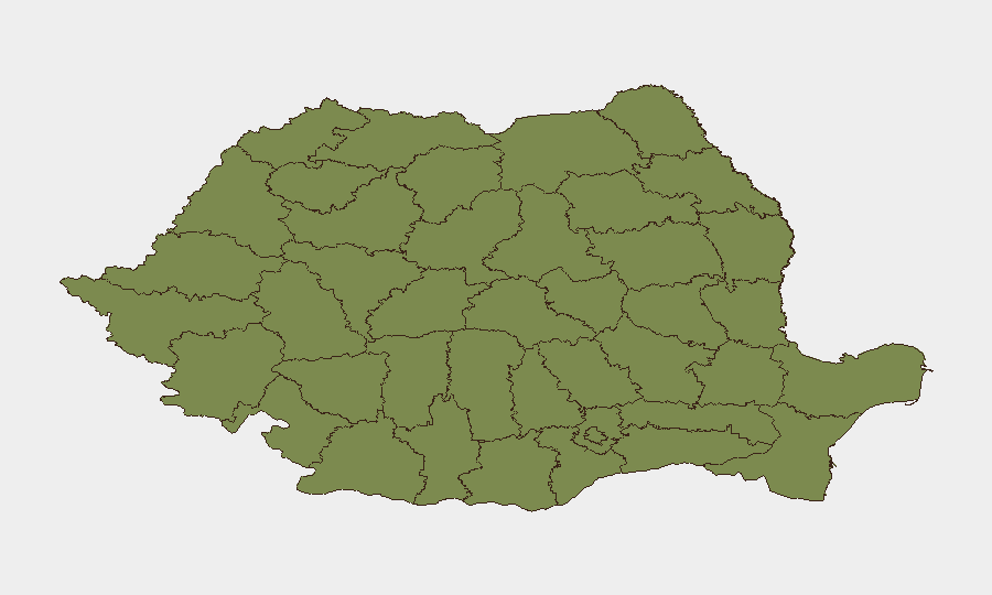
Brașov County dominates the sub-national risk profile (composite risk 32), substantially higher than all other regions and warranting immediate focus for organizations with personnel or operations there. Bucharest (risk 3.8) remains the secondary hotspot, reflecting capital-city concentration of political activity and critical infrastructure. Peripheral counties (Maramureș, Sibiu, Prahova, Vâlcea, and others) cluster at risk levels 2–2.9, suggesting distributed, low-intensity risk drivers rather than geographic concentration outside Brașov and Bucharest. The sharp differential in Brașov warrants targeted local intelligence and physical security review.
How GeoBit Would Assist
Security teams should employ AOI (Area of Interest) Monitoring & Early Warning on Brașov, Bucharest, and the Tulcea–Danube border corridor to detect escalation in protest activity, armed-group movement, or cross-border incidents before they affect corporate operations. Cyber threat intelligence via network analysis and OSINT fusion would track healthcare-sector ransomware remediation and identify secondary attack vectors targeting supply-chain and financial-sector partners. Conflict & Military tracking combined with Maritime & Aviation tracking provides real-time visibility on Russian drone and Ukrainian activity near the border, enabling duty-of-care teams to anticipate evacuation or shelter-in-place protocols for northern operations.
7-Day Outlook
Russian drone activity near the Danube and Black Sea border is likely to persist as long as Ukraine conflict operations continue; Romanian air defence will maintain heightened readiness with low probability of airspace penetration or direct impact. Cyber threats, particularly targeting healthcare and critical infrastructure, will remain elevated. Civil-sector disapproval signals should be monitored for escalation, though no immediate large-scale protest or violence indicators are present.
Highest-Risk Areas — Ranked
| # | State / Region | Risk |
|---|---|---|
| 1 | Brașov | 32 |
| 2 | Bucharest | 3.8 |
| 3 | Maramureș | 2.9 |
| 4 | Sibiu | 2.9 |
| 5 | Prahova | 2.9 |
| 6 | Vâlcea | 2 |
| 7 | Bihor | 2 |
| 8 | Timiș | 2 |
| 9 | Caraș-Severin | 2 |
| 10 | Satu Mare | 2 |
| 11 | Sălaj | 2 |
| 12 | Arad | 2 |
Sources
Previous Daily Briefs
A new Romania brief is written every day — each with its own risk map and downloadable CSV. Here's the last week; use the calendar to go further back.
📅 Browse every day by calendar →
Highlighted days have a brief. Tap a day for that day's map & analysis, or “csv” for that day's dataset ($5).