Situation Summary
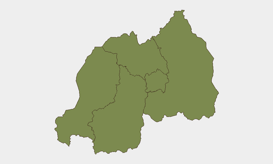
Rwanda remains a lower-tier global security risk (#128, composite score 11), with a heavily concentrated threat profile: Southern Province accounts for the overwhelming majority of identified risk (32.3 vs. 2.3 for all other provinces), suggesting either acute localized instability or elevated criminal/transnational activity in that region. No major armed conflict, mass civil unrest, or infrastructure collapse is evident in open-source reporting over the last 24–48 hours. The security environment appears stable at the national level, though Southern Province warrants focused monitoring.
Key Developments
Open-source verification of specific security or civil incidents in Rwanda during the last 24–48 hours is limited. The most notable recent activity in Kigali is the South–South & Triangular Cooperation Convention (22–23 June 2026), a development and diplomatic gathering hosted by the government with UN and UNICEF participation—framed as a cooperation framework rather than a security event. GeoBit's event signals reference territorial and blockade actions involving Rwanda and Goma (DRC), and military force signals dated 21–22 June, but these appear to relate to cross-border or regional posture rather than domestic Rwandan security incidents. Recent Marburg virus disease signals (exact date and case count not confirmed in available open reporting) suggest ongoing public-health monitoring is warranted. No corroborated reports of armed clashes, kidnappings, major crime, protests, or political arrests have been identified in the last 48 hours.
Highest-Risk Areas
Southern Province drives the vast majority of Rwanda's composite threat score (32.3 vs. 2.3 baseline for other provinces), indicating either a concentrated crime, trafficking, or displacement problem, or heightened vulnerability to cross-border spillover from neighboring territories. The remaining four provinces and Kigali City show roughly equal and significantly lower risk, suggesting the Southern Province concentration is either genuinely localized or reflects a reporting/monitoring bias toward border-adjacent areas. Corporate security teams with staff or assets in the South should prioritize AOI monitoring and alternative routing options; teams elsewhere in Rwanda face baseline country-level risk typical of the region.
How GeoBit Would Assist
Security teams should employ AOI Monitoring & Early Warning to maintain persistent watch on Southern Province, with alert thresholds for criminal, displacement, or cross-border militia activity. Conflict & Military tracking, border analysis, and satellite/imagery monitoring of DRC–Rwanda border zones will clarify whether recent territorial and blockade signals pose secondary risk to Rwandan soil. Multi-language OSINT and Telegram/X feeds targeted at Rwandan government, security-sector, and transnational-crime communities will provide early notice of unrest, criminal surges, or policy shifts affecting duty-of-care obligations.
7-Day Outlook
No acute escalation or security shock is expected in the near term; the country remains comparatively stable relative to regional peers. Southern Province remains the principal focus for monitoring; any spike in cross-border militia activity, criminal violence, or population displacement there should trigger rapid escalation review. The Marburg virus signals warrant parallel epidemiological tracking to ensure health-risk briefings remain current.
Highest-Risk Areas — Ranked
| # | State / Region | Risk |
|---|---|---|
| 1 | Southern Province | 32.3 |
| 2 | Western Province | 2.3 |
| 3 | Northern Province | 2.3 |
| 4 | Kigali City | 2.3 |
| 5 | Eastern Province | 2.3 |
Sources
Previous Daily Briefs
A new Rwanda brief is written every day — each with its own risk map and downloadable CSV. Here's the last week; use the calendar to go further back.
📅 Browse every day by calendar →
Highlighted days have a brief. Tap a day for that day's map & analysis, or “csv” for that day's dataset ($5).