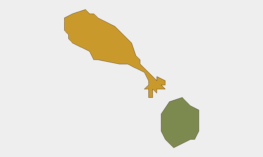
Situation Summary
Saint Kitts and Nevis remains at baseline security risk with no acute threats to persons or infrastructure within the islands as of 22 June 2026. Open-source reporting confirms no credible incidents of civil unrest, terrorism, violent crime spikes, or critical infrastructure disruption in the past 48 hours. Saint Kitts island carries elevated composite risk (72) compared to Nevis (28), though this reflects underlying crime and governance vulnerabilities rather than an active crisis. The security posture is stable; duty-of-care obligations should focus on persistent baseline hazards (petty and occasional violent crime) and maritime risks to flag-state vessels operating outside territorial waters.
Key Developments
- Black Sea maritime (outside SKN territory), 20 June 2026 – A Saint Kitts and Nevis–flagged civilian vessel sustained minor injuries to three crew members during Russian drone attacks on commercial shipping near Ukrainian waters; one fatality reported on a separate Panamanian-flagged vessel. This represents a flag-state maritime-conflict exposure but poses no direct threat to in-country operations.
- National governance – CBI security reform (mid-June), policy-level – Authorities announced structural reforms to the Citizenship by Investment programme, tightening due diligence and security vetting for investor applications; this is preventive policy, not an incident response.
- National infrastructure – Addressing System development (19 June), administrative – Government continued work on a National Addressing System to improve emergency response and service delivery; no disruption or security incident implied.
- Regional advisory status (19 June), policy reference – Canada's travel advisory for Saint Kitts and Nevis was refreshed at "take normal security precautions," noting baseline levels of petty and occasional violent crime with no recent spike or new incident reported.
Highest-Risk Areas
Saint Kitts island dominates the sub-national risk profile (composite 72 vs. Nevis 28), reflecting higher concentrations of petty crime, occasional violent incidents, and underlying socio-economic pressures. Nevis presents significantly lower risk and remains the more stable jurisdiction. Corporate and duty-of-care teams should apply heightened situational awareness protocols in Saint Kitts, particularly in urban centers and informal settlements, while Nevis-based operations face reduced baseline criminal risk. No recent incident data suggest an acute deterioration in either jurisdiction.
How GeoBit Would Assist
Security teams protecting personnel and assets in Saint Kitts and Nevis should deploy AOI Monitoring & Early Warning (persistent area-of-interest watch with alerting on Saint Kitts and major economic/port facilities) to detect emerging civil unrest, crime spikes, or infrastructure disruption in near-real time. Intel Sweep and OSINT fusion across local news, government channels, social media, and maritime tracking would provide continuous baseline awareness of crime trends, political instability, and shipping risks affecting flag-state vessels. Routing & Network Analysis capabilities enable security teams to plan alternative movement routes and assess safe passage corridors during any future localized disruption.
7-Day Outlook
No acute threat escalation is anticipated in the next seven days based on current event signals and open reporting. Baseline crime risk and maritime exposure to Black Sea flag-state conflicts remain the primary standing concerns. Continuous monitoring of governance developments and worker-relations activity is warranted to detect early warning of labor unrest or institutional friction that could affect business continuity.
Highest-Risk Areas — Ranked
| # | State / Region | Risk |
|---|---|---|
| 1 | Saint Kitts | 72 |
| 2 | Nevis | 28 |
Sources
Previous Daily Briefs
A new Saint Kitts and Nevis brief is written every day — each with its own risk map and downloadable CSV. Here's the last week; use the calendar to go further back.
📅 Browse every day by calendar →
Highlighted days have a brief. Tap a day for that day's map & analysis, or “csv” for that day's dataset ($5).