Situation Summary
Saint Lucia remains a low-threat environment globally (rank #188, composite score 2.7) with no recorded security incidents in the past 24–48 hours. Recent government and civic activity, including legislative sittings and customs platform updates, proceeded without disruption or reported incident. The country's security posture is stable, though concentrated urban and tourism-corridor risk warrants standard corporate duty-of-care protocols for personnel and assets in higher-risk districts.
Key Developments
- No verifiable security incidents recorded in Saint Lucia during the last 24–48 hours. Open-source intelligence and live web research (June 23–24, 2026) identified no credible reports of violent crime clusters, civil unrest, infrastructure failure, or sudden political instability.
- Routine government activity ongoing. House of Assembly legislative sittings and customs administration updates (online payment platform announcement) proceeded normally on June 23, with no disruption or advisory issued.
- Tourism and commercial operations normal. Tourism promotion and general commercial posts from June 23 reflect standard business continuity; no travel alerts or operational warnings detected.
Highest-Risk Areas
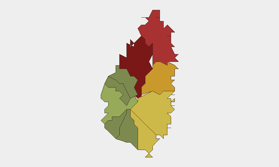
Castries (risk 95) remains the primary security concern, reflecting its status as the capital and largest urban center; Gros Islet (78) and Dennery (72) follow as secondary concentration points. Risk in these three districts is consistent with typical Caribbean urban-corridor crime patterns—property crime, petty theft, and localized violence in specific neighborhoods rather than systemic or widespread instability. The steep drop-off in risk scores beyond the top three (Vieux Fort at 68, Micoud at 65) suggests that risk is heavily concentrated in and around the capital and immediate northern tourism zones. Peripheral and southern districts (Canaries at 12, Choiseul at 35) present negligible acute risk and may serve as safer operational alternatives for personnel or assets requiring lower-threat environments.
How GeoBit Would Assist
Security and risk teams with personnel or assets in Saint Lucia should leverage AOI (Area-of-Interest) Monitoring & Early Warning to establish persistent watch on Castries, Gros Islet, and Dennery, configured to alert on crime, civil unrest, or infrastructure incidents. Intel Sweep and multi-language OSINT fusion provide real-time corroboration of local news, government statements, and social-media activity to detect emerging threats earlier than traditional reporting. GIS & Spatial Analysis can map personnel locations and assets against the sub-national risk ranking, enabling dynamic route planning and safe-zone identification using Routing & Network Analysis capabilities.
7-Day Outlook
No acute threat indicators are visible in the immediate 7-day horizon. Seasonal Caribbean weather patterns and routine legislative/administrative activity are the primary drivers of operational planning; security conditions are expected to remain stable. Continued passive monitoring of Castries and Gros Islet via standard OSINT protocols is recommended as a baseline precaution.
Highest-Risk Areas — Ranked
| # | State / Region | Risk |
|---|---|---|
| 1 | Castries | 95 |
| 2 | Gros Islet | 78 |
| 3 | Dennery | 72 |
| 4 | Vieux Fort | 68 |
| 5 | Micoud | 65 |
| 6 | Soufrière | 42 |
| 7 | Laborie | 38 |
| 8 | Choiseul | 35 |
| 9 | Anse La Raye | 28 |
| 10 | Canaries | 12 |
Previous Daily Briefs
A new Saint Lucia brief is written every day — each with its own risk map and downloadable CSV. Here's the last week; use the calendar to go further back.
📅 Browse every day by calendar →
Highlighted days have a brief. Tap a day for that day's map & analysis, or “csv” for that day's dataset ($5).