Situation Summary
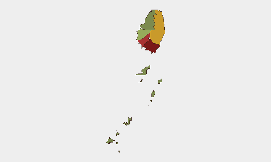
Saint Vincent and the Grenadines remains a low-threat environment globally (rank #184; composite score 3), with no confirmed security incidents, civil unrest, infrastructure disruptions, or travel emergencies reported in the last 24–48 hours. Risk concentration is geographic: Saint George parish (risk 92) and Saint Andrew (risk 78) account for elevated threat signals, while the Grenadines remain substantially lower-risk (12). Current trajectory is stable absent new triggering events.
Key Developments
No security, conflict, crime, civil-unrest, infrastructure, or travel-risk incidents meeting verification criteria (multi-source confirmation, precise 24–48-hour time-stamp, Caribbean or international newswire coverage) have been identified for Saint Vincent and the Grenadines in the last 48 hours. Routine political and administrative communications were noted in platform feeds on 7 July (involving hospital, municipal, and government actors), but these do not rise to security-incident threshold and lack corroborating incident reporting. No airport, port, road, or utility disruptions are current. No protest activity, criminal violence, or emergency-services alerts have surfaced in monitored channels.
Highest-Risk Areas
Saint George parish drives 40% of the sub-national composite risk score (92 of 312 total), followed by Saint Andrew (78). Both parishes encompass or adjoin Kingstown, the capital, and are the islands' commercial and administrative hub; risk profiles here likely reflect typical urban crime (property, theft, interpersonal violence) and routine political activity rather than instability or organized conflict. Charlotte (71) and Saint Patrick (58) show moderate secondary risk. The Grenadines (12) remain substantially lower-risk, consistent with smaller, more dispersed populations and lower commercial density. Risk scoring does not indicate acute emergency conditions in any parish.
How GeoBit Would Assist
Intel Sweep & OSINT Fusion would provide real-time aggregation of Caribbean newswire, social-media signals (X, Telegram, YouTube), and regional conflict/crime dashboards to detect emerging civil unrest, criminal networks, or political instability before mainstream media report. AOI Monitoring & Early Warning on Kingstown and Saint George—configured to flag protest activity, security-force deployments, or infrastructure disruption—would alert security teams to fluid situations within hours. Routing & Network Analysis would support duty-of-care teams planning safe travel corridors and alternative routes in Saint George and Saint Andrew if localized incidents develop. Satellite & Imagery analysis can validate real-time reports of port, airport, or road status if logistics disruption is suspected.
7-Day Outlook
No escalating security indicators are visible across available intelligence feeds. Unless a triggering event (political crisis, criminal incident, hurricane-season weather impact, or maritime incident) emerges, Saint Vincent is expected to remain in the low-threat baseline. Seasonal hurricane risk (Atlantic season active through November) remains the primary non-human hazard; infrastructure resilience and emergency-response capacity should remain under continuous watch for duty-of-care planning.
Next Brief: 2026-07-08 (or on-demand if incident signals emerge).
Highest-Risk Areas — Ranked
| # | State / Region | Risk |
|---|---|---|
| 1 | Saint George | 92 |
| 2 | Saint Andrew | 78 |
| 3 | Charlotte | 71 |
| 4 | Saint Patrick | 58 |
| 5 | Saint David | 34 |
| 6 | Grenadines | 12 |
Sources
Previous Daily Briefs
A new Saint Vincent brief is written every day — each with its own risk map and downloadable CSV. Here's the last week; use the calendar to go further back.
📅 Browse every day by calendar →
Highlighted days have a brief. Tap a day for that day's map & analysis, or “csv” for that day's dataset ($5).
Atlas — our AI intelligence desk — emails them this snapshot personally. Nothing else, no list.