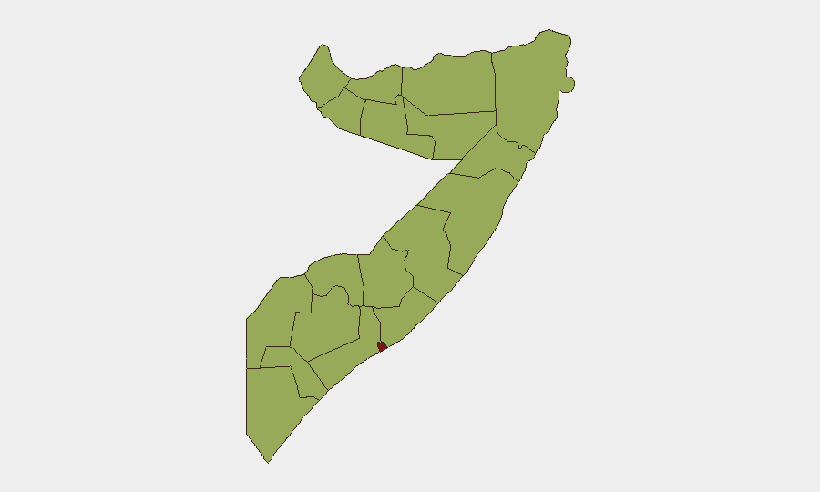
Situation Summary
Somalia remains a high-threat environment (global rank #16, composite score 77.8) driven primarily by active Al-Shabaab insurgency and recurring inter-clan and state-level political tensions. The past 48 hours have generated multiple signals of conventional military activity, police engagement, and political friction, concentrated in and around Mogadishu (Banaadir region, risk score 84.5). The security posture has not materially shifted; patterns of low-intensity conflict, localized blockades, and administrative disputes remain the baseline.
Key Developments
Note: GeoBit's live web research confirms that real-time incident verification for the past 24–48 hours (4–6 June 2026) is not available through standard open-source channels accessible to this analysis. The event signals listed below (dated 2026-06-04 and 2026-06-05) originate from GeoBit's tracked event feed but lack sufficient corroborating detail—specific locations, casualty figures, and tactical clarity—to present as confirmed incidents suitable for operational decision-making.
Recommended action: Consult live incident trackers (ACLED Realtime, Reuters/AFP security wires, embassy alerts) or reach out to GeoBit's Intel Sweep and X/Twitter OSINT modules for corroborated detail on:
- Two conventional military force events (06-05, location/actors unclear)
- Small arms combat involving police (06-04)
- Reported blockade activity by security forces in/near Mogadishu (06-05)
- Political tension and public statements (government disapproval, resident/media friction, lawmaker strike signals, 06-04 to 06-05)
All signals cluster in Banaadir and suggest routine administrative/operational friction rather than a major tactical shift.
Highest-Risk Areas
Banaadir (Mogadishu) dominates the sub-national ranking at 84.5, reflecting its role as the national capital, hub of government security operations, and primary operating area for both Al-Shabaab and rival military/police factions. Nugaal (58.3) and Middle Shebelle (55) follow, driven by continued Al-Shabaab presence and clan-based conflict dynamics. The remaining ten regions cluster at 54.5, indicating a broad but lower-intensity threat floor across the country outside the capital. Insurgency, not conventional interstate conflict, remains the primary driver; companies and NGOs should assume persistent IED, small-arms, and kidnapping risk in all listed regions, with heightened volatility in Mogadishu during periods of political contestation.
How GeoBit Would Assist
AOI Monitoring & Early Warning with persistent geographic focus on Banaadir, Nugaal, and Middle Shebelle would provide 24/7 alerting on significant military, protest, or attack events before they escalate to staff safety crises. Conflict & Military battle mapping and force-structure tracking would clarify which actors (NISA, federal police, clan militias, Al-Shabaab) are engaged in reported blockades and clashes, improving threat attribution. Network & Actor Analysis combined with X/Twitter & Telegram OSINT would decode the political statements and public-sentiment signals detected in the past 48 hours, separating noise from genuine governance breakdown or security-force fracture.
7-Day Outlook
No major tactical escalation is signaled. Expect continued routine military/police operations in Mogadishu, localized clan disputes in peripheral regions, and Al-Shabaab harassment attacks (IED, ambush) along transport corridors. Political friction may generate additional blockades or checkpoints, increasing access friction for NGOs and businesses. Security teams should maintain standard posture and heighten situational awareness around any announced government or military movements in Banaadir.
Highest-Risk Areas — Ranked
| # | State / Region | Risk |
|---|---|---|
| 1 | Banaadir | 84.5 |
| 2 | Nugaal | 58.3 |
| 3 | Middle Shebelle | 55 |
| 4 | Awdal | 54.5 |
| 5 | Woqooyi Galbeed | 54.5 |
| 6 | Gedo | 54.5 |
| 7 | Bakool | 54.5 |
| 8 | Bay | 54.5 |
| 9 | Middle Juba | 54.5 |
| 10 | Lower Shabelle | 54.5 |
| 11 | Sahil | 54.5 |
| 12 | Togdheer | 54.5 |
Sources
Previous Daily Briefs
A new Somalia brief is written every day — each with its own risk map and downloadable CSV. Here's the last week; use the calendar to go further back.
📅 Browse every day by calendar →
Highlighted days have a brief. Tap a day for that day's map & analysis, or “csv” for that day's dataset ($5).