Situation Summary
Spain is experiencing a significant multi-region wildfire emergency as of late July 2026, with eight major active blazes reported across the country and emergency protocols activated at the national level. The Community of Madrid and Valencian Community (Castellón/Azuébar area) are currently bearing the highest operational burden, with simultaneous large-scale evacuations and confinement orders affecting civilian populations and critical infrastructure. Recent military and police activity, coupled with cross-border tension signals with France (27 July), indicate stress on emergency response capacity and inter-agency coordination. The overall national threat composite remains moderate (rank #119 globally), but regional concentrations—particularly Madrid and Valencia—require active monitoring.
Key Developments
- Madrid Region, 27–28 July: Large-scale wildfire-driven evacuations and lockdowns activated; national emergency framework engaged with multiple active fronts reported. Firefighting and military resources mobilized to contain blazes threatening populated areas.
- Castellón (Azuébar/Sierra de Espadán), 27 July: Fast-moving wildfire advanced toward inhabited areas; emergency level 2 declared, aerial resources deployed, and evacuations ordered. Firefighting systems reported under strain due to simultaneous regional fires.
- Tiana (Barcelona metropolitan area), 27 July: Multi-front wildfire prompted confinement of residential areas and at least one hostel; emergency response ongoing.
- Castile and León (El Tilo area), 26–27 July: Major active wildfire under combat by firefighting units as part of broader national emergency response.
- Catalonia, 26–27 July: Multiple preventive lockdowns and confinement orders issued in affected zones; firefighting capacity stretched across simultaneous incidents.
- Barcelona Region, 27 July: Arrest/detention activity reported in connection with prison operations; context unclear but noted during emergency period.
- Spain–France Border, 27 July: Diplomatic disapproval and military force signals exchanged; implications for cross-border emergency mutual aid or resource disputes require clarification.
- National Level, 28 July: Government public statement issued; school closures reported in affected zones; ongoing emergency management communications.
Highest-Risk Areas
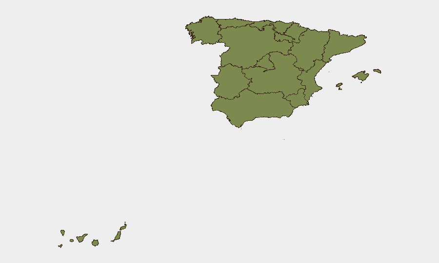
The Community of Madrid dominates the current risk profile (composite score 32), driven by the active large-scale wildfire emergency and evacuation operations affecting Spain's largest metropolitan area and critical infrastructure. The Valencian Community (score 7.8), particularly Castellón province, ranks second and is currently experiencing acute operational risk from the Azuébar fire complex and aerial/ground resource saturation. Catalonia (score 6.6) rounds out the immediate concern tier, with multiple simultaneous incidents stretching emergency services. These three regions account for the majority of the 831 tracked events in Spain's current security picture; southern and eastern coastal/interior zones are more acutely stressed than northern or western regions.
How GeoBit Would Assist
A security team protecting personnel or assets in Madrid, Valencia, or Catalonia would deploy AOI Monitoring & Early Warning on active wildfire zones and evacuation perimeters, combined with GIS & Spatial Analysis to model fire spread, road closures, and safe egress routes. Satellite & Imagery Analysis provides real-time damage assessment and infrastructure vulnerability mapping. Intel Sweep and multi-language OSINT track government emergency statements, police/military deployments, and cross-border diplomatic signals to anticipate resource shortfalls or operational disruptions affecting duty-of-care obligations.
7-Day Outlook
Active wildfire conditions are expected to persist through early August in Madrid and Valencia given sustained heat and reported aerial/ground resource constraints. Evacuation zones and confinement orders will likely remain in place or expand if wind patterns shift or new ignition points emerge. Cross-border coordination with France and internal military deployment patterns warrant continued monitoring for impacts on supply chains, transportation, and personnel movement.
Highest-Risk Areas — Ranked
| # | State / Region | Risk |
|---|---|---|
| 1 | Community of Madrid | 32 |
| 2 | Valencian Community | 7.8 |
| 3 | Catalonia | 6.6 |
| 4 | Andalusia | 5.4 |
| 5 | Balearic Islands | 4.3 |
| 6 | Canary Islands | 3.7 |
| 7 | Galicia | 3.1 |
| 8 | Castile and León | 3 |
| 9 | Castile-La Mancha | 2.9 |
| 10 | Cantabria | 2.2 |
| 11 | Aragon | 2.1 |
| 12 | Region of Murcia | 2.1 |
Sources
Previous Daily Briefs
A new Spain brief is written every day — each with its own risk map and downloadable CSV. Here's the last week; use the calendar to go further back.
📅 Browse every day by calendar →
Highlighted days have a brief. Tap a day for that day's map & analysis, or “csv” for that day's dataset ($5).
Atlas — our AI intelligence desk — emails them this snapshot personally. Nothing else, no list.