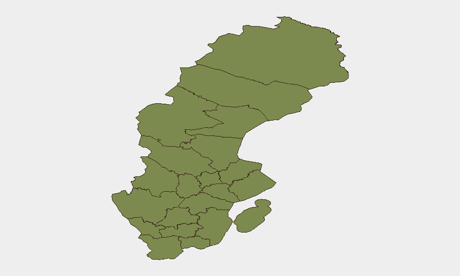
Situation Summary
Sweden remains a low-threat environment globally (rank #153, composite score 5.0) but faces elevated regional instability tied to Baltic security dynamics and recent domestic policy friction. Over the past 72 hours, multiple discrete incidents—including aerial weapons engagement involving Ukrainian forces, small-arms combat, arrests, and government-media tensions—have generated a cluster of 160 tracked events. Jämtland County presents anomalously high risk (score 32), warranting specific investigation; Stockholm and secondary regions show baseline elevated activity consistent with capital-region and border-adjacent exposure.
Key Developments
- 2026-06-25 · Aerial Weapons Engagement (Sweden–Ukrainian): Cross-border or airspace incident involving Ukrainian forces and Swedish territory or assets; specific location and casualty status require urgent clarification via OSINT sweep.
- 2026-06-25 · Tourist Disapproval Incident: Reported negative sentiment or formal complaint by tourist population directed at Sweden; may signal diplomatic friction or security event affecting visitors.
- 2026-06-24 · Arrest/Detention (Sweden vs. Worker): Labor-related arrest or detention; context suggests possible labor-dispute escalation or migrant-worker incident.
- 2026-06-24 · Arrest/Detention (Sweden vs. Citizen & Saint): Two separate detention events involving Swedish national and foreign national ("Saint"); motivations unclear—requires actor and charge clarification.
- 2026-06-23 · Small-Arms Combat (Sweden): Discrete armed confrontation; location within Sweden not yet pinpointed; may relate to organized crime, extremist cells, or border-smuggling activity.
- 2026-06-23 · Government–Media Disapproval: Public statement conflict between government and media outlets; suggests information-control tensions or polarized crisis response.
Note: Precise locations, casualty counts, and cause chains for these incidents are not yet available in public reporting. Escalation watch and tactical attribution are pending.
Highest-Risk Areas
Jämtland County (risk 32) is the clear outlier and requires immediate focused investigation—its score is 6.4× that of Stockholm, suggesting either a concentrated incident cluster, organized-crime activity, or reporting anomaly that needs validation. Stockholm County (risk 5.0) reflects capital-region density, diplomatic presence, and cross-border exposure; secondary-tier counties (Örebro, Kronoberg, Norrbotten) cluster at risk 2–3.2, consistent with Nordic border proximity and migrant-transit corridors. The concentration in Jämtland—near Norway and Russia's sphere—warrants asset-protection prioritization if operations exist in that county.
How GeoBit Would Assist
Security teams should deploy Intel Sweep and OSINT fusion to corroborate the six incidents above and extract precise incident location, actor identity, and casualty/impact data from X, Swedish media, and government statement feeds in Swedish and English. AOI Monitoring & Early Warning on Jämtland County, Stockholm, and border regions (Norrbotten, Västerbotten) will provide persistent watch and alerting for follow-on events, arrests, or policy shifts. Network & Actor Analysis across Swedish extremist, labor-union, and organized-crime databases will clarify whether small-arms combat and detention events reflect organized activity or isolated incidents.
7-Day Outlook
Expect continued low-grade tensions around EU policy friction and Baltic military activity; small-arms incidents and arrests suggest underlying criminality or labor unrest rather than imminent systemic instability. Monitor Jämtland and Stockholm for secondary incidents and government response escalation over the next 48–72 hours. If the aerial weapons incident represents a genuine cross-border incursion, NATO/Swedish defense posture may harden, affecting travel and asset access in northern regions.
Highest-Risk Areas — Ranked
| # | State / Region | Risk |
|---|---|---|
| 1 | Jämtland County | 32 |
| 2 | Stockholm County | 5 |
| 3 | Örebro County | 3.2 |
| 4 | Kronoberg County | 2.2 |
| 5 | Norrbotten County | 2 |
| 6 | Västerbotten County | 2 |
| 7 | Västernorrland County | 2 |
| 8 | Dalarna County | 2 |
| 9 | Gävleborg County | 2 |
| 10 | Skåne County | 2 |
| 11 | Blekinge County | 2 |
| 12 | Västra Götaland County | 2 |
Sources
Previous Daily Briefs
A new Sweden brief is written every day — each with its own risk map and downloadable CSV. Here's the last week; use the calendar to go further back.
📅 Browse every day by calendar →
Highlighted days have a brief. Tap a day for that day's map & analysis, or “csv” for that day's dataset ($5).