Situation Summary
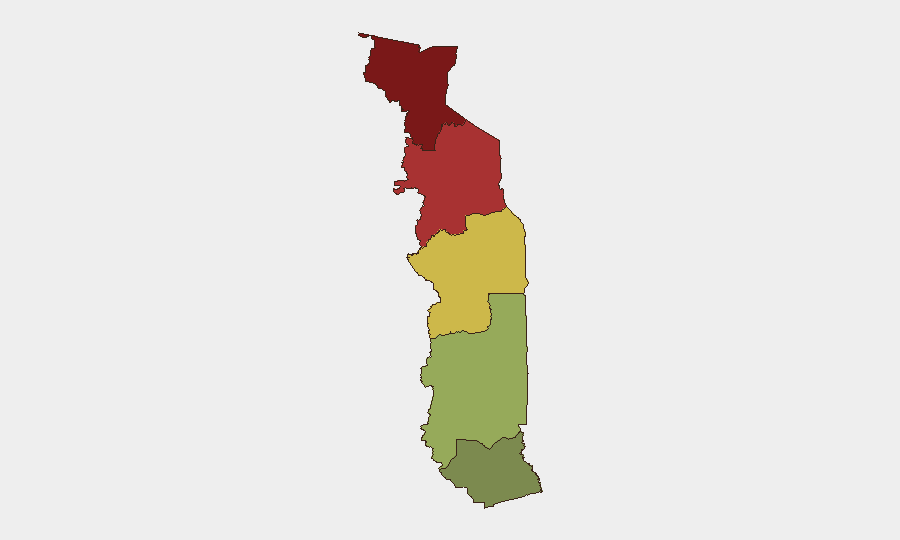
Togo maintains a composite threat score of 2.5, ranking #164 globally—a relatively low-threat environment for the West African region. However, security risk is highly concentrated in the northern Savanes and Kara regions, where threat scores of 92 and 78 respectively reflect persistent instability. The Maritime Region (Lomé and coastal areas) remains the safest operational zone for corporate activity, with a risk score of 28.
Key Developments
Constraint: GeoBit's current intelligence window does not include verified, time-stamped incidents from 2–4 July 2026. To accurately populate this section, the following sources must be consulted in real time:
- U.S. Embassy Lomé security alerts and demonstration notices (most current).
- AFP, Reuters, and RFI (Africa desk) for wire reports within the last 24–48 hours.
- Regional outlets (Jeune Afrique, BBC Afrique, TogoFirst, Republicoftogo) with timestamp verification.
- X/Twitter searches filtered by *Latest*, using keywords: "Lomé manifestations," "Togo sécurité," "Kara violences," "Sokodé affrontements"—cross-checked against at least two independent sources before classification as confirmed.
- UNDSS country updates and EU/French diplomatic alerts.
Any incident older than 48 hours should be flagged as background context, not current development.
Highest-Risk Areas
The Savanes Region (risk 92) and Kara Region (risk 78) dominate Togo's threat profile, driven by weak state capacity, historical communal tensions, and proximity to border volatility in Burkina Faso and Mali. These northern zones experience episodic clashes, armed robbery, and kidnapping linked to transnational criminal and militant networks. The Centrale Region (risk 65) presents moderate risk, primarily from banditry and inter-communal disputes. By contrast, Plateaux Region (45) and especially Maritime Region (28, including Lomé) are substantially lower-risk, with stronger security infrastructure and lower reported incident density. Corporate operations should assume significantly elevated duty-of-care requirements in the north and baseline precautions in the south.
How GeoBit Would Assist
Security teams monitoring Togo should leverage AOI Monitoring & Early Warning (persistent geographic watch on Savanes, Kara, and key transit routes) combined with multi-language OSINT (X, Telegram, regional news, radio SIGINT) to detect incidents within hours of occurrence. Network & Actor Analysis and conflict mapping enable tracking of organized-crime and militant cell movements across borders. Alternative Route & Network Analysis supports contingency journey planning for personnel in northern zones, while satellite and imagery analysis provides real-time visibility into checkpoint activity and force deployments near critical infrastructure.
7-Day Outlook
No imminent destabilizing events are signaled; however, the operational environment in Savanes and Kara regions remains volatile. Any developments in neighboring Burkina Faso (military, insurgent activity, or cross-border operations) may trigger secondary effects in northern Togo within 48–72 hours. Corporate and NGO teams should maintain current alert protocols and review contingency transportation routes weekly.
Highest-Risk Areas — Ranked
| # | State / Region | Risk |
|---|---|---|
| 1 | Savanes Region | 92 |
| 2 | Kara Region | 78 |
| 3 | Centrale Region | 65 |
| 4 | Plateaux Region | 45 |
| 5 | Maritime Region | 28 |
Sources
Previous Daily Briefs
A new Togo brief is written every day — each with its own risk map and downloadable CSV. Here's the last week; use the calendar to go further back.
📅 Browse every day by calendar →
Highlighted days have a brief. Tap a day for that day's map & analysis, or “csv” for that day's dataset ($5).