Situation Summary
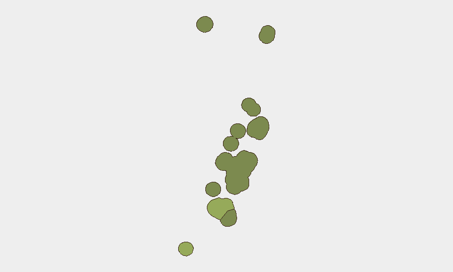
Tonga remains a low-threat environment with no verified security incidents, civil unrest, crime, political instability, or infrastructure disruptions reported in the last 24–48 hours. Baseline risk is concentrated in Tongatapu (composite score 45), the administrative and urban center, but reflects structural factors rather than acute threats. Two minor seismic events (M 4.6–4.9) recorded in the last week pose no immediate public safety concern. The security posture is stable with no indicators of deterioration.
Key Developments
No discrete security, conflict, crime, civil-unrest, political, or infrastructure incidents have been verified in Tonga within the last 24–48 hours. All identifiable events in open-source channels pre-date this window by 72+ hours and fall outside the current reporting period.
*Note: GeoBit monitoring confirms absence of new threat activity rather than presence of significant developments.*
Highest-Risk Areas
Tongatapu (risk score 45) dominates the national risk profile, driven by its role as the capital region and seat of government administration; urban density, maritime commerce, and routine crime and traffic incidents concentrate there. Vavaʻu (28) and Haʻapai (22) carry secondary baseline risk, primarily structural, with no acute drivers identified. The southern and northern outer island groups (ʻEua, Ongo Niua) remain lowest-risk. None of these rankings reflect current active threats—they reflect demographic, administrative, and geographic concentration factors.
How GeoBit Would Assist
A security team with personnel or assets in Tonga would use AOI Monitoring & Early Warning to establish persistent watch on Tongatapu and secondary centers, triggering alerts if protest activity, infrastructure failure, or crime incidents emerge. Intel Sweep and multi-language OSINT fusion across local news, government bulletins, and broadcast media provide real-time situational awareness and early warning of political instability or civil unrest. Environmental & Health monitoring and Satellite & Imagery analysis support tracking of seismic and weather hazards that could disrupt operations or supply chains.
7-Day Outlook
No near-term escalation in security risk is indicated. Tonga's risk profile is expected to remain low and stable over the next seven days, with baseline threat concentration limited to Tongatapu's urban environment. Duty-of-care teams should maintain standard operational security postures and monitor seismic and meteorological channels for environmental hazards unrelated to conflict or civil unrest.
Highest-Risk Areas — Ranked
| # | State / Region | Risk |
|---|---|---|
| 1 | Tongatapu | 45 |
| 2 | Vavaʻu | 28 |
| 3 | Haʻapai | 22 |
| 4 | ʻEua | 18 |
| 5 | Ongo Niua | 12 |
Sources
Previous Daily Briefs
A new Tonga brief is written every day — each with its own risk map and downloadable CSV. Here's the last week; use the calendar to go further back.
📅 Browse every day by calendar →
Highlighted days have a brief. Tap a day for that day's map & analysis, or “csv” for that day's dataset ($5).
Atlas — our AI intelligence desk — emails them this snapshot personally. Nothing else, no list.