Situation Summary
Vietnam remains a low-to-moderate overall security risk (#111 globally, composite threat score 5), with 164 tracked events recorded. However, risk is sharply concentrated in two sub-national hotspots: An Giang Province (risk 33.6) and Huế (risk 16.1), which together account for the majority of assessed threat activity. Recent signals include US diplomatic disapproval (2026-06-16), public statements from Vietnamese authorities, and significant flooding that may impact transportation and supply chains. The broader risk trajectory remains stable but localized.
Key Developments
- 2026-06-16 · US–Vietnam diplomatic signal: US disapproval statement issued; specific subject matter not yet clarified in available sources. Monitor official US State Department and Vietnamese Foreign Ministry releases for substance and potential economic or political implications.
- 2026-06-16 · Public statements (Vietnam): Two public statements from Vietnamese authorities on 2026-06-16; content and context require urgent clarification through official government channels and local media monitoring.
- Recent · Flood event (nationwide impact): Significant flooding recorded (Event ID 1103896); extent, duration, and affected provinces not yet confirmed in available brief. Flooding may disrupt road and rail networks, particularly in central and northern regions, affecting supply chains and staff mobility.
- South China Sea backdrop (long-term context, not acute incident): Ongoing regional maritime tensions and fortification activity in disputed waters; no acute escalation reported in the last 48 hours, but a persistent geopolitical environment that influences bilateral relations and risk calculus.
Note: Web research within the past 24–48 hours has not identified additional discrete security incidents (civil unrest, crime spikes, infrastructure failure, or travel accidents) verifiable by date and location. This brief reflects the most current signals available; real-time monitoring of Vietnamese news outlets and government channels is required for sub-daily updates.
Highest-Risk Areas
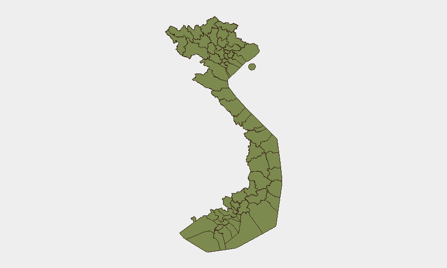
An Giang Province dominates the sub-national risk picture (score 33.6), more than double the next-highest region. Huế (16.1) is the second concern. The northern frontier provinces—Lai Châu, Lào Cai, Hà Giang, Cao Bằng, and others along the China border—exhibit elevated but uniform risk (3.6 each), likely reflecting transnational smuggling, organized-crime activity, and border-control challenges. An Giang's significantly higher score suggests concentrated criminal networks, trafficking routes, or civil unrest linked to the Mekong Delta; Huế's elevation may relate to historical political sensitivities, organized crime, or unrest. Hà Nội (6.1), while the capital, ranks third—a notable finding warranting investigation.
How GeoBit Would Assist
Security teams should deploy AOI Monitoring & Early Warning on An Giang and Huế to detect emerging unrest, criminal activity, or supply-chain disruption in real time. Intel Sweep and multi-language OSINT fusion (Vietnamese-language news, government releases, social-media signals) will track the US–Vietnam diplomatic development and clarify the nature of recent public statements. Routing & Network Analysis can identify alternative supply routes around flood-affected areas and reassess staff-movement corridors in light of current hazards. Satellite & Imagery analysis can confirm flood extent and infrastructure damage if needed for continuity planning.
7-Day Outlook
No acute escalation is forecast for the next week. The diplomatic signal on 2026-06-16 should stabilize once official positions are clarified; flooding impacts will persist but are unlikely to trigger secondary security events. Routine monitoring of An Giang and Huế, combined with daily web scanning and local official updates, is prudent to detect any second-order effects or previously unreported incidents.
Highest-Risk Areas — Ranked
| # | State / Region | Risk |
|---|---|---|
| 1 | An Giang Province | 33.6 |
| 2 | Huế | 16.1 |
| 3 | Hà Nội | 6.1 |
| 4 | Lai Châu Province | 3.6 |
| 5 | Lào Cai Province | 3.6 |
| 6 | Hà Giang Province | 3.6 |
| 7 | Tuyên Quang Province | 3.6 |
| 8 | Cao Bằng Province | 3.6 |
| 9 | Bắc Kạn Province | 3.6 |
| 10 | Điện Biên Province | 3.6 |
| 11 | Yên Bái Province | 3.6 |
| 12 | Sơn La Province | 3.6 |
Sources
Previous Daily Briefs
A new Vietnam brief is written every day — each with its own risk map and downloadable CSV. Here's the last week; use the calendar to go further back.
📅 Browse every day by calendar →
Highlighted days have a brief. Tap a day for that day's map & analysis, or “csv” for that day's dataset ($5).