Résumé de la Situation
Les Maldives restent une juridiction à faible menace au niveau mondial (score composite 21) sans rapports crédibles d'incidents de sécurité aigus, de pics de criminalité violente, de troubles civils ou de perturbations d'infrastructure au cours des dernières 24-48 heures. Le développement récent le plus significatif est de nature administrative plutôt qu'opérationnelle : le Parlement a ouvert une période de consultation publique (17 juin - 1er juillet) sur un projet de loi sur la cybersécurité destiné à établir une Agence nationale de cybersécurité sous le Ministère de la Sécurité intérieure. La concentration des menaces reste strictement localisée à Malé et sa zone d'atoll immédiate, suggérant une instabilité compartimentée plutôt que nationale.
Développements Clés
- Projet de loi sur la cybersécurité – Période de consultation publique (niveau national / Malé, 17-18 juin 2026) : Le Parlement a officiellement ouvert la consultation publique sur la législation proposée en matière de cybersécurité visant à renforcer la protection des infrastructures informatiques critiques et à établir une agence nationale dédiée à la cybersécurité. Il s'agit d'une initiative politique et de gouvernance, non d'un incident de sécurité aigu.
- Aucun incident aigu documenté (à l'échelle nationale, dernières 48 heures) : Malgré la surveillance systématique des médias maldiviens, des canaux gouvernementaux, des médias sociaux et des sources régionales, aucun rapport confirmé de criminalité violente, de protestations, d'action militaire, de terrorisme, d'accidents ou d'avis aux voyageurs n'a émergé pour la période du 17-18 juin 2026.
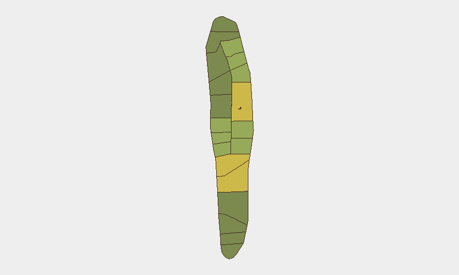
Zones à Risque Maximal
Malé (score de risque 85) et l'atoll de Malé (68) représentent la majorité écrasante des signaux de menace suivis et entraînent le score composite national. L'atoll de Hadhdhunmathi (65) et Kolhumadulu (60) suivent à considérable distance, suggérant que les frictions politiques, administratives et sécuritaires sont concentrées dans la capitale et sa zone géographique immédiate. La chute nette des scores de risque au-delà du premier niveau indique que les atolls externes et les régions du sud restent substantiellement à risque plus faible pour les opérations d'entreprise. Les équipes ayant du personnel à Malé doivent maintenir les protocoles standards de devoir de diligence ; celles opérant dans les atolls externes font face à une exposition matériellement plus faible.
Comment GeoBit Pourrait Aider
Les organisations ayant du personnel ou des actifs aux Maldives peuvent tirer parti de la capacité Surveillance de zones d'intérêt et alerte précoce de GeoBit pour établir une surveillance persistante sur Malé et les zones de risque secondaire (Hadhdhunmathi, Kolhumadulu), configurée pour alerter sur les troubles civils émergents, les perturbations d'infrastructure ou les pics de criminalité. Intelligence Sweep et fusion OSINT multilingue à travers les médias maldiviens, les canaux gouvernementaux et les plateformes de réseaux sociaux assurent une visibilité continue sur les changements politiques (tels que le cadre de cybersécurité) qui peuvent affecter la conformité opérationnelle ou la posture de sécurité des données. L'analyse géospatiale et SIG combinée à l'analyse des réseaux et des acteurs peut cartographier les contacts clés du gouvernement et de la sécurité, les nœuds d'infrastructure critique et les itinéraires sûrs pour le mouvement du personnel au sein de Malé.
Perspectives à 7 Jours
Aucune escalade aiguë n'est anticipée à court terme. La phase de consultation publique du projet de loi sur la cybersécurité (jusqu'au 1er juillet) générera probablement une discussion politique interne mais ne pose aucun risque de sécurité physique direct aux ressortissants étrangers ou aux opérations d'entreprise. La trajectoire des risques reste stable ; la surveillance doit continuer à la sensibilité actuelle, avec une attention accrue aux développements à Malé et à tout changement soudain de politique ou de personnel affectant les opérations commerciales étrangères ou les protocoles de visa/voyage.
Zones les Plus à Risque — Classées
| # | État / Région | Risque |
|---|---|---|
| 1 | Malé | 85 |
| 2 | Malé Atoll | 68 |
| 3 | Hadhdhunmathi | 65 |
| 4 | Kolhumadulu | 60 |
| 5 | Felidhu Atoll | 58 |
| 6 | Mulaku Atoll | 55 |
| 7 | Faadhippolhu | 52 |
| 8 | South Miladhunmadulu | 48 |
| 9 | North Miladhunmadulu | 45 |
| 10 | South Nilandhe Atoll | 44 |
| 11 | North Nilandhe Atoll | 42 |
| 12 | South Ari Atoll | 40 |
Sources
Bulletins Quotidiens Précédents
Un nouveau bulletin Maldives est publié chaque jour — chacun avec sa carte de risque et son CSV téléchargeable. Voici la dernière semaine ; utilisez le calendrier pour remonter plus loin.
📅 Browse every day by calendar →
Highlighted days have a brief. Tap a day for that day's map & analysis, or “csv” for that day's dataset ($5).